Rosemount, Minnesota
| Rosemount | |
|---|---|
| City | |
| Rosemount, Minnesota | |
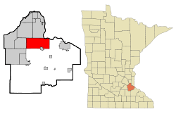 Location of the city of Rosemount within Dakota County, Minnesota | |
| Coordinates: 44°44′28″N 93°7′11″W / 44.74111°N 93.11972°W | |
| Country | United States |
| State | Minnesota |
| County | Dakota |
| Government | |
| • Mayor | Bill Droste |
| Area[1] | |
| • Total | 35.21 sq mi (91.19 km2) |
| • Land | 33.22 sq mi (86.04 km2) |
| • Water | 1.99 sq mi (5.15 km2) |
| Elevation | 965 ft (294 m) |
| Population (2010)[2] | |
| • Total | 21,874 |
| • Estimate (2015)[3] | 23,413 |
| • Density | 658.5/sq mi (254.2/km2) |
| Time zone | Central (CST) (UTC-6) |
| • Summer (DST) | CDT (UTC-5) |
| ZIP code | 55068 |
| Area code(s) | 651 |
| FIPS code | 27-55726 |
| GNIS feature ID | 0650291[4] |
| Website | City of Rosemount |


Rosemount is a city in Dakota County, Minnesota, United States, in the Twin Cities Metropolitan Area. The population was 21,874 at the 2010 census.[5] Rosemount was established as a township in 1858[6] and incorporated as a city in 1972, encompassing the old village of Rosemount and Pine Bend. According to the city's website, there was some debate over whether to name the township Saratoga or Rosemount, with the latter finally being chosen to reflect the town's Irish heritage, and to remain in keeping with the name given to the post office a few years earlier. Rosemount is home to the Pine Bend Refinery, which is the largest oil refinery in Minnesota and the 14th-largest in the United States. Rosemount was also home to a military gunpowder plant in the 1940s called Gopher Ordnance Works.
Geography
According to the United States Census Bureau, the city has a total area of 35.21 square miles (91.19 km2), of which 33.22 square miles (86.04 km2) is land and 1.99 square miles (5.15 km2) is water.[1]
U.S. Highway 52, Minnesota Highway 3, Minnesota Highway 55, and County Road 42 are four of the main routes in Rosemount.
Demographics
| Historical population | |||
|---|---|---|---|
| Census | Pop. | %± | |
| 1880 | 116 | — | |
| 1890 | 198 | 70.7% | |
| 1900 | 182 | −8.1% | |
| 1910 | 238 | 30.8% | |
| 1920 | 310 | 30.3% | |
| 1930 | 294 | −5.2% | |
| 1940 | 364 | 23.8% | |
| 1950 | 567 | 55.8% | |
| 1960 | 1,068 | 88.4% | |
| 1970 | 1,337 | 25.2% | |
| 1980 | 5,083 | 280.2% | |
| 1990 | 8,622 | 69.6% | |
| 2000 | 14,619 | 69.6% | |
| 2010 | 21,874 | 49.6% | |
| Est. 2015 | 23,413 | [7] | 7.0% |
| U.S. Decennial Census[8] 2015 Estimate[3] | |||
Rosemount is the home of the Rosemount High School "Irish" and Dakota County Technical College, a member of the Minnesota State Colleges and Universities system.
2010 census
As of the census[2] of 2010, there were 21,874 people, 7,587 households, and 5,918 families residing in the city. The population density was 658.5 inhabitants per square mile (254.2/km2). There were 7,853 housing units at an average density of 236.4 per square mile (91.3/km2). The racial makeup of the city was 87.3% White, 3.0% African American, 0.4% Native American, 5.6% Asian, 1.1% from other races, and 2.6% from two or more races. Hispanic or Latino of any race were 3.1% of the population.
There were 7,587 households of which 46.5% had children under the age of 18 living with them, 65.0% were married couples living together, 8.9% had a female householder with no husband present, 4.0% had a male householder with no wife present, and 22.0% were non-families. 16.6% of all households were made up of individuals and 5.2% had someone living alone who was 65 years of age or older. The average household size was 2.88 and the average family size was 3.27.
The median age in the city was 34.7 years. 30.7% of residents were under the age of 18; 6.8% were between the ages of 18 and 24; 29.8% were from 25 to 44; 25.2% were from 45 to 64; and 7.7% were 65 years of age or older. The gender makeup of the city was 49.4% male and 50.6% female.
2000 census
As of the census of 2000, there were 14,619 people, 4,742 households, and 3,931 families residing in the city. The population density was 434.2 people per square mile (167.6/km²). There were 4,845 housing units at an average density of 143.9 per square mile (55.6/km²). The racial makeup of the city was 92.78% White, 2.03% African American, 0.30% Native American, 2.13% Asian, 0.80% from other races, and 1.96% from two or more races. Hispanic or Latino of any race were 1.83% of the population.
There were 4,742 households out of which 52.4% had children under the age of 18 living with them, 70.1% were married couples living together, 9.1% had a female householder with no husband present, and 17.1% were non-families. 13.0% of all households were made up of individuals and 4.0% had someone living alone who was 65 years of age or older. The average household size was 3.08 and the average family size was 3.38.
In the city the population was spread out with 35.1% under the age of 18, 6.3% from 18 to 24, 36.5% from 25 to 44, 16.8% from 45 to 64, and 5.4% who were 65 years of age or older. The median age was 31 years. For every 100 females there were 99.1 males. For every 100 females age 18 and over, there were 96.6 males.
The median income for a household in the city was $65,916, and the median income for a family was $68,929 (these figures had risen to $83,826 and $90,644 respectively as of a 2007 estimate). Males had a median income of $45,567 versus $33,247 for females. The per capita income for the city was $23,116. About 2.2% of families and 3.3% of the population were below the poverty line, including 3.2% of those under age 18 and 6.8% of those age 65 or over.
Politics
Rosemount is located in Minnesota's 2nd congressional district, represented by John Kline, a Republican, scoring 2.8% progressive on a range of issues[9] and 88% conservative based on 2006 House votes.[10]
- State Representative: Anna Wills (Republican)
- State Senator: Greg Clausen (Democrat)
- County Commissioner: District 4 Nancy Schouweiler, District 7 Chris Gerlach (Republican)
- Mayor: Bill Droste (Republican)
- Council: Shaun Nelson, Mark DeBettignes, Vanessa Demuth, Jeff Weisensel
- City Manager: Dwight Johnson
Events
Despite the relatively small population of Rosemount, they are the only multiple-time hosts of the USA Broomball National Championships, welcoming competing teams in 2001, 2002, 2003, and 2005. Three different rinks in the area have been used to host games in the men's and co-rec divisions. Rosemount also holds Leprechaun Days, a 10-day-long community festival with many events.
Schools
- Rosemount Elementary School
- Shannon Park Elementary School
- Rosemount Middle School
- Rosemount High School
- Saint Joseph Catholic School
Notable natives and residents
- Robert M. Boche, Wisconsin State Assemblyman
- Pierce Butler, Associate Justice of the US Supreme Court
- Hugh Derham, Founder (along with Andrew Keegan) of the city and benefactor of Derham Hall High School later to become Cretin-Derham Hall High School
- Mike Morris, Retired Long-snapper, Minnesota Vikings
- Tom Preissing, Defenseman, Colorado Avalanche
- Duane Andreas, Former CEO of Archer Daniels Midland
- Lona Williams, writer/actress/producer
- Peter Breitmeyer, actor, appearing most recently in "A Serious Man", which was written/produced by the Coen Brothers (also from Minnesota)
- Mike 'The Marine' Richman, Bellator Featherweight
- Tom Compton, Offensive lineman, NFL
- JT Brown, NHL Player with the Tampa Bay Lightning
References
- 1 2 "US Gazetteer files 2010". United States Census Bureau. Retrieved 2012-11-13.
- 1 2 "American FactFinder". United States Census Bureau. Retrieved 2012-11-13.
- 1 2 "Population Estimates". United States Census Bureau. Retrieved June 8, 2016.
- ↑ "US Board on Geographic Names". United States Geological Survey. 2007-10-25. Retrieved 2008-01-31.
- ↑ "2010 Census Redistricting Data (Public Law 94-171) Summary File". American FactFinder. United States Census Bureau. Retrieved 27 April 2011.
- ↑ Upham, Warren (1920). Minnesota Geographic Names: Their Origin and Historic Significance. Minnesota Historical Society. p. 166.
- ↑ "Annual Estimates of the Resident Population for Incorporated Places: April 1, 2010 to July 1, 2015". Retrieved July 2, 2016.
- ↑ United States Census Bureau. "Census of Population and Housing". Retrieved November 2, 2014.
- ↑ Grossman, Joshua. "ProgressivePunch Leading with the Left". All Issues. ProgressivePunch. Archived from the original on September 29, 2007. Retrieved 2007-09-08.
- ↑ "ACU Ratings of Congress, 2006". American Conservative Union. 2006. Archived from the original on 2007-09-03. Retrieved 2007-09-08.
External links
Municipalities and communities of Dakota County, Minnesota, United States | ||
|---|---|---|
| Cities | 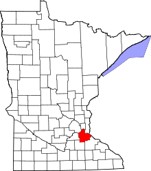 | |
| Townships | ||
| Unincorporated communities | ||
| Ghost towns | ||
| Indian reservation | ||
| Footnotes | ‡This populated place also has portions in an adjacent county or counties | |
Coordinates: 44°44′22″N 93°07′33″W / 44.73944°N 93.12583°W