West St. Paul, Minnesota
| West Saint Paul, Minnesota | |
|---|---|
| City | |
| City of West Saint Paul | |
| Nickname(s): W.S.P. | |
| Motto: "We're Close To It All" | |
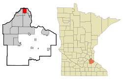 Location of the city of West Saint Paul within Dakota County, Minnesota | |
| Coordinates: 44°54′27″N 93°5′15″W / 44.90750°N 93.08750°WCoordinates: 44°54′27″N 93°5′15″W / 44.90750°N 93.08750°W | |
| Country | United States |
| State | Minnesota |
| County | Dakota |
| Area[1] | |
| • Total | 5.01 sq mi (12.98 km2) |
| • Land | 4.91 sq mi (12.72 km2) |
| • Water | 0.10 sq mi (0.26 km2) |
| Elevation | 1,027 ft (313 m) |
| Population (2010)[2] | |
| • Total | 19,540 |
| • Estimate (2015)[3] | 19,727 |
| • Density | 3,979.6/sq mi (1,536.5/km2) |
| Time zone | Central (CST) (UTC-6) |
| • Summer (DST) | CDT (UTC-5) |
| ZIP codes | 55118 |
| Area code(s) | 651 |
| FIPS code | 27-69700 |
| GNIS feature ID | 0654003[4] |
| Website | City of West St. Paul |
West Saint Paul is a city in Dakota County, Minnesota, immediately south of the city of Saint Paul, Minnesota. The city's misleading name comes in part from the fact that it lies on the west bank of the predominantly north-to-south Mississippi River. A previous City of West St. Paul, incorporated in the late 19th century, was situated in what is now called St. Paul's Lower West Side. According to the West 7th/Fort Road foundation, St. Paul annexed the West Side, and was incorporated for two reasons: "to aid law enforcement—criminals could escape St. Paul authorities by crossing to the West Side and Dakota County—and to eliminate the Wabasha Street Bridge tolls which were inhibiting development on the West Side." The current West St. Paul split from the western half of South St. Paul, and was incorporated in 1889, just south of the city of St. Paul. The population was 19,540 at the 2010 census,[5] growing by 135 since 2000. West Saint Paul is known for its 2.5-mile retail strip along Robert Street. The city is pursuing a sister-city relationship with West Saint Paul, MB (Canada).
Geography
According to the United States Census Bureau, the city has a total area of 5.01 square miles (12.98 km2), of which 4.91 square miles (12.72 km2) is land and 0.10 square miles (0.26 km2) is water.[1]
The Lafayette Freeway, also known as U.S. Highway 52, Robert Street, and Minnesota Highway 110 are three of West St. Paul's main routes. Interstate Highway 494 runs just south of the city and Minnesota Highway 3 (unmarked Route 952) runs through the middle of the city and into downtown Saint Paul as Robert Street. Robert Street was named for Captain Louis Roberts, a Mississippi River boat captain and early French-Canadian settler of Saint Paul.
Demographics
| Historical population | |||
|---|---|---|---|
| Census | Pop. | %± | |
| 1890 | 1,596 | — | |
| 1900 | 1,830 | 14.7% | |
| 1910 | 2,660 | 45.4% | |
| 1920 | 2,962 | 11.4% | |
| 1930 | 4,463 | 50.7% | |
| 1940 | 5,733 | 28.5% | |
| 1950 | 7,955 | 38.8% | |
| 1960 | 13,101 | 64.7% | |
| 1970 | 18,802 | 43.5% | |
| 1980 | 18,527 | −1.5% | |
| 1990 | 19,248 | 3.9% | |
| 2000 | 19,405 | 0.8% | |
| 2010 | 19,540 | 0.7% | |
| Est. 2015 | 19,727 | [6] | 1.0% |
| U.S. Decennial Census[7] 2015 Estimate[3] | |||
2010 census
As of the census[2] of 2010, there were 19,540 people, 8,529 households, and 4,751 families residing in the city. The population density was 3,979.6 inhabitants per square mile (1,536.5/km2). There were 9,139 housing units at an average density of 1,861.3 per square mile (718.7/km2). The racial makeup of the city was 78.0% White, 6.0% African American, 0.9% Native American, 2.2% Asian, 0.1% Pacific Islander, 8.6% from other races, and 4.3% from two or more races. Hispanic or Latino of any race were 19.5% of the population.
There were 8,529 households, of which 27.2% had children under the age of 18 living with them, 38.8% were married couples living together, 12.3% had a female householder with no husband present, 4.7% had a male householder with no wife present, and 44.3% were non-families. 37.6% of all households were made up of individuals and 15.1% had someone living alone who was 65 years of age or older. The average household size was 2.25 and the average family size was 3.00.
The median age in the city was 39.7 years. 22.3% of residents were under the age of 18; 7.8% were between the ages of 18 and 24; 26.4% were from 25 to 44; 26.4% were from 45 to 64; and 17% were 65 years of age or older. The gender makeup of the city was 47.6% male and 52.4% female.
2000 census
As of the census of 2000, there were 19,405 people, 8,645 households, and 4,875 families residing in the city. The population density was 3,874.2 people per square mile (1,495.5/km²). There were 8,779 housing units at an average density of 1,752.7 per square mile (676.6/km²). The racial makeup of the city was 87.27% White, 2.83% African American, 0.62% Native American, 1.89% Asian, 0.03% Pacific Islander, 4.88% from other races, and 2.49% from two or more races. Hispanic or Latino of any race were 9.98% of the population.
There were 8,645 households, of which 24.6% had children under the age of 18 living with them, 42.4% were married couples living together, 10.7% had a female householder with no husband present, and 43.6% were non-families. 37.1% of all households were made up of individuals and 15.9% had someone living alone who was 65 years of age or older. The average household size was 2.20 and the average family size was 2.93.
In the city the population was spread out with 21.1% under the age of 18, 8.9% from 18 to 24, 28.7% from 25 to 44, 22.1% from 45 to 64, and 19.2% who were 65 years of age or older. The median age was 39 years. For every 100 females there were 87.3 males. For every 100 females age 18 and over, there were 83.1 males.
The median income for a household in the city was $41,103, and the median income for a family was $56,786. Males had a median income of $39,344 versus $29,836 for females. The per capita income for the city was $23,558. About 3.8% of families and 5.9% of the population were below the poverty line, including 6.6% of those under age 18 and 5.2% of those age 65 or over.
Religion
Crown of Life Lutheran Church is a Christian church of the Wisconsin Evangelical Lutheran Synod (WELS) in West St. Paul.[8]
Government
- Mayor: David Meisinger
- State Senator (Senate District 52): James Metzen
- State Representative (House District 52A[9]): Richard J. Hansen
- County Commissioner (Commissioner District 2): Kathleen Gaylord
- Council members: Dick Vitelli (Ward 1), Pat Armon (Ward 1), Jenny Halverson (Ward 2), Ed Iago (Ward 2), David Wright (Ward 3), Dave Napier (Ward 3).
Education
Crown of Life Lutheran (K-8)[10] and St. Croix Lutheran (6-12)[11] are two Christian schools of the Wisconsin Evangelical Lutheran Synod in West St. Paul.
Economy
West Saint Paul's major employers include:
- TapeMark, a medical adhesives manufacturer (approx. 300 employees)
- Dakota County Government, the Northern Dakota County Service Center and Courthouse (approx. 500 employees)
- Independent School District 197 (approx. 300 employees)
Notable people
- Tom Gibis, voice actor
- Joan Kroc, philanthropist and wife of McDonald's founder Ray Kroc
- J. Robert Stassen, Minnesota state senator and businessman
- Harold Stassen, former Minnesota governor, presidential candidate, statesman, and university president
- Richard M. Schulze, founder of Best Buy
References
- 1 2 "US Gazetteer files 2010". United States Census Bureau. Retrieved 2012-11-13.
- 1 2 "American FactFinder". United States Census Bureau. Retrieved 2012-11-13.
- 1 2 "Population Estimates". United States Census Bureau. Retrieved June 13, 2016.
- ↑ "US Board on Geographic Names". United States Geological Survey. 2007-10-25. Retrieved 2008-01-31.
- ↑ "2010 Census Redistricting Data (Public Law 94-171) Summary File". American FactFinder. United States Census Bureau. Retrieved 27 April 2011.
- ↑ "Annual Estimates of the Resident Population for Incorporated Places: April 1, 2010 to July 1, 2015". Retrieved July 2, 2016.
- ↑ United States Census Bureau. "Census of Population and Housing". Retrieved November 6, 2014.
- ↑ "Crown of Life Lutheran Church and School".
- ↑ http://www.sos.state.mn.us/index.aspx?page=1854
- ↑ "K-8 School".
- ↑ "About St. Croix Lutheran".
External links
Municipalities and communities of Dakota County, Minnesota, United States | ||
|---|---|---|
| Cities | 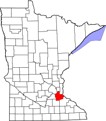 | |
| Townships | ||
| Unincorporated communities | ||
| Ghost towns | ||
| Indian reservation | ||
| Footnotes | ‡This populated place also has portions in an adjacent county or counties | |