Miesville, Minnesota
| Miesville, Minnesota | |
|---|---|
| City | |
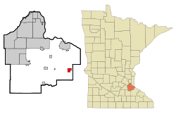 Location of the city of Miesville within Dakota County, Minnesota | |
| Coordinates: 44°35′55″N 92°48′27″W / 44.59861°N 92.80750°W | |
| Country | United States |
| State | Minnesota |
| County | Dakota |
| Area[1] | |
| • Total | 1.80 sq mi (4.66 km2) |
| • Land | 1.80 sq mi (4.66 km2) |
| • Water | 0 sq mi (0 km2) |
| Elevation | 935 ft (285 m) |
| Population (2010)[2] | |
| • Total | 125 |
| • Estimate (2012[3]) | 126 |
| • Density | 69.4/sq mi (26.8/km2) |
| Time zone | Central (CST) (UTC-6) |
| • Summer (DST) | CDT (UTC-5) |
| Area code(s) | 651 |
| FIPS code | 27-42092[4] |
| GNIS feature ID | 0647830[5] |
Miesville is a city in Dakota County, Minnesota, United States. The population was 125 at the 2010 census.[6]
U.S. Highway 61 serves as a main route in the community. Minnesota Highways 20, 50, and 316 are nearby.
Miesville is perhaps best known for its amateur baseball team, the Miesville Mudhens, which participates in Town Team Baseball.
History
Miesville was founded in 1874 by John Mies, and named for him.[7] A post office called Miesville was established in 1884, and remained in operation until 1903.[8]
Geography
According to the United States Census Bureau, the city has a total area of 1.80 square miles (4.66 km2), all of it land.[1]
Miesville is located in the southeast part of Dakota County.
Demographics
| Historical population | |||
|---|---|---|---|
| Census | Pop. | %± | |
| 1960 | 126 | — | |
| 1970 | 192 | 52.4% | |
| 1980 | 179 | −6.8% | |
| 1990 | 135 | −24.6% | |
| 2000 | 135 | 0.0% | |
| 2010 | 125 | −7.4% | |
| Est. 2015 | 131 | [9] | 4.8% |
Coordinates: 44°36′02″N 92°48′47″W / 44.60056°N 92.81306°W
2010 census
As of the census[2] of 2010, there were 125 people, 52 households, and 33 families residing in the city. The population density was 69.4 inhabitants per square mile (26.8/km2). There were 57 housing units at an average density of 31.7 per square mile (12.2/km2). The racial makeup of the city was 100.0% White.
There were 52 households of which 21.2% had children under the age of 18 living with them, 53.8% were married couples living together, 7.7% had a female householder with no husband present, 1.9% had a male householder with no wife present, and 36.5% were non-families. 30.8% of all households were made up of individuals and 23.1% had someone living alone who was 65 years of age or older. The average household size was 2.40 and the average family size was 3.03.
The median age in the city was 48.8 years. 20% of residents were under the age of 18; 6.4% were between the ages of 18 and 24; 20% were from 25 to 44; 28.8% were from 45 to 64; and 24.8% were 65 years of age or older. The gender makeup of the city was 44.0% male and 56.0% female.
2000 census
As of the census[4] of 2000, there were 135 people, 52 households, and 35 families residing in the city. The population density was 74.8 people per square mile (29.0/km²). There were 54 housing units at an average density of 29.9 per square mile (11.6/km²). The racial makeup of the city was 100.00% White.
There were 52 households out of which 25.0% had children under the age of 18 living with them, 61.5% were married couples living together, 5.8% had a female householder with no husband present, and 30.8% were non-families. 19.2% of all households were made up of individuals and 11.5% had someone living alone who was 65 years of age or older. The average household size was 2.52 and the average family size was 2.97.
In the city the population was spread out with 20.7% under the age of 18, 6.7% from 18 to 24, 24.4% from 25 to 44, 26.7% from 45 to 64, and 21.5% who were 65 years of age or older. The median age was 42 years. For every 100 females there were 104.5 males. For every 100 females age 18 and over, there were 122.9 males.
The median income for a household in the city was $53,750, and the median income for a family was $53,125. Males had a median income of $31,786 versus $31,875 for females. The per capita income for the city was $19,931. There were 10.3% of families and 9.9% of the population living below the poverty line, including 21.9% of under eighteens and none of those over 64.
References
- 1 2 "US Gazetteer files 2010". United States Census Bureau. Retrieved 2012-11-13.
- 1 2 "American FactFinder". United States Census Bureau. Retrieved 2012-11-13.
- ↑ "Population Estimates". United States Census Bureau. Retrieved 2013-05-28.
- 1 2 "American FactFinder". United States Census Bureau. Retrieved 2008-01-31.
- ↑ "US Board on Geographic Names". United States Geological Survey. 2007-10-25. Retrieved 2008-01-31.
- ↑ "2010 Census Redistricting Data (Public Law 94-171) Summary File". American FactFinder. United States Census Bureau. Retrieved 27 April 2011.
- ↑ Upham, Warren (1920). Minnesota Geographic Names: Their Origin and Historic Significance. Minnesota Historical Society. p. 167.
- ↑ "Dakota County". Jim Forte Postal History. Retrieved 10 May 2015.
- ↑ "Annual Estimates of the Resident Population for Incorporated Places: April 1, 2010 to July 1, 2015". Retrieved July 2, 2016.
- ↑ "Census of Population and Housing". Census.gov. Retrieved June 4, 2015.
Municipalities and communities of Dakota County, Minnesota, United States | ||
|---|---|---|
| Cities | 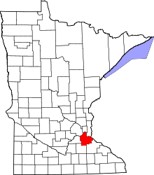 | |
| Townships | ||
| Unincorporated communities | ||
| Ghost towns | ||
| Indian reservation | ||
| Footnotes | ‡This populated place also has portions in an adjacent county or counties | |