Dover Township, Bureau County, Illinois
| Dover Township | |
|---|---|
| Township | |
 Location in Bureau County | |
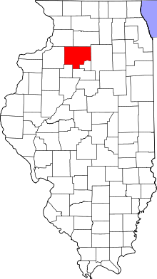 Bureau County's location in Illinois | |
| Coordinates: 41°26′59″N 89°27′18″W / 41.44972°N 89.45500°WCoordinates: 41°26′59″N 89°27′18″W / 41.44972°N 89.45500°W | |
| Country | United States |
| State | Illinois |
| County | Bureau |
| Established | November 6, 1849 |
| Area | |
| • Total | 36.85 sq mi (95.4 km2) |
| • Land | 36.85 sq mi (95.4 km2) |
| • Water | 0 sq mi (0 km2) 0% |
| Elevation | 705 ft (215 m) |
| Population (2010) | |
| • Total | 550 |
| • Density | 14.9/sq mi (5.8/km2) |
| Time zone | CST (UTC-6) |
| • Summer (DST) | CDT (UTC-5) |
| ZIP codes | 61323, 61349, 61356, 61376 |
| GNIS feature ID | 0428908 |
Dover Township is one of twenty-five townships in Bureau County, Illinois, USA. As of the 2010 census, its population was 550 and it contained 249 housing units.[1]
Geography
According to the 2010 census, the township has a total area of 36.85 square miles (95.4 km2), all land.[1]
Cities
Unincorporated towns
(This list is based on USGS data and may include former settlements.)
Cemeteries
The township contains these six cemeteries: Dover, Heatons Point, Limerick, Mason, Pioneer and Prairie Repose.
Major highways
Landmarks
- City Co Park
- Mason Grove Cmtry
- Prairie Repose Cmtry
Political districts
- Illinois' 11th congressional district
- State House District 74
- State Senate District 37
References
- "Dover Township, Bureau County, Illinois". Geographic Names Information System. United States Geological Survey. Retrieved 2010-01-04.
- United States Census Bureau 2007 TIGER/Line Shapefiles
- United States National Atlas
- 1 2 "Population, Housing Units, Area, and Density: 2010 - County -- County Subdivision and Place -- 2010 Census Summary File 1". United States Census. Retrieved 2013-05-28.
External links
 |
Walnut Township | Ohio Township | Lamoille Township | |
| Bureau Township | |
Berlin Township | ||
| ||||
| | ||||
| Wyanet Township | Princeton Township | Selby Township |
Municipalities and communities of Bureau County, Illinois, United States | ||
|---|---|---|
| Cities | ||
| Villages | ||
| Townships | ||
| Unincorporated communities | ||
| Ghost town | ||
| Footnotes | ‡This populated place also has portions in an adjacent county or counties | |
This article is issued from Wikipedia - version of the 7/16/2015. The text is available under the Creative Commons Attribution/Share Alike but additional terms may apply for the media files.