Fairfield Township, Bureau County, Illinois
| Fairfield Township | |
|---|---|
| Township | |
 Location in Bureau County | |
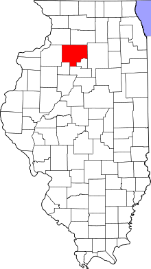 Bureau County's location in Illinois | |
| Coordinates: 41°32′26″N 89°48′46″W / 41.54056°N 89.81278°WCoordinates: 41°32′26″N 89°48′46″W / 41.54056°N 89.81278°W | |
| Country | United States |
| State | Illinois |
| County | Bureau |
| Established | November 6, 1849 |
| Area | |
| • Total | 36.39 sq mi (94.2 km2) |
| • Land | 36.39 sq mi (94.2 km2) |
| • Water | 0 sq mi (0 km2) 0% |
| Elevation | 627 ft (191 m) |
| Population (2010) | |
| • Total | 375 |
| • Density | 10.3/sq mi (4.0/km2) |
| Time zone | CST (UTC-6) |
| • Summer (DST) | CDT (UTC-5) |
| ZIP codes | 61283, 61344, 61361 |
| GNIS feature ID | 0428985 |
Fairfield Township is one of twenty-five townships in Bureau County, Illinois, USA. As of the 2010 census, its population was 375 and it contained 145 housing units.[1]
Geography
According to the 2010 census, the township has a total area of 36.39 square miles (94.2 km2), all land.[1]
Unincorporated towns
(This list is based on USGS data and may include former settlements.)
Cemeteries
The township contains these three cemeteries: Amish, Anderson Family and Yorktown.
Major highways
Airports and landing strips
- Lisa Landing Strip
Landmarks
- Hennepin Canal Parkway State Park (north quarter)
School districts
- Bureau Valley Community Unit School District 340
- Prophetstown-Lyndon-Tampico Community Unit School District 3
Political districts
- Illinois' 14th congressional district
- State House District 74
- State Senate District 37
References
- "Fairfield Township, Bureau County, Illinois". Geographic Names Information System. United States Geological Survey. Retrieved 2010-01-04.
- United States Census Bureau 2007 TIGER/Line Shapefiles
- United States National Atlas
- 1 2 "Population, Housing Units, Area, and Density: 2010 - County -- County Subdivision and Place -- 2010 Census Summary File 1". United States Census. Retrieved 2013-05-28.
External links

Municipalities and communities of Bureau County, Illinois, United States | ||
|---|---|---|
| Cities | ||
| Villages | ||
| Townships | ||
| Unincorporated communities | ||
| Ghost town | ||
| Footnotes | ‡This populated place also has portions in an adjacent county or counties | |
This article is issued from Wikipedia - version of the 7/16/2015. The text is available under the Creative Commons Attribution/Share Alike but additional terms may apply for the media files.