Selby Township, Bureau County, Illinois
| Selby Township | |
|---|---|
| Township | |
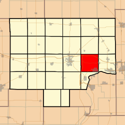 Location in Bureau County | |
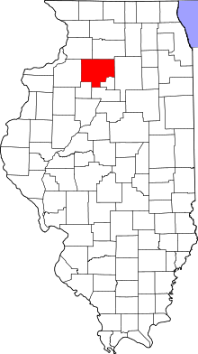 Bureau County's location in Illinois | |
| Coordinates: 41°21′45″N 89°19′53″W / 41.36250°N 89.33139°WCoordinates: 41°21′45″N 89°19′53″W / 41.36250°N 89.33139°W | |
| Country | United States |
| State | Illinois |
| County | Bureau |
| Established | November 6, 1849 |
| Area | |
| • Total | 36.15 sq mi (93.6 km2) |
| • Land | 35.94 sq mi (93.1 km2) |
| • Water | 0.21 sq mi (0.5 km2) 0.58% |
| Elevation | 659 ft (201 m) |
| Population (2010) | |
| • Total | 2,536 |
| • Density | 70.6/sq mi (27.3/km2) |
| Time zone | CST (UTC-6) |
| • Summer (DST) | CDT (UTC-5) |
| ZIP codes | 61322, 61356, 61359, 61362 |
| GNIS feature ID | 0429727 |
Selby Township is one of twenty-five townships in Bureau County, Illinois, USA. As of the 2010 census, its population was 2,536 and it contained 971 housing units.[1]
Geography
According to the 2010 census, the township has a total area of 36.15 square miles (93.6 km2), of which 35.94 square miles (93.1 km2) (or 99.42%) is land and 0.21 square miles (0.54 km2) (or 0.58%) is water.[1]
Cities
- De Pue (northwest three-quarters)
- Hollowayville
- Seatonville (west quarter)
Unincorporated towns
(This list is based on USGS data and may include former settlements.)
Cemeteries
The township contains these six cemeteries: Artestian Well, De Pue Village, Evangelical and Reformed, Hollowayville, Saint Johns Lutheran and Searl Ridge.
Major highways
Airports and landing strips
- Foley Airport
Landmarks
- Lake Park
- White City Park
School districts
- Depue Community Unit School District 103
Political districts
- Illinois' 11th congressional district
- State House District 76
- State Senate District 38
References
- "Selby Township, Bureau County, Illinois". Geographic Names Information System. United States Geological Survey. Retrieved 2010-01-04.
- United States Census Bureau 2007 TIGER/Line Shapefiles
- United States National Atlas
- 1 2 "Population, Housing Units, Area, and Density: 2010 - County -- County Subdivision and Place -- 2010 Census Summary File 1". United States Census. Retrieved 2013-05-28.
External links
 |
Dover Township | Berlin Township | Westfield Township | |
| Princeton Township | |
Hall Township | ||
| ||||
| | ||||
| Arispie Township | Leepertown Township |
Municipalities and communities of Bureau County, Illinois, United States | ||
|---|---|---|
| Cities | ||
| Villages | ||
| Townships | ||
| Unincorporated communities | ||
| Ghost town | ||
| Footnotes | ‡This populated place also has portions in an adjacent county or counties | |
This article is issued from Wikipedia - version of the 7/21/2015. The text is available under the Creative Commons Attribution/Share Alike but additional terms may apply for the media files.