Indiantown Township, Bureau County, Illinois
| Indiantown Township | |
|---|---|
| Township | |
 Location in Bureau County | |
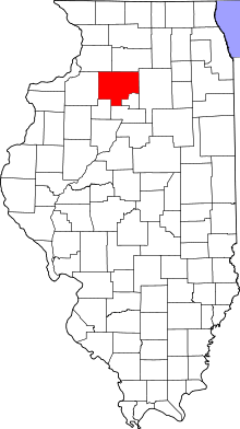 Bureau County's location in Illinois | |
| Coordinates: 41°16′41″N 89°34′08″W / 41.27806°N 89.56889°WCoordinates: 41°16′41″N 89°34′08″W / 41.27806°N 89.56889°W | |
| Country | United States |
| State | Illinois |
| County | Bureau |
| Established | November 6, 1849 |
| Area | |
| • Total | 36.41 sq mi (94.3 km2) |
| • Land | 36.33 sq mi (94.1 km2) |
| • Water | 0.08 sq mi (0.2 km2) 0.22% |
| Elevation | 843 ft (257 m) |
| Population (2010) | |
| • Total | 711 |
| • Density | 19.6/sq mi (7.6/km2) |
| Time zone | CST (UTC-6) |
| • Summer (DST) | CDT (UTC-5) |
| ZIP codes | 61314, 61356, 61368, 61379, 61421 |
| GNIS feature ID | 0429169 |
Indiantown Township is one of twenty-five townships in Bureau County, Illinois, USA. As of the 2010 census, its population was 711 and it contained 311 housing units.[1]
Geography
According to the 2010 census, the township has a total area of 36.41 square miles (94.3 km2), of which 36.33 square miles (94.1 km2) (or 99.78%) is land and 0.08 square miles (0.21 km2) (or 0.22%) is water.[1]
Cities
- Tiskilwa (west half)
Unincorporated towns
(This list is based on USGS data and may include former settlements.)
Cemeteries
The township contains these five cemeteries: Catholic, Mount Bloom, Oak Hill, Saint Marys and Willow Springs.
Lakes
- Menno-Haven Lake
School districts
- Bradford Community Unit School District 1
- Bureau Valley Community Unit School District 340
Political districts
- Illinois' 11th congressional district
- State House District 73
- State Senate District 37
References
- "Indiantown Township, Bureau County, Illinois". Geographic Names Information System. United States Geological Survey. Retrieved 2010-01-04.
- United States Census Bureau 2007 TIGER/Line Shapefiles
- United States National Atlas
- 1 2 "Population, Housing Units, Area, and Density: 2010 - County -- County Subdivision and Place -- 2010 Census Summary File 1". United States Census. Retrieved 2013-05-28.
External links
 |
Wyanet Township | Princeton Township | | |
| Macon Township | |
Arispie Township | ||
| ||||
| | ||||
| Milo Township | Wheatland Township |
Municipalities and communities of Bureau County, Illinois, United States | ||
|---|---|---|
| Cities | ||
| Villages | ||
| Townships | ||
| Unincorporated communities | ||
| Ghost town | ||
| Footnotes | ‡This populated place also has portions in an adjacent county or counties | |
This article is issued from Wikipedia - version of the 9/9/2016. The text is available under the Creative Commons Attribution/Share Alike but additional terms may apply for the media files.