Milo Township, Bureau County, Illinois
| Milo Township | |
|---|---|
| Township | |
 Location in Bureau County | |
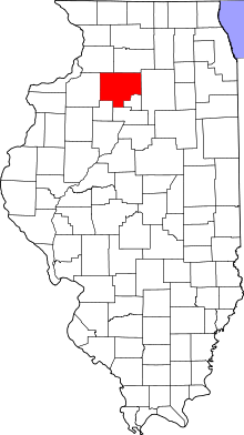 Bureau County's location in Illinois | |
| Coordinates: 41°10′59″N 89°35′04″W / 41.18306°N 89.58444°WCoordinates: 41°10′59″N 89°35′04″W / 41.18306°N 89.58444°W | |
| Country | United States |
| State | Illinois |
| County | Bureau |
| Established | November 6, 1849 |
| Area | |
| • Total | 34.99 sq mi (90.6 km2) |
| • Land | 34.98 sq mi (90.6 km2) |
| • Water | 0.01 sq mi (0.03 km2) 0.03% |
| Elevation | 846 ft (258 m) |
| Population (2010) | |
| • Total | 207 |
| • Density | 5.9/sq mi (2.3/km2) |
| Time zone | CST (UTC-6) |
| • Summer (DST) | CDT (UTC-5) |
| ZIP codes | 61314, 61368, 61421 |
| GNIS feature ID | 0429371 |
Milo Township is one of twenty-five townships in Bureau County, Illinois, USA. As of the 2010 census, its population was 207 and it contained 80 housing units.[1]
The township was named after Milo, New York.[2]
Geography
According to the 2010 census, the township has a total area of 34.99 square miles (90.6 km2), of which 34.98 square miles (90.6 km2) (or 99.97%) is land and 0.01 square miles (0.026 km2) (or 0.03%) is water.[1]
Unincorporated towns
Cemeteries
The township contains these two cemeteries: Boyds Grove and Milo.
Airports and landing strips
- Rinkenberger RLA Airport
School districts
- Bradford Community Unit School District 1
Political districts
- Illinois' 18th congressional district
- State House District 73
- State Senate District 37
References
- "Milo Township, Bureau County, Illinois". Geographic Names Information System. United States Geological Survey. Retrieved 2010-01-04.
- United States Census Bureau 2007 TIGER/Line Shapefiles
- United States National Atlas
- 1 2 "Population, Housing Units, Area, and Density: 2010 - County -- County Subdivision and Place -- 2010 Census Summary File 1". United States Census. Retrieved 2013-05-28.
- ↑ Gannett, Henry (1905). The Origin of Certain Place Names in the United States. U.S. Government Printing Office. p. 209.
External links
 |
Macon Township | Indiantown Township | | |
| Osceola Township, Stark County | |
Wheatland Township | ||
| ||||
| | ||||
| Penn Township, Stark County | Saratoga Township, Marshall County | Whitefield Township, Marshall County |
Municipalities and communities of Bureau County, Illinois, United States | ||
|---|---|---|
| Cities | ||
| Villages | ||
| Townships | ||
| Unincorporated communities | ||
| Ghost town | ||
| Footnotes | ‡This populated place also has portions in an adjacent county or counties | |
This article is issued from Wikipedia - version of the 10/16/2016. The text is available under the Creative Commons Attribution/Share Alike but additional terms may apply for the media files.