Fort Motte
|
Fort Motte Battle Site | |
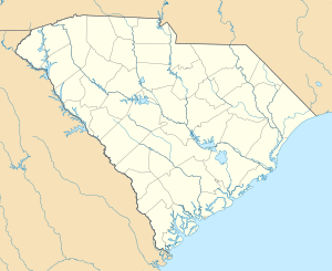  | |
| Location | Calhoun County, South Carolina |
|---|---|
| Nearest city | St. Matthews, South Carolina |
| Coordinates | 33°44′21″N 80°41′33″W / 33.73917°N 80.69250°WCoordinates: 33°44′21″N 80°41′33″W / 33.73917°N 80.69250°W |
| Area | 5 acres (2.0 ha) |
| NRHP Reference # | 72001195[1] |
| Added to NRHP | November 9, 1972 |
Fort Motte (Fort Motte Station) was a plantation commandeered by the British as a temporary military outpost in what is now South Carolina during the American Revolutionary War.[2] Later, it was considered as a possible location for the capitol for the newly formed state of South Carolina (before Columbia was chosen).
British forces occupied and converted into a stockade the recently built Mt. Joseph plantation home of Miles Brewton, whose business was located in Charleston, South Carolina.[3][4] The site is near a strategic river crossing of the Congaree River that would allow the British an important chain of transport from Charleston to points north and west.[5]
By May 1781 Fort Motte was a small but imposing wood and earth fortification of palisades (9' tall), ramparts (10-11' wide), with a 6' deep ditch in front; and 20-30' from the ditch a row of abatis. Defending the fort were 184 British regulars, Hessians, and Provincials under the command of Capt. Lt. Donald McPherson.[6] Later that month, General Francis "Swamp Fox" Marion captured the location after the Siege of Fort Motte.
Mt. Joseph became known as Fort Motte after General Marion's siege due to Rebecca Brewton Motte, sister of Miles Brewton. Rebecca was living at Mt. Joseph with her children at the time of the British occupation. During General Marion's siege, Rebecca famously helped in shooting flaming arrows into her family home in order to drive the British from it.[7]
The Cherokee Path is nearby. It is also roughly in the area of an early town (1735) known as Amelia Town, South Carolina. There were several other less well-known forts in the area. Before the forts were established, there were sites which served as trading posts.
The South Carolina Department of Archives and History, the South Carolina Library, and the University of South Carolina have the earliest extant maps for this area.
References
- ↑ National Park Service (2010-07-09). "National Register Information System". National Register of Historic Places. National Park Service.
- ↑ "Fort Motte Battle Site, Calhoun County (Address Restricted)". National Register Properties in South Carolina. South Carolina Department of Archives and History. Retrieved 9 June 2012.
- ↑ Lossing, Benson John The Pictorial Field-book of the Revolution Harper Brothers 1860
- ↑ Edgar and Bailey. Biographical Directory of the South Carolina House of Representatives, Volume II, The Commons House of Assembly 1692-1775. University of SC Press. 1974. pp. 480-481.
- ↑ Obstinate and Strong: the history and archeology of the siege of Fort Motte. Steven D. Smith, et al., SC Institute of Archeology and Anthropology, U. of South Carolina, Columbia, SC. 2007. p. 18
- ↑ Letter, Sumter to Greene, May 2nd 1781. Greene Papers, Volume III. p. 193
- ↑ Letter, Lord Rawdon to Cornwallis, May 24th 1781 in R. W. Gibbes. Documentary History of the American Revolution in 1781 and 1782. Appleton and Co. 1855. p. 79.
External links
| Topics |   | |
|---|---|---|
| Lists by county |
| |
| Lists by city | ||
| Other lists | ||