| [3] |
Name on the Register[4] |
Image |
Date listed[5] |
Location |
City or town |
Description |
|---|
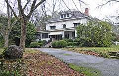
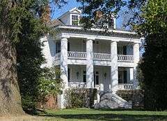
| 1 |
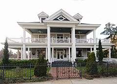
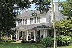
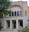
Alexander House |
|
000000002003-04-11-0000April 11, 2003
(#03000205) |
319 E. Main St.
34°57′03″N 81°55′28″W / 34.950833°N 81.924444°W / 34.950833; -81.924444 (Alexander House) |
Spartanburg |
|
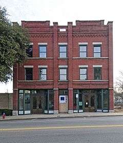
| 2 |
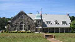
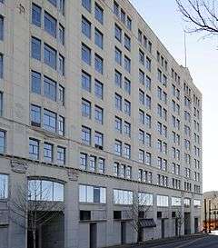
American Legion Building |
|
000000002003-04-18-0000April 18, 2003
(#03000271) |
94 W. Park Dr.
34°56′03″N 81°54′51″W / 34.934167°N 81.914167°W / 34.934167; -81.914167 (American Legion Building) |
Spartanburg |
|
| 3 |
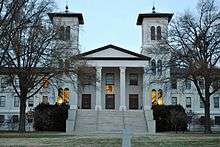
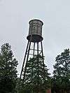
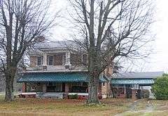
Anderson's Mill |
|
000000001978-11-14-0000November 14, 1978
(#78002529) |
West of Spartanburg off South Carolina Highway 296
34°52′59″N 82°00′42″W / 34.883056°N 82.011667°W / 34.883056; -82.011667 (Anderson's Mill) |
Spartanburg |
|
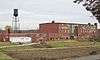
| 4 |
Apalache Mill |
|
000000002015-12-15-0000December 15, 2015
(#15000616) |
2200 Racing Rd.
34°57′44″N 82°12′30″W / 34.962312°N 82.208289°W / 34.962312; -82.208289 (Apalache Mill) |
Greer |
|
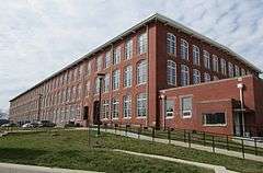
| 5 |
Arcadia Mill No. 1 |
|
000000002014-09-30-0000September 30, 2014
(#14000819) |
1875 Hayne St.
34°57′25″N 81°59′34″W / 34.9570°N 81.9927°W / 34.9570; -81.9927 (Arcadia Mill No. 1) |
Spartanburg |
|
| 6 |
Arcadia Mill No. 2 |
|
000000002005-10-04-0000October 4, 2005
(#05001158) |
100 W. Cleveland St.
34°57′26″N 82°00′00″W / 34.957222°N 82.0°W / 34.957222; -82.0 (Arcadia Mill No. 2) |
Spartanburg |
|
| 7 |
Archeological Site 38SP11 |
Upload image |
000000001980-12-10-0000December 10, 1980
(#80003698) |
Address Restricted
|
Pacolet |
|
| 8 |
Archeological Site 38SP12 |
Upload image |
000000001980-12-10-0000December 10, 1980
(#80003699) |
Address Restricted
|
Pacolet |
|
| 9 |
Archeological Site 38SP13 |
Upload image |
000000001980-12-10-0000December 10, 1980
(#80003700) |
Address Restricted
|
Pacolet |
|
| 10 |
Archeological Site 38SP17 |
Upload image |
000000001980-12-10-0000December 10, 1980
(#80003701) |
Address Restricted
|
Pacolet |
|
| 11 |
Archeological Site 38SP18 |
Upload image |
000000001980-12-10-0000December 10, 1980
(#80003702) |
Address Restricted
|
Pacolet |
|
| 12 |
Archeological Site 38SP19 |
Upload image |
000000001980-12-10-0000December 10, 1980
(#80003703) |
Address Restricted
|
Pacolet |
|
| 13 |
Archeological Site 38SP20 |
Upload image |
000000001980-12-10-0000December 10, 1980
(#80003704) |
Address Restricted
|
Pacolet |
|
| 14 |
Archeological Site 38SP21 |
Upload image |
000000001980-12-10-0000December 10, 1980
(#80003705) |
Address Restricted
|
Pacolet |
|
| 15 |
Archeological Site 38SP23 |
Upload image |
000000001980-12-10-0000December 10, 1980
(#80003706) |
Address Restricted
|
Pacolet |
|
| 16 |
Archeological Site 38SP52 |
Upload image |
000000001980-12-10-0000December 10, 1980
(#80003707) |
Address Restricted
|
Pacolet |
|
| 17 |
Archeological Site 38SP53 |
Upload image |
000000001980-12-10-0000December 10, 1980
(#80003708) |
Address Restricted
|
Pacolet |
|
| 18 |
Archeological Site 38SP54 |
Upload image |
000000001980-12-10-0000December 10, 1980
(#80003709) |
Address Restricted
|
Pacolet |
|
| 19 |
Archeological Site 38SP57 |
Upload image |
000000001980-12-10-0000December 10, 1980
(#80003710) |
Address Restricted
|
Pacolet |
|
| 20 |
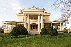
Bivings-Converse House |
|
000000001995-05-26-0000May 26, 1995
(#95000638) |
1 Douglas St.
34°56′34″N 81°50′12″W / 34.942778°N 81.836667°W / 34.942778; -81.836667 (Bivings-Converse House) |
Glendale |
|
| 21 |
Bon Haven |
|
000000001976-06-29-0000June 29, 1976
(#76001711) |
728 N. Church St.
34°57′48″N 81°56′38″W / 34.963333°N 81.943889°W / 34.963333; -81.943889 (Bon Haven) |
Spartanburg |
|
| 22 |
Bush House |
|
000000002003-10-21-0000October 21, 2003
(#03000695) |
3960 New Cut Rd.
35°01′25″N 82°04′26″W / 35.023611°N 82.073889°W / 35.023611; -82.073889 (Bush House) |
Inman |
|
| 23 |
Camp Hill |
|
000000001970-07-06-0000July 6, 1970
(#70000600) |
South of Glenn Springs on South Carolina Highway 215
34°47′22″N 81°48′59″W / 34.789444°N 81.816389°W / 34.789444; -81.816389 (Camp Hill) |
Glenn Springs |
|
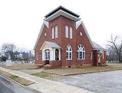
| 24 |
Central Methodist Church |
|
000000002003-10-03-0000October 3, 2003
(#03001002) |
233 N. Church St.
34°57′09″N 81°56′00″W / 34.9525°N 81.933333°W / 34.9525; -81.933333 (Central Methodist Church) |
Spartanburg |
|
| 25 |
Church of the Advent |
|
000000002000-05-26-0000May 26, 2000
(#00000553) |
141 Advent St.
34°56′59″N 81°55′28″W / 34.949722°N 81.924444°W / 34.949722; -81.924444 (Church of the Advent) |
Spartanburg |
|
| 26 |
Cleveland Law Range |
|
000000001973-04-13-0000April 13, 1973
(#73001730) |
171 Magnolia St.
34°57′03″N 81°56′04″W / 34.950833°N 81.934444°W / 34.950833; -81.934444 (Cleveland Law Range) |
Spartanburg |
|
| 27 |
Converse College Historic District |
|
000000001975-11-12-0000November 12, 1975
(#75001706) |
580 E. Main St.
34°57′18″N 81°55′02″W / 34.955°N 81.917222°W / 34.955; -81.917222 (Converse College Historic District) |
Spartanburg |
|
| 28 |
Converse Heights Historic District |
|
000000002007-09-25-0000September 25, 2007
(#07001021) |
Southeast of E. Main St. and northeast of Pine St., containing properties along portions of Clifton, Connecticut, & Glendalyn Aves., Hale & Maple Sts., Mills Ave., Norwood St., Otis Blvd., Palmetto, Plume, Poplar, & Rutledge Sts., S. Fairview Ave, and Woodland St.[6]
34°57′05″N 81°54′32″W / 34.9514°N 81.9089°W / 34.9514; -81.9089 (Converse Heights Historic District) |
Spartanburg |
|
| 29 |
Converse Mill |
|
000000002015-10-05-0000October 5, 2015
(#15000709) |
200 High St.
34°59′39″N 81°50′16″W / 34.9941°N 81.8378°W / 34.9941; -81.8378 (Converse Mill) |
Spartanburg |
|
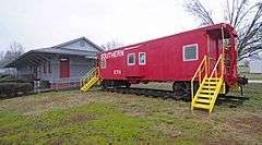
| 30 |
Cowpens Depot |
|
000000001997-09-04-0000September 4, 1997
(#97001104) |
120 Palmetto St.
35°00′56″N 81°48′10″W / 35.015556°N 81.802778°W / 35.015556; -81.802778 (Cowpens Depot) |
Cowpens |
|
| 31 |
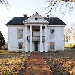
James M. Davis House |
|
000000002010-06-07-0000June 7, 2010
(#10000317) |
2763 Old Hwy 14 S[7]
34°51′43″N 82°13′27″W / 34.8619°N 82.2242°W / 34.8619; -82.2242 (James M. Davis House) |
Pelham |
|
| 32 |
Drayton Mill |
|
000000002012-10-24-0000October 24, 2012
(#12000882) |
1802 Drayton Rd.
34°58′12″N 81°54′30″W / 34.969883°N 81.908226°W / 34.969883; -81.908226 (Drayton Mill) |
Spartanburg |
|
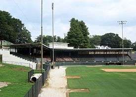
| 33 |
Duncan Park Stadium |
|
000000002016-01-26-0000January 26, 2016
(#15001009) |
0 W. Park Dr.
34°56′11″N 81°54′46″W / 34.936493°N 81.912818°W / 34.936493; -81.912818 (Duncan Park Stadium) |
Spartanburg |
|
| 34 |
Bishop William Wallace Duncan House |
|
000000002009-10-02-0000October 2, 2009
(#76001712) |
300 Howard St.
34°57′17″N 81°56′18″W / 34.954722°N 81.938333°W / 34.954722; -81.938333 (Bishop William Wallace Duncan House) |
Spartanburg |
Originally listed on 000000001976-07-12-0000July 12, 1976 and delisted on 000000002005-12-08-0000December 8, 2005; listing date represents a relisting
|
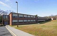
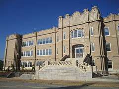
| 35 |
Frank Evans High School |
|
000000002012-06-27-0000June 27, 2012
(#12000373) |
142 S. Dean St.
34°56′57″N 81°55′37″W / 34.9492950°N 81.926826°W / 34.9492950; -81.926826 (Frank Evans High School) |
Spartanburg |
|
| 36 |
Evans-Russell House |
|
000000002007-03-21-0000March 21, 2007
(#07000183) |
716 Otis Boulevard
34°57′09″N 81°54′33″W / 34.9525°N 81.909167°W / 34.9525; -81.909167 (Evans-Russell House) |
Spartanburg |
|
| 37 |
Evins-Bivings House |
|
000000001970-07-16-0000July 16, 1970
(#70000601) |
563 N. Church St.
34°57′35″N 81°56′27″W / 34.959722°N 81.940833°W / 34.959722; -81.940833 (Evins-Bivings House) |
Spartanburg |
|
| 38 |
First Presbyterian Church of Woodruff |
|
000000002005-01-26-0000January 26, 2005
(#04001563) |
300 W. Georgia St.
34°44′19″N 82°02′27″W / 34.738611°N 82.040833°W / 34.738611; -82.040833 (First Presbyterian Church of Woodruff) |
Woodruff |
|
| 39 |
Foster's Tavern |
|
000000001970-12-18-0000December 18, 1970
(#70000602) |
191 Cedar Spring Rd.
34°55′18″N 81°53′14″W / 34.921667°N 81.887222°W / 34.921667; -81.887222 (Foster's Tavern) |
Spartanburg |
|
| 40 |
William Dixon Fowler House |
|
000000002012-02-08-0000February 8, 2012
(#12000016) |
5885 SC 215
34°48′46″N 81°50′23″W / 34.812869°N 81.839786°W / 34.812869; -81.839786 (William Dixon Fowler House) |
Pauline |
|
| 41 |
Fremont School |
|
000000002000-10-24-0000October 24, 2000
(#00001234) |
600 Magnolia St.
34°57′37″N 81°56′47″W / 34.960278°N 81.946389°W / 34.960278; -81.946389 (Fremont School) |
Spartanburg |
|
| 42 |
Glenn Springs Historic District |
|
000000001982-11-04-0000November 4, 1982
(#82001526) |
South Carolina Highway 150 and Rich Hill Rd.
34°49′05″N 81°49′45″W / 34.818056°N 81.829167°W / 34.818056; -81.829167 (Glenn Springs Historic District) |
Glenn Springs |
|
| 43 |
Golightly-Dean House |
|
000000001988-09-29-0000September 29, 1988
(#88001845) |
South Carolina Highway 56
34°52′28″N 81°52′57″W / 34.874444°N 81.8825°W / 34.874444; -81.8825 (Golightly-Dean House) |
Spartanburg |
|
| 44 |
Hampton Heights Historic District |
|
000000001983-01-27-0000January 27, 1983
(#83002208) |
Roughly bounded by Spring, Henry, Hydrick, and Peronneau Sts., Hampton Dr., and both sides of Hampton Ave.
34°56′29″N 81°55′54″W / 34.941389°N 81.931667°W / 34.941389; -81.931667 (Hampton Heights Historic District) |
Spartanburg |
|
| 45 |
Hotel Oregon |
|
000000002001-04-10-0000April 10, 2001
(#01000311) |
247 and 249 Magnolia St.
34°57′10″N 81°56′11″W / 34.952778°N 81.936389°W / 34.952778; -81.936389 (Hotel Oregon) |
Spartanburg |
|
| 46 |
Hurricane Tavern |
|
000000002001-07-19-0000July 19, 2001
(#01000755) |
4101 South Carolina Highway 101
34°48′04″N 82°07′25″W / 34.801111°N 82.123611°W / 34.801111; -82.123611 (Hurricane Tavern) |
Woodruff |
|
| 47 |
Inman Mills |
|
000000002016-03-15-0000March 15, 2016
(#16000090) |
240 4th St.
35°02′26″N 82°05′56″W / 35.040537°N 82.098780°W / 35.040537; -82.098780 (Inman Mills) |
Inman |
|
| 48 |
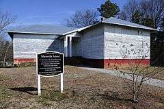
Marysville School |
|
000000002007-01-09-0000January 9, 2007
(#06001231) |
Sunny Acres Rd.
34°55′06″N 81°45′27″W / 34.918333°N 81.7575°W / 34.918333; -81.7575 (Marysville School) |
Pacolet |
|
| 49 |
McMakin's Tavern |
|
000000001974-10-09-0000October 9, 1974
(#74001876) |
Northwest of Lyman off South Carolina Highway 358
34°58′23″N 82°09′07″W / 34.973056°N 82.151944°W / 34.973056; -82.151944 (McMakin's Tavern) |
Lyman |
|
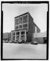
| 50 |
Montgomery Building |
|
000000002011-05-25-0000May 25, 2011
(#08000760) |
187 N. Church St.
34°57′08″N 81°55′56″W / 34.952222°N 81.932222°W / 34.952222; -81.932222 (Montgomery Building) |
Spartanburg |
|
| 51 |
Walter Scott Montgomery House |
|
000000001984-11-01-0000November 1, 1984
(#84000345) |
314 S. Pine St.
34°56′50″N 81°54′59″W / 34.947222°N 81.916389°W / 34.947222; -81.916389 (Walter Scott Montgomery House) |
Spartanburg |
|
| 52 |
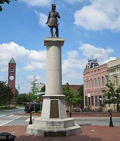
Daniel Morgan Monument |
|
000000001980-09-22-0000September 22, 1980
(#80003711) |
Main and Church Sts.
34°56′58″N 81°55′55″W / 34.949444°N 81.931944°W / 34.949444; -81.931944 (Daniel Morgan Monument) |
Spartanburg |
|
| 53 |
Mountain Shoals Plantation |
|
000000001979-04-24-0000April 24, 1979
(#79002394) |
Junction of U.S. Route 221 and South Carolina Highway 92
34°39′09″N 81°57′50″W / 34.6525°N 81.963889°W / 34.6525; -81.963889 (Mountain Shoals Plantation) |
Enoree |
|
| 54 |
New Hope Farm |
|
000000001999-05-20-0000May 20, 1999
(#98000558) |
10088 Greenville Highway
34°56′22″N 82°04′18″W / 34.939444°N 82.071667°W / 34.939444; -82.071667 (New Hope Farm) |
Wellford |
|
| 55 |
Nicholls-Crook House |
|
000000001973-03-20-0000March 20, 1973
(#73001731) |
15 miles southwest of Spartanburg off U.S. Route 221
34°46′57″N 82°01′22″W / 34.7825°N 82.022778°W / 34.7825; -82.022778 (Nicholls-Crook House) |
Spartanburg |
|
| 56 |
Pacolet Mill Office |
|
000000002004-07-28-0000July 28, 2004
(#04000760) |
180 Montgomery Ave.
34°55′14″N 81°44′30″W / 34.920556°N 81.741667°W / 34.920556; -81.741667 (Pacolet Mill Office) |
Pacolet |
|
| 57 |
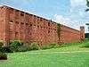
Pacolet Mills Cloth Room and Warehouse |
|
000000002006-02-01-0000February 1, 2006
(#05001571) |
1560 Sunny Acres Rd.
34°55′11″N 81°44′34″W / 34.919722°N 81.742778°W / 34.919722; -81.742778 (Pacolet Mills Cloth Room and Warehouse) |
Pacolet |
|
| 58 |
Pacolet Mills Historic District |
|
000000002007-11-16-0000November 16, 2007
(#07001207) |
Roughly bounded by Brewster, Milliken, Walker, Montgomery, and Moore Sts. and Granite Ave.
34°55′07″N 81°44′26″W / 34.918611°N 81.740556°W / 34.918611; -81.740556 (Pacolet Mills Historic District) |
Pacolet |
|
| 59 |
Palmetto Theater |
Upload image |
000000001996-04-12-0000April 12, 1996
(#96000405) |
172 E. Main St.
34°57′01″N 81°55′47″W / 34.950278°N 81.929722°W / 34.950278; -81.929722 (Palmetto Theater) |
Spartanburg |
Demolished in 2003.
|
| 60 |
Pine Street Elementary School |
|
000000002016-10-17-0000October 17, 2016
(#16000731) |
500 S. Pine St.
34°56′37″N 81°54′41″W / 34.943724°N 81.911518°W / 34.943724; -81.911518 (Pine Street Elementary School) |
Spartanburg |
|
| 61 |
Price's Post Office |
|
000000001969-10-28-0000October 28, 1969
(#69000174) |
Southeast of Moore at the junction of County Roads 86, 199, and 200
34°46′33″N 81°58′12″W / 34.775833°N 81.97°W / 34.775833; -81.97 (Price's Post Office) |
Moore |
|
| 62 |
Reidville Academy Faculty House |
|
000000001997-09-04-0000September 4, 1997
(#97001105) |
Junction of College and Main Sts.
34°51′37″N 82°06′52″W / 34.860278°N 82.114444°W / 34.860278; -82.114444 (Reidville Academy Faculty House) |
Reidville |
|
| 63 |
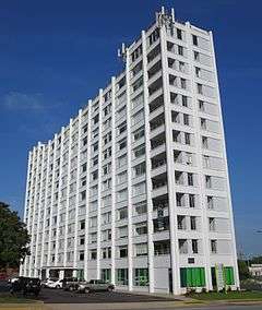
Schuyler Apartments |
|
000000002014-05-12-0000May 12, 2014
(#14000208) |
275 S. Church St.
34°56′42″N 81°55′46″W / 34.944928°N 81.929362°W / 34.944928; -81.929362 (Schuyler Apartments) |
Spartanburg |
|
| 64 |
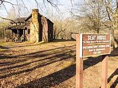
Jammie Seay House |
|
000000001971-10-07-0000October 7, 1971
(#71000807) |
Darby Rd. off Crescent Ave.
34°55′49″N 81°56′30″W / 34.930278°N 81.941667°W / 34.930278; -81.941667 (Jammie Seay House) |
Spartanburg |
|
| 65 |
Shiloh Methodist Church |
|
000000002005-02-02-0000February 2, 2005
(#04001591) |
Blackstock Rd.
35°01′35″N 82°05′03″W / 35.026389°N 82.084167°W / 35.026389; -82.084167 (Shiloh Methodist Church) |
Inman |
|
| 66 |
Smith's Tavern |
|
000000001974-07-23-0000July 23, 1974
(#74001878) |
East of South Carolina Highway 49
34°51′38″N 81°56′47″W / 34.860556°N 81.946389°W / 34.860556; -81.946389 (Smith's Tavern) |
Roebuck |
|
| 67 |
Spartanburg Historic District |
|
000000001983-05-19-0000May 19, 1983
(#83002209) |
W. Main, Magnolia, Wall, Ezell, and Spring Sts.; also the 100 block of E. Main St.
34°56′58″N 81°55′59″W / 34.949444°N 81.933056°W / 34.949444; -81.933056 (Spartanburg Historic District) |
Spartanburg |
Second set of addresses represents a boundary increase of 000000002000-01-28-0000January 28, 2000
|
| 68 |
Walker Hall |
|
000000001977-12-06-0000December 6, 1977
(#77001232) |
Southeast of Spartanburg on South Carolina Highway 56
34°54′37″N 81°52′48″W / 34.910278°N 81.88°W / 34.910278; -81.88 (Walker Hall) |
Spartanburg |
|
| 69 |
Walnut Grove Plantation |
|
000000001970-07-01-0000July 1, 1970
(#70000603) |
8 miles southeast of Spartanburg, about 1 miles east of the junction of Interstate 26 and U.S. Route 921
34°49′33″N 81°57′36″W / 34.825833°N 81.96°W / 34.825833; -81.96 (Walnut Grove Plantation) |
Spartanburg |
|
| 70 |
Williams Place |
|
000000001982-11-10-0000November 10, 1982
(#82001527) |
Southwest of Glenn Springs on South Carolina Highway 113
34°45′08″N 81°52′32″W / 34.752222°N 81.875556°W / 34.752222; -81.875556 (Williams Place) |
Glenn Springs |
|
| 71 |
Wofford College Historic District |
|
000000001974-12-27-0000December 27, 1974
(#74001879) |
Wofford College campus
34°57′30″N 81°56′05″W / 34.958333°N 81.934722°W / 34.958333; -81.934722 (Wofford College Historic District) |
Spartanburg |
|
| 72 |
Woodruff High School |
|
000000002006-10-18-0000October 18, 2006
(#06000578) |
239 E. Hayne St.
34°44′21″N 82°02′05″W / 34.739167°N 82.034722°W / 34.739167; -82.034722 (Woodruff High School) |
Woodruff |
The current Woodruff High School uses a different building
|
| 73 |
Mary H. Wright Elementary School |
|
000000002007-08-03-0000August 3, 2007
(#07000798) |
201 Caulder Ave.
34°56′03″N 81°55′35″W / 34.934167°N 81.926389°W / 34.934167; -81.926389 (Mary H. Wright Elementary School) |
Spartanburg |
|
.jpg)

.jpg)

.JPG)

.jpg)
.jpg)


.jpg)
.jpg)
.jpg)