Fulton Place, Edmonton
| Fulton Place | |
|---|---|
| Neighbourhood | |
|
Fulton Place Location of Fulton Place in Edmonton | |
| Coordinates: 53°32′49″N 113°25′30″W / 53.547°N 113.425°W | |
| Country |
|
| Province |
|
| City | Edmonton |
| Quadrant[1] | NW |
| Ward[1] | 8 |
| Sector[2] | Mature area |
| Government[3] | |
| • Administrative body | Edmonton City Council |
| • Councillor | Ben Henderson |
| Area[4] | |
| • Total | 0.98 km2 (0.38 sq mi) |
| Elevation | 662 m (2,172 ft) |
| Population (2014)[5] | |
| • Total | 2,161 |
| • Density | 2,205.1/km2 (5,711/sq mi) |
| • Change (20012–14) |
|
| • Dwellings | 990 |
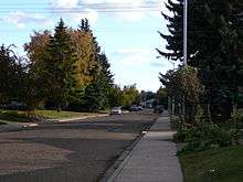
Fulton Place is a residential neighbourhood in south east Edmonton, Alberta, Canada. It is named for the creek which runs along the neighbourhood's west boundary. The area is also sometimes known as Hardisty.
The neighbourhood is bounded on the north by 106 Avenue, on the south by 101 Avenue, on the east by 50 Street, and on the west and south west by Fulton Creek Ravine. At the north west corner of the neighbourhood is an interchange between 106 Avenue and Wayne Gretzky Drive.
Demographics
In the City of Edmonton's 2014 municipal census, Fulton Place had a population of 2,161 living in 990 dwellings,[5] a -0.37% change from its 2012 population of 2,244.[6] With a land area of 0.98 km2 (0.38 sq mi),[4] it had a population density of 2,205.1 people/km2 in 2014.[4][5]
Residential development
While a small percentage (3.4%) of the residences in Fulton Place were built before the end of World War II, according to the 2001 federal census four out of five (79.1%) of all residences were built between 1946 and 1960. Another one in ten (9.6%) residences were built during the 1960s. A small proportion of residences were built after 1970.[7]
The most common type of residence in the neighbourhood, according to the 2005 municipal census, is the single-family dwelling. These account for almost nine out of every ten (86%) residences in the neighbourhood. Another one residence in twenty (6%) are rented apartments in low-rise buildings with fewer than five stories. There are a small number (1%) of duplexes.[8] The remaining one residence in twenty (7%) are classified as other kinds of residence. Almost nine out of every ten (85%) of all residences are owner-occupied while the remaining residences are rented.[9]
Schools and recreation facilities
Hardisty School, operated by the Edmonton Public School System, is located in Fulton Place with over 600 students enrolled in kindergarten through grade 9. Fulton Place School, formerly an elementary school, was closed in 2010 and the building is now used by several non-profit and community-based organizations.[10]
Hardisty Fitness and Leisure Centre and the Michael Cameron Arena are both located in the neighbourhood.
Surrounding neighbourhoods
 |
Forest Heights | Capilano | Capilano | |
| Forest Heights[11] | |
Gold Bar | ||
| ||||
| | ||||
| Terrace Heights | Ottewell | Eastgate Business Park |
References
- 1 2 "City of Edmonton Wards & Standard Neighbourhoods" (PDF). City of Edmonton. Retrieved February 13, 2013.
- ↑ "Edmonton Developing and Planned Neighbourhoods, 2011" (PDF). City of Edmonton. Retrieved February 13, 2013.
- ↑ "City Councillors". City of Edmonton. Retrieved February 13, 2013.
- 1 2 3 "Neighbourhoods (data plus kml file)". City of Edmonton. Retrieved February 13, 2013.
- 1 2 3 "Municipal Census Results – Edmonton 2014 Census". City of Edmonton. Retrieved February 22, 2013.
- ↑ "2009 Municipal Census Results". City of Edmonton. Retrieved February 22, 2013.
- ↑ http://censusdocs.edmonton.ca/DD23/FEDERAL%202001/Neighbourhood/FULTON%20PLACE.pdf
- ↑ Duplexes include triplexes and fourplexes.
- ↑ http://censusdocs.edmonton.ca/C05002/MUNICIPAL%202005/Neighbourhood/FULTON%20PLACE.pdf
- ↑ http://edmonton.ctvnews.ca/students-at-fulton-place-school-bid-farewell-1.527487
- ↑ Forest Heights is to the west of Wayne Gretzky Drive. Terrace Heights is between Wayne Gretzky Drive and Fulton Creek Ravine.