Westridge, Edmonton
| Westridge | |
|---|---|
| Neighbourhood | |
|
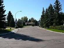
Westridge Location of Westridge in Edmonton | |
| Coordinates: 53°30′25″N 113°36′14″W / 53.507°N 113.604°W | |
| Country |
|
| Province |
|
| City | Edmonton |
| Quadrant[1] | NW |
| Ward[1] | 5 |
| Sector[2] | West |
| Area[3][4] | West Jasper Place |
| Government[5] | |
| • Administrative body | Edmonton City Council |
| • Councillor | Karen Leibovici |
| Area[6] | |
| • Total | 0.75 km2 (0.29 sq mi) |
| Elevation | 671 m (2,201 ft) |
| Population (2012)[7] | |
| • Total | 1,327 |
| • Density | 1,769.3/km2 (4,582/sq mi) |
| • Change (2009–12) |
|
| • Dwellings | 496 |
Westridge is a residential neighbourhood in west Edmonton, Alberta, Canada.
The neighbourhood is bounded to the north and northeast by Patricia Ravine and to the south by Wolf Willow Ravine. The southeast tip overlooks the North Saskatchewan River valley. The western boundary is 170 Street. Access to the neighbourhood is exclusively by way of Wolf Willow Road.
According to the 2001 federal census, four out of five (80.2%) of the residences in Westridge were built during the 1970s. The remaining one in five (19.8%) were built during the 1980s.[8]
Almost all of the houses in the neighbourhood (93.5%), according to the 2005 municipal census, are single-family dwellings. The remainder (6.5%) are row houses. Almost all residences in the neighbourhood are owner-occupied, with less than 1% being rented.[9]
The north west corner of the neighbourhood is close to the 170 Street interchange with Whitemud Drive. This provides people in the neighbourhood with good access to destinations on the south side including: the University of Alberta, Fort Edmonton Park, and Old Strathcona.
West Edmonton Mall is located to the north of the neighbourhood along 170 Street. Residents also enjoy comparatively good access to the downtown core.
Demographics
In the City of Edmonton's 2012 municipal census, Westridge had a population of 1,327 living in 496 dwellings,[7] a -6.2% change from its 2009 population of 1,415.[10] With a land area of 0.75 km2 (0.29 sq mi),[6] it had a population density of 1,769.3 people/km2 in 2012.[6][7]
Surrounding neighbourhoods
 |
Thorncliff | Elmwood River Valley Lessard North Patricia Heights |
River Valley Lessard North Patricia Heights |
|
| Callingwood North | |
River Valley Lessard North | ||
| ||||
| | ||||
| Callingwood South | Oleskiw River Valley Lessard North |
River Valley Lessard North |
References
- 1 2 "City of Edmonton Wards & Standard Neighbourhoods" (PDF). City of Edmonton. Retrieved February 13, 2013.
- ↑ "Edmonton Developing and Planned Neighbourhoods, 2011" (PDF). City of Edmonton. Retrieved February 13, 2013.
- ↑ "The Way We Grow: Municipal Development Plan Bylaw 15100" (PDF). City of Edmonton. 2010-05-26. Retrieved February 13, 2013.
- ↑ "City of Edmonton Plans in Effect" (PDF). City of Edmonton. November 2011. Retrieved February 13, 2013.
- ↑ "City Councillors". City of Edmonton. Retrieved February 13, 2013.
- 1 2 3 "Neighbourhoods (data plus kml file)". City of Edmonton. Retrieved February 22, 2013.
- 1 2 3 "Municipal Census Results – Edmonton 2012 Census". City of Edmonton. Retrieved February 22, 2013.
- ↑ http://censusdocs.edmonton.ca/DD23/FEDERAL%202001/Neighbourhood/WESTRIDGE.pdf
- ↑ http://censusdocs.edmonton.ca/C05002/MUNICIPAL%202005/Neighbourhood/WESTRIDGE.pdf
- ↑ "2009 Municipal Census Results". City of Edmonton. Retrieved February 22, 2013.