Montrose, Edmonton
| Montrose | |
|---|---|
| Neighbourhood | |
|
Montrose Location of Montrose in Edmonton | |
| Coordinates: 53°34′26″N 113°26′31″W / 53.574°N 113.442°W | |
| Country |
|
| Province |
|
| City | Edmonton |
| Quadrant[1] | NW |
| Ward[1] | 7 |
| Sector[2] | Mature area |
| Government[3] | |
| • Administrative body | Edmonton City Council |
| • Councillor | Tony Caterina |
| Area[4] | |
| • Total | 1.41 km2 (0.54 sq mi) |
| Elevation | 662 m (2,172 ft) |
| Population (2012)[5] | |
| • Total | 3,249 |
| • Density | 2,304.3/km2 (5,968/sq mi) |
| • Change (2009–12) |
|
| • Dwellings | 1,586 |
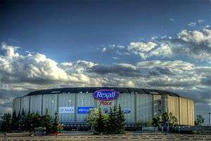
Montrose is a residential neighbourhood in north east Edmonton, Alberta, Canada. Northlands Coliseum is located at the southwest corner of the neighbourhood.
It is bounded on the north by the Yellowhead Trail, on the west by the Canadian National Railway right of way and the north east line of the Edmonton Transit System's LRT system, on the south by 118 (Alberta) Avenue, and on the east by 58 Street. Wayne Gretzky Drive, which provides access to destinations south of the North Saskatchewan River, passes through the neighbourhood.
The Coliseum LRT Station is located next to the Coliseum at the north west corner of the neighbourhood.
Demographics
In the City of Edmonton's 2012 municipal census, Montrose had a population of 3,249 living in 1,586 dwellings,[5] a 3% change from its 2009 population of 3,153.[6] With a land area of 1.41 km2 (0.54 sq mi), it had a population density of 2,304.3 people/km2 in 2012.[4][5]
Residential development
Development of the neighbourhood began before the end of World War II with approximately one in five (20.4%) of residences being constructed before 1946 according to the 2001 federal census. Just under half of the residences (45.6%) were constructed between 1946 and 1960. Most of the remaining residences were built by 1980.[7]
The most common type of residence in the neighbourhood, according to the 2005 municipal census, is the single-family dwelling. These account for roughly four out of five (78%) of all the residences. Most of the remainder (16%) are rented apartments in low-rise buildings with fewer than five stories. The remaining 6% are duplexes.[8] Three out of five (61%) are owner-occupied with the remaining two out of five (39%) being rented.[9]
According to the 2005 municipal census, the neighbourhood population is highly mobile with one in six (17.1%) having moved within the previous year. Another one in five (19.5%) had moved within the previous one to three years. Less than half of all residents (47.8%) had lived at the same address for five or more years.[10]
Schools and recreation
There are two schools in the neighbourhood.
Montrose Elementary School is operated by the Edmonton Public School System while Ben Calf Robe St Clare Elementary Junior High School is operated by the Edmonton Catholic School System.
The Russ Barnes Arena is also located in the neighbourhood.
Surrounding neighbourhoods
 |
Yellowhead Corridor | Industrial Heights | Industrial Heights | |
| Eastwood, Elmwood Park | |
Newton | ||
| ||||
| | ||||
| Parkdale | Bellevue, Highlands, Edmonton Northlands | Highlands |
References
- 1 2 "City of Edmonton Wards & Standard Neighbourhoods" (PDF). City of Edmonton. Retrieved February 13, 2013.
- ↑ "Edmonton Developing and Planned Neighbourhoods, 2011" (PDF). City of Edmonton. Retrieved February 13, 2013.
- ↑ "City Councillors". City of Edmonton. Retrieved February 13, 2013.
- 1 2 "Neighbourhoods (data plus kml file)". City of Edmonton. Retrieved February 13, 2013.
- 1 2 3 "Municipal Census Results – Edmonton 2012 Census". City of Edmonton. Retrieved February 22, 2013.
- ↑ "2009 Municipal Census Results". City of Edmonton. Retrieved February 22, 2013.
- ↑ http://censusdocs.edmonton.ca/DD23/FEDERAL%202001/Neighbourhood/MONTROSE.pdf
- ↑ Duplexes include triplexes and quadruplexes.
- ↑ http://censusdocs.edmonton.ca/C05002/MUNICIPAL%202005/Neighbourhood/MONTROSE.pdf
- ↑ http://censusdocs.edmonton.ca/C05022B/MUNICIPAL%202005/Neighbourhood/MONTROSE.pdf