Lower Squankum, New Jersey
| Lower Squankum, New Jersey | |
|---|---|
| Unincorporated community | |
|
| |
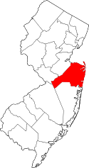
 Lower Squankum, New Jersey 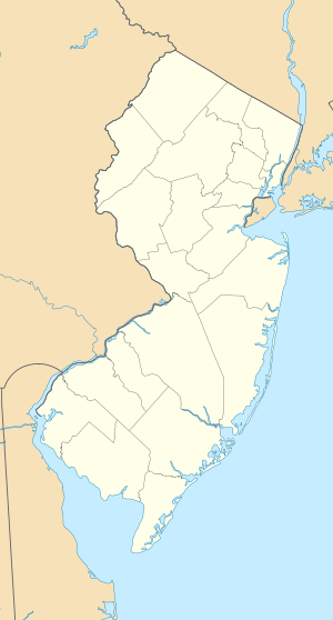 Lower Squankum, New Jersey  Lower Squankum, New Jersey Location of Lower Squankum in Monmouth County Inset: Location of county within the state of New Jersey | |
| Coordinates: 40°09′31″N 74°09′25″W / 40.15861°N 74.15694°WCoordinates: 40°09′31″N 74°09′25″W / 40.15861°N 74.15694°W | |
| Country |
|
| State |
|
| County | Monmouth |
| Township | Howell |
| Elevation[1] | 43 ft (13 m) |
| GNIS feature ID | 877973[1] |

Lower Squankum is an unincorporated community located within Howell Township in Monmouth County, New Jersey, United States.[2] The settlement is located along Lakewood-Farmingdale Road (County Route 547) at its intersection with Herbertsville Road (CR 549) and Old Tavern Road (CR 21) in the eastern side of the township. It is also located near the boundary of Allaire State Park and is south of Interstate 195's exit 31.[3] Nearby the community are the remains of the Lower Squankum Mill and the Lower Squankum Friends Burial Site, located within the median of CR 547 at the aforementioned interchange.[4][5]
References
- 1 2 "Lower Squankum". Geographic Names Information System. United States Geological Survey.
- ↑ Locality Search, State of New Jersey. Accessed February 26, 2015.
- ↑ Google (August 19, 2016). "Aerial view of Lower Squankum" (Map). Google Maps. Google. Retrieved August 19, 2016.
- ↑ "The Lower Squankum Mill Site: Rise and Fall of a 19th-Century Agricultural Enterprise" (PDF). Cultural Resources Digest. New Jersey Department of Transportation. July 2005. Retrieved August 19, 2016.
- ↑ "Lower Squankum Friends Burial Ground". Find a Grave. Retrieved August 19, 2016.
This article is issued from Wikipedia - version of the 8/19/2016. The text is available under the Creative Commons Attribution/Share Alike but additional terms may apply for the media files.