Monmouth Heights at Marlboro, New Jersey
Not to be confused with Monmouth Heights at Manalapan, New Jersey.
| Monmouth Heights at Marlboro, New Jersey | |
|---|---|
| Unincorporated community | |
|
Looking east along Ogden Avenue from Route 79 | |
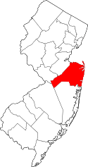
 Monmouth Heights at Marlboro, New Jersey 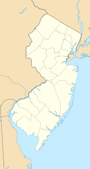 Monmouth Heights at Marlboro, New Jersey  Monmouth Heights at Marlboro, New Jersey Location of Monmouth Heights at Marlboro in Monmouth County Inset: Location of county within the state of New Jersey | |
| Coordinates: 40°19′40″N 74°14′36″W / 40.32778°N 74.24333°WCoordinates: 40°19′40″N 74°14′36″W / 40.32778°N 74.24333°W | |
| Country |
|
| State |
|
| County | Monmouth |
| Township | Marlboro |
| Elevation[1] | 125 ft (38 m) |
| GNIS feature ID | 883509[1] |
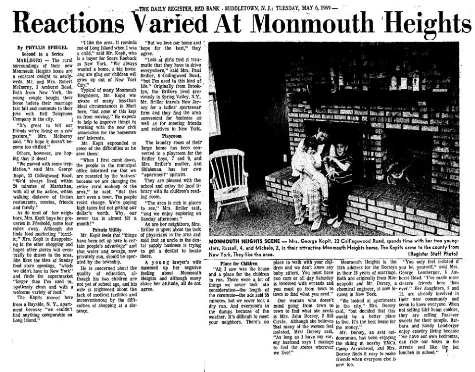
Monmouth Heights at Marlboro is an unincorporated community located within Marlboro Township in Monmouth County, New Jersey, United States. The housing development was created in the 1960s by Levitt & Sons though some protests occurred by long-time residents of Marlboro Township at the time of its creation.[2] The community is located along New Jersey Route 79 across the highway from Marlboro High School.[3]
References
- 1 2 "Monmouth Heights at Marlboro". Geographic Names Information System. United States Geological Survey.
- ↑ Spiegel, Phyllis (May 6, 1969). "Reactions Varied At Monmouth Heights". The Daily Register (Red Bank). Retrieved September 13, 2016 – via Marlboro History.
- ↑ Google (February 27, 2015). "Monmouth Heights at Marlboro, New Jersey" (Map). Google Maps. Google. Retrieved February 27, 2015.
External links
This article is issued from Wikipedia - version of the 9/18/2016. The text is available under the Creative Commons Attribution/Share Alike but additional terms may apply for the media files.