Marquette County, Wisconsin
| Marquette County, Wisconsin | |
|---|---|
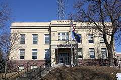 Marquette County Courthouse | |
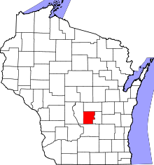 Location in the U.S. state of Wisconsin | |
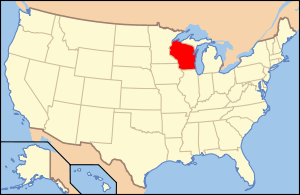 Wisconsin's location in the U.S. | |
| Founded | 1848 |
| Seat | Montello |
| Largest city | Montello |
| Area | |
| • Total | 464 sq mi (1,202 km2) |
| • Land | 456 sq mi (1,181 km2) |
| • Water | 8.7 sq mi (23 km2), 1.9% |
| Population | |
| • (2010) | 15,404 |
| • Density | 34/sq mi (13/km²) |
| Congressional district | 6th |
| Time zone | Central: UTC-6/-5 |
| Website |
www |
Marquette County is a county located in the U.S. state of Wisconsin. As of the 2010 census, the population was 15,404.[1] Its county seat is Montello.[2] The county was created in 1836 from the Wisconsin Territory and organized in 1848.[3]
Geography
According to the U.S. Census Bureau, the county has a total area of 464 square miles (1,200 km2), of which 456 square miles (1,180 km2) is land and 8.7 square miles (23 km2) (1.9%) is water.[4] The Mecan River, Buffalo Lake, and Puckaway Lake lie within Marquette County. The highest altitude in the county is a rocky area known as Mt. Shaw.
Major highways
 Interstate 39
 U.S. Highway 51
 Highway 22 (Wisconsin)
 Highway 23 (Wisconsin)
 Highway 73 (Wisconsin)
 Highway 82 (Wisconsin)
Adjacent counties
- Waushara County - north
- Green Lake County - east
- Columbia County - south
- Adams County - west
National protected area
Demographics

| Historical population | |||
|---|---|---|---|
| Census | Pop. | %± | |
| 1840 | 18 | — | |
| 1850 | 8,641 | 47,905.6% | |
| 1860 | 8,233 | −4.7% | |
| 1870 | 8,056 | −2.1% | |
| 1880 | 8,908 | 10.6% | |
| 1890 | 9,676 | 8.6% | |
| 1900 | 10,509 | 8.6% | |
| 1910 | 10,741 | 2.2% | |
| 1920 | 10,443 | −2.8% | |
| 1930 | 9,388 | −10.1% | |
| 1940 | 9,097 | −3.1% | |
| 1950 | 8,839 | −2.8% | |
| 1960 | 8,516 | −3.7% | |
| 1970 | 8,865 | 4.1% | |
| 1980 | 11,672 | 31.7% | |
| 1990 | 12,321 | 5.6% | |
| 2000 | 15,832 | 28.5% | |
| 2010 | 15,404 | −2.7% | |
| Est. 2015 | 15,075 | [5] | −2.1% |
| U.S. Decennial Census[6] 1790–1960[7] 1900–1990[8] 1990–2000[9] 2010–2014[1] | |||
As of the census[10] of 2000, there were 15,832 people, 5,986 households, and 4,166 families residing in the county. The population density was 35 people per square mile (13/km²). There were 8,664 housing units at an average density of 19 per square mile (7/km²). The racial makeup of the county was 93.66% White, 3.44% Black or African American, 1.04% Native American, 0.27% Asian, 0.10% Pacific Islander, 0.38% from other races, and 1.11% from two or more races. 2.66% of the population were Hispanic or Latino of any race. 45.7% were of German, 8.2% Irish, 6.9% Polish, 6.1% English, 5.6% Norwegian and 5.1% American ancestry according to Census 2000. 94.8% spoke English, 2.8% Spanish and 1.1% German as their first language.
There were 5,986 households out of which 26.90% had children under the age of 18 living with them, 58.70% were married couples living together, 6.70% had a female householder with no husband present, and 30.40% were non-families. 25.40% of all households were made up of individuals and 12.30% had someone living alone who was 65 years of age or older. The average household size was 2.41 and the average family size was 2.86.
In the county, the population was spread out with 21.10% under the age of 18, 6.70% from 18 to 24, 28.90% from 25 to 44, 25.00% from 45 to 64, and 18.30% who were 65 years of age or older. The median age was 41 years. For every 100 females there were 118.90 males. For every 100 females age 18 and over, there were 123.70 males.
Communities


City
- Montello (county seat)
Villages
Towns
Census-designated place
Unincorporated communities
See also
References
- 1 2 "State & County QuickFacts". United States Census Bureau. Retrieved January 22, 2014.
- ↑ "Find a County". National Association of Counties. Retrieved 2011-06-07.
- ↑ "Wisconsin: Individual County Chronologies". Wisconsin Atlas of Historical County Boundaries. The Newberry Library. 2007. Retrieved August 15, 2015.
- ↑ "2010 Census Gazetteer Files". United States Census Bureau. August 22, 2012. Retrieved August 6, 2015.
- ↑ "County Totals Dataset: Population, Population Change and Estimated Components of Population Change: April 1, 2010 to July 1, 2015". Retrieved July 2, 2016.
- ↑ "U.S. Decennial Census". United States Census Bureau. Retrieved August 6, 2015.
- ↑ "Historical Census Browser". University of Virginia Library. Retrieved August 6, 2015.
- ↑ Forstall, Richard L., ed. (March 27, 1995). "Population of Counties by Decennial Census: 1900 to 1990". United States Census Bureau. Retrieved August 6, 2015.
- ↑ "Census 2000 PHC-T-4. Ranking Tables for Counties: 1990 and 2000" (PDF). United States Census Bureau. April 2, 2001. Retrieved August 6, 2015.
- ↑ "American FactFinder". United States Census Bureau. Retrieved 2011-05-14.
Further reading
- Portrait and Biographical Album of Green Lake, Marquette and Waushara Counties, Wisconsin. Chicago: Acme Publishing, 1890.
External links
- Marquette County government website
- Marquette County map from the Wisconsin Department of Transportation
 |
Waushara County | | ||
| Adams County | |
Green Lake County | ||
| ||||
| | ||||
| Columbia County |
Municipalities and communities of Marquette County, Wisconsin, United States | ||
|---|---|---|
| City | | |
| Villages | ||
| Towns | ||
| CDP | ||
| Unincorporated communities | ||
Coordinates: 43°49′N 89°23′W / 43.82°N 89.39°W