Osterdock, Iowa
| Osterdock, Iowa | |
|---|---|
| City | |
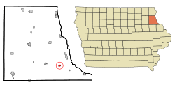 Location of Osterdock, Iowa | |
| Coordinates: 42°43′47″N 91°9′42″W / 42.72972°N 91.16167°WCoordinates: 42°43′47″N 91°9′42″W / 42.72972°N 91.16167°W | |
| Country |
|
| State |
|
| County | Clayton |
| Area[1] | |
| • Total | 0.46 sq mi (1.19 km2) |
| • Land | 0.46 sq mi (1.19 km2) |
| • Water | 0 sq mi (0 km2) |
| Elevation | 640 ft (195 m) |
| Population (2010)[2] | |
| • Total | 59 |
| • Estimate (2012[3]) | 58 |
| • Density | 128.3/sq mi (49.5/km2) |
| Time zone | Central (CST) (UTC-6) |
| • Summer (DST) | CDT (UTC-5) |
| FIPS code | 19-60015 |
| GNIS feature ID | 0459913 |
Osterdock is a city located in Clayton County, Iowa. As of the 2010 census, the city had a total population of 59, up from 50 at the 2000 census.
History
Osterdock had its start in the year 1877 by the building of the railroad through that territory.[4]
Geography
Osterdock is located at 42°43'47" North, 91°9'42" West (42.729756, -91.161709).[5]
According to the United States Census Bureau, the city has a total area of 0.46 square miles (1.19 km2), all of it land.[1]
Demographics
| Historical populations | ||
|---|---|---|
| Year | Pop. | ±% |
| 1910 | 97 | — |
| 1920 | 103 | +6.2% |
| 1930 | 92 | −10.7% |
| 1940 | 78 | −15.2% |
| 1950 | 51 | −34.6% |
| 1960 | 45 | −11.8% |
| 1970 | 59 | +31.1% |
| 1980 | 35 | −40.7% |
| 1990 | 49 | +40.0% |
| 2000 | 50 | +2.0% |
| 2010 | 59 | +18.0% |
| 2014 | 57 | −3.4% |
| 2015 | 57 | +0.0% |
| Source:"American FactFinder". United States Census Bureau. and Iowa Data Center Source: | ||
2010 census
As of the census[2] of 2010, there were 59 people, 23 households, and 16 families residing in the city. The population density was 128.3 inhabitants per square mile (49.5/km2). There were 23 housing units at an average density of 50.0 per square mile (19.3/km2). The racial makeup of the city was 94.9% White and 5.1% from two or more races. Hispanic or Latino of any race were 3.4% of the population.
There were 23 households of which 26.1% had children under the age of 18 living with them, 60.9% were married couples living together, 4.3% had a female householder with no husband present, 4.3% had a male householder with no wife present, and 30.4% were non-families. 26.1% of all households were made up of individuals and 8.7% had someone living alone who was 65 years of age or older. The average household size was 2.57 and the average family size was 3.00.
The median age in the city was 50.3 years. 20.3% of residents were under the age of 18; 6.9% were between the ages of 18 and 24; 13.6% were from 25 to 44; 44.1% were from 45 to 64; and 15.3% were 65 years of age or older. The gender makeup of the city was 42.4% male and 57.6% female.
2000 census
As of the census[7] of 2000, there are 50 peoples, 21 households, and 16 families residing in the city. The population density is 109.9 people per square mile (42.9/km²). There are 21 housing units at an average density of 46.2 per square mile (18.0/km²). The racial makeup of the city is 100.00% White.
There are 21 households out of which 23.8% have children under the age of 18 living with them, 76.2% are married couples living together, and 23.8% are non-families. 23.8% of all households are made up of individuals and 9.5% have someone living alone who is 65 years of age or older. The average household size is 2.38 and the average family size is 2.81.
In the city the population is spread out with 20.0% under the age of 18, 6.0% from 18 to 24, 28.0% from 25 to 44, 38.0% from 45 to 64, and 8.0% who are 65 years of age or older. The median age is 43 years. For every 100 females there are 108.3 males. For every 100 females age 18 and over, there are 150.0 males.
The median income for a household in the city is $31,250, and the median income for a family is $46,250. Males have a median income of $40,625 versus $18,750 for females. The per capita income for the city is $18,566. 26.0% of the population and 27.8% of families are below the poverty line. Out of the total population, none of those under the age of 18 and 36.4% of those 65 and older are living below the poverty line.
Notable people
- William Smith, Latter Day Saints leader
References
- 1 2 "US Gazetteer files 2010". United States Census Bureau. Retrieved 2012-05-11.
- 1 2 "American FactFinder". United States Census Bureau. Retrieved 2012-05-11.
- ↑ "Population Estimates". United States Census Bureau. Retrieved 2013-05-23.
- ↑ Price, Realto E. (1916). History of Clayton County, Iowa: From the Earliest Historical Times Down to the Present. Robert O. Law Company. p. 319.
- ↑ "US Gazetteer files: 2010, 2000, and 1990". United States Census Bureau. 2011-02-12. Retrieved 2011-04-23.
- ↑ "Census of Population and Housing". Census.gov. Retrieved June 4, 2015.
- ↑ "American FactFinder". United States Census Bureau. Retrieved 2008-01-31.
Municipalities and communities of Clayton County, Iowa, United States | ||
|---|---|---|
| Cities | ||
| Townships | ||
| Unincorporated communities |
| |
| Footnotes | ‡This populated place also has portions in an adjacent county or counties | |