Ostvorpommern

Ostvorpommern
District

Coat of arms
Country  Germany
State Mecklenburg-Vorpommern
Founded 1994
Disbanded 2011
Capital Anklam
Area
  Total 1,899 km2 (733 sq mi)
Population (2010-12-31)
  Total 105,036
  Density 55/km2 (140/sq mi)
Time zone CET (UTC+1)
  Summer (DST) CEST (UTC+2)
Vehicle registration OVP
Website http://www.kreis-ovp.de

Ostvorpommern was a Kreis (district) in the eastern part of Mecklenburg-Vorpommern, Germany. The district was created on June 12, 1994 by merging the former districts of Anklam, Greifswald and Wolgast. It was merged into Vorpommern-Greifswald on 4 September 2011.

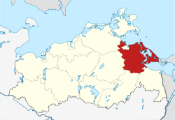
Neighboring districts were (from east clockwise) Uecker-Randow, Mecklenburg-Strelitz, Demmin and Nordvorpommern. The Hanseatic city of Greifswald was enclosed by the district, but did not belong to it.

Coat of arms

The coat of arms shows the griffin of Pomerania.

Towns and municipalities

The subdivisions of the district were (situation August 2011):

Amt-free townsAmt-free municipalities
  1. Anklam
  1. Heringsdorf
Ämter
  1. Buggenhagen
  2. Hohendorf
  3. Krummin
  4. Lassan2
  5. Lütow
  6. Sauzin
  7. Wolgast1, 2
  8. Zemitz
  1. Bargischow
  2. Blesewitz
  3. Boldekow
  4. Bugewitz
  5. Butzow
  6. Ducherow
  7. Iven
  8. Krien
  9. Krusenfelde
  10. Liepen
  11. Medow
  12. Neetzow
  13. Neu Kosenow
  14. Neuendorf A
  15. Neuendorf B
  16. Neuenkirchen
  17. Postlow
  18. Putzar
  19. Rossin
  20. Sarnow
  21. Spantekow1
  22. Stolpe
  1. Behrenhoff
  2. Dargelin
  3. Dersekow
  4. Diedrichshagen
  5. Hinrichshagen
  6. Levenhagen
  7. Mesekenhagen
  8. Neuenkirchen1
  9. Wackerow
  10. Weitenhagen
  1. Brünzow
  2. Hanshagen
  3. Katzow
  4. Kemnitz
  5. Kröslin
  6. Loissin
  7. Lubmin1
  8. Neu Boltenhagen
  9. Rubenow
  10. Wusterhusen
  1. Karlshagen
  2. Mölschow
  3. Peenemünde
  4. Trassenheide
  5. Zinnowitz1
  1. Benz
  2. Dargen
  3. Garz
  4. Kamminke
  5. Korswandt
  6. Koserow
  7. Loddin
  8. Mellenthin
  9. Pudagla
  10. Rankwitz
  11. Stolpe auf Usedom
  12. Ückeritz
  13. Usedom1, 2
  14. Zempin
  15. Zirchow
  1. Bandelin
  2. Gribow
  3. Groß Kiesow
  4. Groß Polzin
  5. Gützkow2
  6. Karlsburg
  7. Klein Bünzow
  8. Kölzin
  9. Lühmannsdorf
  10. Murchin
  11. Rubkow
  12. Schmatzin
  13. Wrangelsburg
  14. Ziethen
  15. Züssow1
1seat of the Amt; 2town

References

    Wikimedia Commons has media related to Landkreis Ostvorpommern.

    Coordinates: 53°56′N 13°40′E / 53.93°N 13.67°E / 53.93; 13.67

    This article is issued from Wikipedia - version of the 2/13/2016. The text is available under the Creative Commons Attribution/Share Alike but additional terms may apply for the media files.