Saint-André-d'Hébertot
| Saint-André-d'Hébertot | |
|---|---|
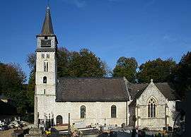 | |
 Saint-André-d'Hébertot | |
|
Location within Normandy region  Saint-André-d'Hébertot | |
| Coordinates: 49°18′50″N 0°16′49″E / 49.3139°N 0.2803°ECoordinates: 49°18′50″N 0°16′49″E / 49.3139°N 0.2803°E | |
| Country | France |
| Region | Normandy |
| Department | Calvados |
| Arrondissement | Lisieux |
| Canton | Blangy-le-Château |
| Intercommunality | Blangy Pont-l'Évêque Intercom |
| Government | |
| • Mayor (2008–2014) | Étienne Delabarre |
| Area1 | 9.79 km2 (3.78 sq mi) |
| Population (2008)2 | 456 |
| • Density | 47/km2 (120/sq mi) |
| Time zone | CET (UTC+1) |
| • Summer (DST) | CEST (UTC+2) |
| INSEE/Postal code | 14555 / 14130 |
| Elevation |
23–146 m (75–479 ft) (avg. 92 m or 302 ft) |
|
1 French Land Register data, which excludes lakes, ponds, glaciers > 1 km² (0.386 sq mi or 247 acres) and river estuaries. 2 Population without double counting: residents of multiple communes (e.g., students and military personnel) only counted once. | |
Saint-André-d'Hébertot is a commune in the Calvados department in the Normandy region in northwestern France.
Population
| Historical population | ||
|---|---|---|
| Year | Pop. | ±% |
| 1962 | 330 | — |
| 1968 | 301 | −8.8% |
| 1975 | 257 | −14.6% |
| 1982 | 244 | −5.1% |
| 1990 | 292 | +19.7% |
| 1999 | 390 | +33.6% |
| 2008 | 456 | +16.9% |
See also
References
| Wikimedia Commons has media related to Saint-André-d'Hébertot. |
This article is issued from Wikipedia - version of the 3/16/2016. The text is available under the Creative Commons Attribution/Share Alike but additional terms may apply for the media files.