Złocieniec
| Złocieniec | |||
|---|---|---|---|
|
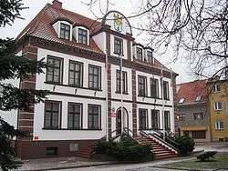
Town hall | |||
| |||
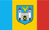
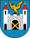
 Złocieniec | |||
| Coordinates: 53°31′37″N 16°0′44″E / 53.52694°N 16.01222°E | |||
| Country |
| ||
| Voivodeship | West Pomeranian | ||
| County | Drawsko | ||
| Gmina | Złocieniec | ||
| Area | |||
| • Total | 32.22 km2 (12.44 sq mi) | ||
| Population (2006) | |||
| • Total | 13,377 | ||
| • Density | 420/km2 (1,100/sq mi) | ||
| Postal code | 78-520 | ||
| Website | http://www.zlocieniec.pl | ||
Złocieniec [zwɔˈt͡ɕeɲet͡s] (German: Falkenburg) is a town in north-western Poland region of Middle Pomerania. Located in West Pomeranian Voivodeship's Drawsko County since 1999, it was previously a part of Koszalin Voivodeship (1950–1998). The population of Złocieniec is around 12,000.
History
The official town webpage states that between the 7th and 6th century BC the area of the town was the site of a village and that the area of Western Pomerania was settled by Slavs in the 6th-8th centuries; when the town rights were established the Złocieniec webpage informs that it's highly probable that among German inhabitants of the town were also Slavs from Budów i Strzebłów-villages that were disbanded.[1] Town laws were established by the brothers von Wedel on 13 December 1333.[1] In 1668 the town was almost completely destroyed by a fire.[1] During the era of Nazi Germany the Ordensburg Krössinsee was built near the town in 1934. The SA attacked the Jewish population here during Kristallnacht, later, during the Second World War a forced labour camp was established near the town, from which 31 Poles managed to escape.[1][2] After World War II the town was handed over to Poland by the Allies per the Potsdam Conference, with Poles being transferred from the East while Germans were expelled to the west.
Notable residents
- Caspar Brülow (1585–1627) scholar and dramatist
- Otto Neitzel (1852–1920), composer
- Ullrich Haupt (1887–1931), actor
- Rudolf Katz (1895–1961), politician
Population statistics
- 1666: 990
- 1880: 4,009[3]
- 1925: 5,529[3]
- 1939: 8,623[3]
- 1950: 7,550
- 1960: 8,400
- 1970: 10,200
- 1975: 11,500
- 1980: 12,000
- 1990: 18,000
- 2000: 22,000
- 2005: 28,000
International relations
Twin towns — sister cities
Złocieniec is twinned with:
References
- 1 2 3 4 www.zlocieniec.pl
- ↑ Od pierwszej do ostatniej godziny drugiej wojny światowej: dzieje Polski i Polaków Czesław Łuczak 1995 page 80
- 1 2 3 verwaltungsgeschichte.de(German)
External links
| Wikimedia Commons has media related to Złocieniec. |
| Town and seat | 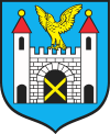 | |
|---|---|---|
| Villages | ||
Coordinates: 53°32′N 16°00′E / 53.533°N 16.000°E