Bagley, Wisconsin
- There is also the Town of Bagley in Oconto County, Wisconsin.
| Bagley, Wisconsin | |
|---|---|
| Village | |
 Location of Bagley, Wisconsin | |
| Coordinates: 42°54′10″N 91°6′3″W / 42.90278°N 91.10083°WCoordinates: 42°54′10″N 91°6′3″W / 42.90278°N 91.10083°W | |
| Country | United States |
| State | Wisconsin |
| County | Grant |
| Area[1] | |
| • Total | 0.81 sq mi (2.10 km2) |
| • Land | 0.77 sq mi (1.99 km2) |
| • Water | 0.04 sq mi (0.10 km2) |
| Elevation[2] | 640 ft (195 m) |
| Population (2010)[3] | |
| • Total | 379 |
| • Estimate (2012[4]) | 373 |
| • Density | 492.2/sq mi (190.0/km2) |
| Time zone | Central (CST) (UTC-6) |
| • Summer (DST) | CDT (UTC-5) |
| Area code(s) | 608 |
| FIPS code | 55-04250[5] |
| GNIS feature ID | 1561083[2] |
Bagley is a village in Grant County in the U.S. state of Wisconsin located on the Upper Mississippi River about 9 miles (15 km) south of Prairie du Chien, Wisconsin. The population was 379 at the 2010 census. It is a popular riverside destination in the summer, when the population can quadruple.[6]
History
The village suffered damage on July 18, 2007 when a large thunderstorm dumped 7 inches (180 mm) of rain on the area. The storm was part of a "mesoscale convective systems", bringing thunderstorms with huge amounts of rain and lightning.[7] What were normally minor streams, particularly Glass Hollow Creek,[8] became raging torrents, pushing debris before them, backing up water into the town. No deaths or injuries were reported, but 50 people were evacuated from their homes by boat.[6] Although nearly every home and business sustained damage, the town was not eligible for federal disaster aid.[9]
Geography
Bagley is located at 42°54′10″N 91°6′3″W / 42.90278°N 91.10083°W (42.902764, -91.100714).[10]
According to the United States Census Bureau, the village has a total area of 0.81 square miles (2.10 km2), of which, 0.77 square miles (1.99 km2) of it is land and 0.04 square miles (0.10 km2) is water.[1]
Demographics
| Historical population | |||
|---|---|---|---|
| Census | Pop. | %± | |
| 1920 | 315 | — | |
| 1930 | 284 | −9.8% | |
| 1940 | 293 | 3.2% | |
| 1950 | 329 | 12.3% | |
| 1960 | 275 | −16.4% | |
| 1970 | 271 | −1.5% | |
| 1980 | 317 | 17.0% | |
| 1990 | 306 | −3.5% | |
| 2000 | 339 | 10.8% | |
| 2010 | 379 | 11.8% | |
| Est. 2015 | 364 | [11] | −4.0% |
2010 census
As of the census[3] of 2010, there were 379 people, 185 households, and 111 families residing in the village. The population density was 492.2 inhabitants per square mile (190.0/km2). There were 409 housing units at an average density of 531.2 per square mile (205.1/km2). The racial makeup of the village was 97.9% White, 0.3% African American, 1.1% Native American, and 0.8% from two or more races. Hispanic or Latino of any race were 0.5% of the population.
There were 185 households of which 18.9% had children under the age of 18 living with them, 43.8% were married couples living together, 10.3% had a female householder with no husband present, 5.9% had a male householder with no wife present, and 40.0% were non-families. 35.1% of all households were made up of individuals and 22.2% had someone living alone who was 65 years of age or older. The average household size was 2.05 and the average family size was 2.59.
The median age in the village was 53.9 years. 17.2% of residents were under the age of 18; 5.7% were between the ages of 18 and 24; 15.5% were from 25 to 44; 32.8% were from 45 to 64; and 28.8% were 65 years of age or older. The gender makeup of the village was 52.5% male and 47.5% female.
2000 census
As of the census[5] of 2000, there were 339 people, 157 households, and 107 families residing in the village. The population density was 451.7 people per square mile (174.5/km²). There were 331 housing units at an average density of 441.1 per square mile (170.4/km²). The racial makeup of the village was 96.76% White, 0.88% Native American, 0.29% Asian, 0.59% from other races, and 1.47% from two or more races. Hispanic or Latino of any race were 1.47% of the population.
There were 157 households out of which 22.3% had children under the age of 18 living with them, 57.3% were married couples living together, 8.3% had a female householder with no husband present, and 31.8% were non-families. 28.7% of all households were made up of individuals and 11.5% had someone living alone who was 65 years of age or older. The average household size was 2.16 and the average family size was 2.63.
In the village the population was spread out with 17.1% under the age of 18, 4.7% from 18 to 24, 21.5% from 25 to 44, 33.0% from 45 to 64, and 23.6% who were 65 years of age or older. The median age was 50 years. For every 100 females there were 94.8 males. For every 100 females age 18 and over, there were 93.8 males.
The median income for a household in the village was $26,944, and the median income for a family was $38,906. Males had a median income of $27,841 versus $20,625 for females. The per capita income for the village was $15,685. About 8.9% of families and 11.1% of the population were below the poverty line, including 26.4% of those under age 18 and 2.7% of those age 65 or over.
Notable people
- Thornton Kipper, baseball player, was born in Bagley.[13]
References
- 1 2 "US Gazetteer files 2010". United States Census Bureau. Archived from the original on 2012-01-24. Retrieved 2012-11-18.
- 1 2 "US Board on Geographic Names". United States Geological Survey. 2007-10-25. Retrieved 2008-01-31.
- 1 2 "American FactFinder". United States Census Bureau. Retrieved 2012-11-18.
- ↑ "Population Estimates". United States Census Bureau. Archived from the original on 2013-06-17. Retrieved 2013-06-24.
- 1 2 "American FactFinder". United States Census Bureau. Archived from the original on 2013-09-11. Retrieved 2008-01-31.
- 1 2 Craig Reber, "Dozens Rescued by Boat in Bagley" Dubuque Telegraph Herald, July 19, 2007, p. 1 (online version, registration required)
- ↑ Stu Ostro. " A Textbook Case", The Weather Channel, July 19, 2007.
- ↑ "Glass Hollow Creek". Geographic Names Information System. United States Geological Survey.
- ↑ Dan Simmons. "'500-year' rain leaves mess in southwestern Wisconsin and Iowa". La Crosse Tribune, July 19, 2007.
- ↑ "US Gazetteer files: 2010, 2000, and 1990". United States Census Bureau. 2011-02-12. Retrieved 2011-04-23.
- ↑ "Annual Estimates of the Resident Population for Incorporated Places: April 1, 2010 to July 1, 2015". Retrieved July 2, 2016.
- ↑ "Census of Population and Housing". Census.gov. Archived from the original on May 11, 2015. Retrieved June 4, 2015.
- ↑ Baseball Reference-Thornton Kipper
Municipalities and communities of Grant County, Wisconsin, United States | ||
|---|---|---|
| Cities | 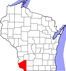 | |
| Villages | ||
| Towns |
| |
| CDPs | ||
| Unincorporated communities |
| |
| Ghost town | ||
| Footnotes | ‡This populated place also has portions in an adjacent county or counties | |