Cuba City, Wisconsin
| Cuba City, Wisconsin | |
|---|---|
| City | |
|
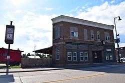
Former Cuba City railway station | |
| Motto: "The City of Presidents" | |
 Location of Cuba City, Wisconsin | |
| Coordinates: 42°36′21″N 90°25′49″W / 42.60583°N 90.43028°W | |
| Country | United States |
| State | Wisconsin |
| Counties | Grant, Lafayette |
| Area[1] | |
| • Total | 1.08 sq mi (2.80 km2) |
| • Land | 1.08 sq mi (2.80 km2) |
| • Water | 0 sq mi (0 km2) |
| Elevation[2] | 1,010 ft (308 m) |
| Population (2010)[3] | |
| • Total | 2,086 |
| • Estimate (2012[4]) | 2,070 |
| • Density | 1,931.5/sq mi (745.8/km2) |
| Time zone | Central (CST) (UTC-6) |
| • Summer (DST) | CDT (UTC-5) |
| Area code(s) | 608 |
| FIPS code | 55-17950[5] |
| GNIS feature ID | 1563606[2] |
| Website | Cuba City, Wisconsin |
Cuba City is a city in Grant and partly in Lafayette counties in the U.S. state of Wisconsin. The population was 2,086 at the 2010 census. Of this, 1,877 were in Grant County, and 209 were in Lafayette County. The city is nicknamed "The City of Presidents" because of the presidential banners displayed along the city's Main Street.
History
The history of the city began in 1836, when John Amie Merle and Mathais Comstock purchased 160 acres of land from the American Government in Grant County. The first structure in the community was erected in 1846 by Jack Deboard. Deboard is considered the first settler in Cuba City.[6]
The name "Yuba City" was finally picked after a dispute about the name of the new village, but after discovering another location had already been given that name, a new name, "Cuba City," was selected.[7][8]
The city was incorporated in 1925.[9]
Geography
Cuba City is located at 42°36′21″N 90°25′49″W / 42.60583°N 90.43028°W (42.605874, -90.430274).[10]
According to the United States Census Bureau, the city has a total area of 1.08 square miles (2.80 km2), all of it land.[1] Most of the city lies in Grant County, with only a small portion in Lafayette County.
The community is located on State Highway 80.
Demographics
| Historical population | |||
|---|---|---|---|
| Census | Pop. | %± | |
| 1880 | 48 | — | |
| 1900 | 636 | — | |
| 1910 | 967 | 52.0% | |
| 1920 | 1,175 | 21.5% | |
| 1930 | 1,157 | −1.5% | |
| 1940 | 1,259 | 8.8% | |
| 1950 | 1,333 | 5.9% | |
| 1960 | 1,673 | 25.5% | |
| 1970 | 1,993 | 19.1% | |
| 1980 | 2,129 | 6.8% | |
| 1990 | 2,024 | −4.9% | |
| 2000 | 2,156 | 6.5% | |
| 2010 | 2,086 | −3.2% | |
| Est. 2015 | 2,055 | [11] | −1.5% |
2010 census
As of the census[3] of 2010, there were 2,086 people, 847 households, and 537 families residing in the city. The population density was 1,931.5 inhabitants per square mile (745.8/km2). There were 899 housing units at an average density of 832.4 per square mile (321.4/km2). The racial makeup of the city was 99.1% White, 0.2% African American, 0.1% Native American, 0.1% Asian, and 0.5% from two or more races. Hispanic or Latino of any race were 0.5% of the population.
There were 847 households of which 29.0% had children under the age of 18 living with them, 51.0% were married couples living together, 7.8% had a female householder with no husband present, 4.6% had a male householder with no wife present, and 36.6% were non-families. 29.4% of all households were made up of individuals and 15.4% had someone living alone who was 65 years of age or older. The average household size was 2.36 and the average family size was 2.95.
The median age in the city was 40.9 years. 23.1% of residents were under the age of 18; 8.4% were between the ages of 18 and 24; 23.4% were from 25 to 44; 23.1% were from 45 to 64; and 21.9% were 65 years of age or older. The gender makeup of the city was 48.6% male and 51.4% female.
2000 census
As of the census[5] of 2000, there were 2,156 people, 861 households, and 569 families residing in the city. The population density was 1,997.1 people per square mile (770.8/km²). There were 900 housing units at an average density of 833.7 per square mile (321.8/km²). The racial makeup of the city was 99.49% White, 0.05% Native American, 0.23% Asian, and 0.23% from two or more races. Hispanic or Latino of any race were 0.09% of the population.
There were 861 households out of which 30.7% had children under the age of 18 living with them, 56.1% were married couples living together, 6.7% had a female householder with no husband present, and 33.9% were non-families. 29.7% of all households were made up of individuals and 15.4% had someone living alone who was 65 years of age or older. The average household size was 2.39 and the average family size was 2.98.
In the city the population was spread out with 24.1% under the age of 18, 7.7% from 18 to 24, 25.6% from 25 to 44, 21.0% from 45 to 64, and 21.7% who were 65 years of age or older. The median age was 40 years. For every 100 females there were 94.4 males. For every 100 females age 18 and over, there were 88.7 males.
The median income for a household in the city was $38,750, and the median income for a family was $46,550. Males had a median income of $30,884 versus $21,359 for females. The per capita income for the city was $19,375. About 5.9% of families and 8.8% of the population were below the poverty line, including 17.8% of those under age 18 and 4.3% of those age 65 or over.
Notable people
- Bert A. Clemens, Wisconsin State Assemblyman, was born in Cuba City.
- Judd Conlon, music arranger for Walt Disney, was born in Cuba City.
- William H. Goldthorpe, Wisconsin State Assemblyman, was Postmaster of Cuba City.
- Chuck Harris, NFL player, was born in Cuba City.
- Robert S. Travis, Jr., Wisconsin State Assemblyman, was born in Cuba City.
- Sherman E. Smalley, Wisconsin State Assemblyman and jurist, lived in Cuba City.
References
- 1 2 "US Gazetteer files 2010". United States Census Bureau. Archived from the original on 2012-01-24. Retrieved 2012-11-18.
- 1 2 "US Board on Geographic Names". United States Geological Survey. 2007-10-25. Retrieved 2008-01-31.
- 1 2 "American FactFinder". United States Census Bureau. Retrieved 2012-11-18.
- ↑ "Population Estimates". United States Census Bureau. Archived from the original on 2013-06-17. Retrieved 2013-06-24.
- 1 2 "American FactFinder". United States Census Bureau. Archived from the original on 2013-09-11. Retrieved 2008-01-31.
- ↑ "City History". Cuba City, Wisconsin. Retrieved July 25, 2012.
- ↑ History of Cuba City
- ↑ Company, Chicago and North Western Railway (1908). A History of the Origin of the Place Names Connected with the Chicago & North Western and Chicago, St. Paul, Minneapolis & Omaha Railways. p. 61.
- ↑ "Cuba City, Wisconsin". City-Data.com. Retrieved July 25, 2012.
- ↑ "US Gazetteer files: 2010, 2000, and 1990". United States Census Bureau. 2011-02-12. Retrieved 2011-04-23.
- ↑ "Annual Estimates of the Resident Population for Incorporated Places: April 1, 2010 to July 1, 2015". Retrieved July 2, 2016.
- ↑ "Census of Population and Housing". Census.gov. Archived from the original on May 11, 2015. Retrieved June 4, 2015.
External links
- Cuba City website
- Profile of Cuba City from the Grant County, Wisconsin website
- Additional information
- Sanborn fire insurance maps: 1900 1908
Coordinates: 42°36′21″N 90°25′49″W / 42.605874°N 90.430274°W
Municipalities and communities of Grant County, Wisconsin, United States | ||
|---|---|---|
| Cities | 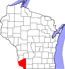 | |
| Villages | ||
| Towns |
| |
| CDPs | ||
| Unincorporated communities |
| |
| Ghost town | ||
| Footnotes | ‡This populated place also has portions in an adjacent county or counties | |
Municipalities and communities of Lafayette County, Wisconsin, United States | ||
|---|---|---|
| Cities | 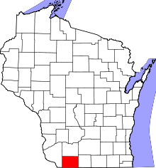 | |
| Villages | ||
| Towns | ||
| CDP | ||
| Unincorporated communities | ||
| Footnotes | ‡This populated place also has portions in an adjacent county or counties | |