Fennimore (town), Wisconsin
| Fennimore, Wisconsin | |
|---|---|
| Town | |
| Coordinates: 42°59′5″N 90°36′22″W / 42.98472°N 90.60611°WCoordinates: 42°59′5″N 90°36′22″W / 42.98472°N 90.60611°W | |
| Country | United States |
| State | Wisconsin |
| County | Grant |
| Area | |
| • Total | 34.8 sq mi (90.0 km2) |
| • Land | 34.8 sq mi (90.0 km2) |
| • Water | 0.0 sq mi (0.0 km2) |
| Elevation[1] | 1,135 ft (346 m) |
| Population (2000) | |
| • Total | 599 |
| • Density | 17.2/sq mi (6.7/km2) |
| Time zone | Central (CST) (UTC-6) |
| • Summer (DST) | CDT (UTC-5) |
| Area code(s) | 608 |
| FIPS code | 55-25625[2] |
| GNIS feature ID | 1583198[1] |
Fennimore is a town in Grant County, Wisconsin, United States. The population was 599 at the 2000 census. The size of the town was reduced when Mount Ida was split off, and when the City of Fennimore was incorporated from a part of the town. The unincorporated community of Lancaster Junction, Wisconsin is located in the town. The unincorporated community of Preston is also located partially in the town.
History
Fennimore was named for a settler who disappeared during the Black Hawk War.[3]
Geography
According to the United States Census Bureau, the town has a total area of 34.8 square miles (90.0 km²), all of it land.
Demographics
As of the census of 2000, there were 599 people, 199 households, and 157 families residing in the town. The population density was 17.2 people per square mile (6.7/km²). There were 216 housing units at an average density of 2.4 persons/km² (6.2 persons/sq mi). The racial makeup of the town was 100.00% White, 0.00% African American, 0.00% Native American, 0.00% Asian, 0.00% Pacific Islander, 0.00% from other races. 0.33% of the population were Hispanic or Latino of any race.
There were 199 households out of which 33.7% had children under the age of 18 living with them, 69.3% were married couples living together, 7.5% have a woman whose husband does not live with her, and 21.1% were non-families. 12.6% of all households were made up of individuals and 5.5% had someone living alone who was 65 years of age or older. The average household size was 3.01 and the average family size was 3.27.
In the town the population was spread out with 29.0% under the age of 18, 9.7% from 18 to 24, 25.9% from 25 to 44, 24.5% from 45 to 64, and 10.9% who were 65 years of age or older. The median age was 37 years. For every 100 females there were 112.4 males. For every 100 females age 18 and over, there were 113.6 males.
The median income for a household in the town was $36,400, and the median income for a family was $38,393. Males had a median income of $25,536 versus $20,833 for females. The per capita income for the town was $13,360. 17.2% of the population and 11.5% of families were below the poverty line. Out of the total people living in poverty, 30.6% are under the age of 18 and 3.3% are 65 or older.
Notable people
- State legislator Edward Heathcote was Chairman of the town and a member of the Town Board.
- State legislator and farmer Gottlieb Wehrle lived in the portion of the town which became Mount Ida, and was twice chairman of the Town Board; the unincorporated community of Werley is named after him.
References
- 1 2 "US Board on Geographic Names". United States Geological Survey. 2007-10-25. Retrieved 2008-01-31.
- ↑ "American FactFinder". United States Census Bureau. Retrieved 2008-01-31.
- ↑ Gannett, Henry (1905). The Origin of Certain Place Names in the United States. Govt. Print. Off. p. 125.
Municipalities and communities of Grant County, Wisconsin, United States | ||
|---|---|---|
| Cities | 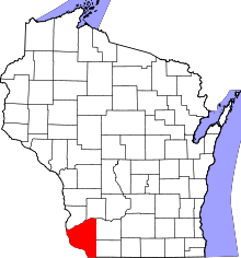 | |
| Villages | ||
| Towns |
| |
| CDPs | ||
| Unincorporated communities |
| |
| Ghost town | ||
| Footnotes | ‡This populated place also has portions in an adjacent county or counties | |