Beaulieu-sur-Layon
For other uses, see Beaulieu.
| Beaulieu-sur-Layon | |
|---|---|
|
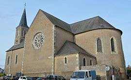
The church in Beaulieu-sur-Layon | |
 Beaulieu-sur-Layon | |
|
Location within Pays de la Loire region  Beaulieu-sur-Layon | |
| Coordinates: 47°18′41″N 0°35′17″W / 47.3114°N 0.5881°WCoordinates: 47°18′41″N 0°35′17″W / 47.3114°N 0.5881°W | |
| Country | France |
| Region | Pays de la Loire |
| Department | Maine-et-Loire |
| Arrondissement | Angers |
| Canton | Thouarcé |
| Intercommunality | Coteaux-du-Layon |
| Government | |
| • Mayor (2008–2014) | Marc Silvestre |
| Area1 | 12.78 km2 (4.93 sq mi) |
| Population (2009)2 | 1,448 |
| • Density | 110/km2 (290/sq mi) |
| Time zone | CET (UTC+1) |
| • Summer (DST) | CEST (UTC+2) |
| INSEE/Postal code | 49022 / 49750 |
| Elevation |
17–104 m (56–341 ft) (avg. 97 m or 318 ft) |
|
1 French Land Register data, which excludes lakes, ponds, glaciers > 1 km² (0.386 sq mi or 247 acres) and river estuaries. 2 Population without double counting: residents of multiple communes (e.g., students and military personnel) only counted once. | |
Beaulieu-sur-Layon (/bo.ljə.syr.lε.jɔ̃/) is a commune in the Maine-et-Loire department in western France.
Geography
The commune is traversed by the river Layon.
Population
| Historical population | ||
|---|---|---|
| Year | Pop. | ±% |
| 1793 | 1,005 | — |
| 1800 | 1,009 | +0.4% |
| 1806 | 777 | −23.0% |
| 1821 | 965 | +24.2% |
| 1831 | 1,008 | +4.5% |
| 1836 | 1,018 | +1.0% |
| 1841 | 996 | −2.2% |
| 1846 | 1,068 | +7.2% |
| 1851 | 1,168 | +9.4% |
| 1856 | 1,185 | +1.5% |
| 1861 | 1,134 | −4.3% |
| 1866 | 1,226 | +8.1% |
| 1872 | 1,188 | −3.1% |
| 1876 | 1,200 | +1.0% |
| 1881 | 1,123 | −6.4% |
| 1886 | 1,095 | −2.5% |
| 1891 | 1,029 | −6.0% |
| 1896 | 1,006 | −2.2% |
| 1901 | 1,018 | +1.2% |
| 1906 | 978 | −3.9% |
| 1911 | 959 | −1.9% |
| 1921 | 854 | −10.9% |
| 1926 | 891 | +4.3% |
| 1931 | 917 | +2.9% |
| 1936 | 932 | +1.6% |
| 1946 | 977 | +4.8% |
| 1954 | 990 | +1.3% |
| 1962 | 1,025 | +3.5% |
| 1968 | 948 | −7.5% |
| 1975 | 944 | −0.4% |
| 1982 | 995 | +5.4% |
| 1990 | 981 | −1.4% |
| 1999 | 1,069 | +9.0% |
| 2006 | 1,355 | +26.8% |
| 2009 | 1,448 | +6.9% |
See also
References
External links
| Wikimedia Commons has media related to Beaulieu-sur-Layon. |
This article is issued from Wikipedia - version of the 11/9/2016. The text is available under the Creative Commons Attribution/Share Alike but additional terms may apply for the media files.