La Ferrière-de-Flée
| La Ferrière-de-Flée | |
|---|---|
|
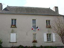
Mairie de la Ferrière-de-Flée | |
 La Ferrière-de-Flée | |
|
Location within Pays de la Loire region  La Ferrière-de-Flée | |
| Coordinates: 47°43′55″N 0°50′42″W / 47.7319°N 0.845°WCoordinates: 47°43′55″N 0°50′42″W / 47.7319°N 0.845°W | |
| Country | France |
| Region | Pays de la Loire |
| Department | Maine-et-Loire |
| Arrondissement | Segré |
| Canton | Segré |
| Intercommunality | Communauté de communes du Canton de Segré |
| Government | |
| • Mayor (2008–2014) | Olivier Chauveau |
| Area1 | 13.12 km2 (5.07 sq mi) |
| Population (2006[1])2 | 309 |
| • Density | 24/km2 (61/sq mi) |
| Time zone | CET (UTC+1) |
| • Summer (DST) | CEST (UTC+2) |
| INSEE/Postal code | 49136 / 49500 |
| Elevation |
48–90 m (157–295 ft) (avg. 80 m or 260 ft) |
|
1 French Land Register data, which excludes lakes, ponds, glaciers > 1 km² (0.386 sq mi or 247 acres) and river estuaries. 2 Population without double counting: residents of multiple communes (e.g., students and military personnel) only counted once. | |
La Ferrière-de-Flée is a commune in the Maine-et-Loire department in western France.
See also
References
| Wikimedia Commons has media related to La Ferrière-de-Flée. |
This article is issued from Wikipedia - version of the 11/10/2014. The text is available under the Creative Commons Attribution/Share Alike but additional terms may apply for the media files.