Parnay, Maine-et-Loire
| Parnay | |
|---|---|
|
L'église | |
 Parnay | |
|
Location within Pays de la Loire region  Parnay | |
| Coordinates: 47°13′55″N 0°00′33″E / 47.2319°N 0.0092°ECoordinates: 47°13′55″N 0°00′33″E / 47.2319°N 0.0092°E | |
| Country | France |
| Region | Pays de la Loire |
| Department | Maine-et-Loire |
| Arrondissement | Saumur |
| Canton | Saumur-Sud |
| Intercommunality | Saumur Loire Développement |
| Government | |
| • Mayor (2008–...) | Éric LEFIEVRE, |
| Area1 | 6.54 km2 (2.53 sq mi) |
| Population (2006[1])2 | 482 |
| • Density | 74/km2 (190/sq mi) |
| Time zone | CET (UTC+1) |
| • Summer (DST) | CEST (UTC+2) |
| INSEE/Postal code | 49235 / 49730 |
| Elevation |
26–101 m (85–331 ft) (avg. 32 m or 105 ft) |
| Website | Site officiel de la ville de Parnay |
|
1 French Land Register data, which excludes lakes, ponds, glaciers > 1 km² (0.386 sq mi or 247 acres) and river estuaries. 2 Population without double counting: residents of multiple communes (e.g., students and military personnel) only counted once. | |
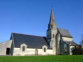
Parnay is a commune in the Maine-et-Loire department in western France. It is known for its 11th Century Church. Parnay is one of the nine communes that is in the AOC Saumur-Champigny and fruit Red Wine made from Cabernet Franc.
See also
References
| Wikimedia Commons has media related to Parnay (Maine-et-Loire). |
This article is issued from Wikipedia - version of the 11/11/2014. The text is available under the Creative Commons Attribution/Share Alike but additional terms may apply for the media files.