Baracé
| Baracé | |
|---|---|
|
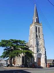
The church in Baracé | |
 Baracé | |
|
Location within Pays de la Loire region  Baracé | |
| Coordinates: 47°38′27″N 0°21′26″W / 47.6408°N 0.3572°WCoordinates: 47°38′27″N 0°21′26″W / 47.6408°N 0.3572°W | |
| Country | France |
| Region | Pays de la Loire |
| Department | Maine-et-Loire |
| Arrondissement | Angers |
| Canton | Durtal |
| Intercommunality | Loir-et-Sarthe |
| Government | |
| • Mayor (2008–2014) | Daniel Le Gouic |
| Area1 | 13.46 km2 (5.20 sq mi) |
| Population (2009)2 | 452 |
| • Density | 34/km2 (87/sq mi) |
| Time zone | CET (UTC+1) |
| • Summer (DST) | CEST (UTC+2) |
| INSEE/Postal code | 49017 / 49430 |
| Elevation |
17–62 m (56–203 ft) (avg. 50 m or 160 ft) |
|
1 French Land Register data, which excludes lakes, ponds, glaciers > 1 km² (0.386 sq mi or 247 acres) and river estuaries. 2 Population without double counting: residents of multiple communes (e.g., students and military personnel) only counted once. | |
Baracé is a commune in the Maine-et-Loire department in western France.
Population
| Historical population | ||
|---|---|---|
| Year | Pop. | ±% |
| 1793 | 639 | — |
| 1800 | 616 | −3.6% |
| 1806 | 655 | +6.3% |
| 1821 | 663 | +1.2% |
| 1831 | 761 | +14.8% |
| 1836 | 784 | +3.0% |
| 1841 | 716 | −8.7% |
| 1846 | 678 | −5.3% |
| 1851 | 654 | −3.5% |
| 1856 | 681 | +4.1% |
| 1861 | 705 | +3.5% |
| 1866 | 723 | +2.6% |
| 1872 | 696 | −3.7% |
| 1876 | 722 | +3.7% |
| 1881 | 683 | −5.4% |
| 1886 | 666 | −2.5% |
| 1891 | 672 | +0.9% |
| 1896 | 625 | −7.0% |
| 1901 | 637 | +1.9% |
| 1906 | 589 | −7.5% |
| 1911 | 549 | −6.8% |
| 1921 | 492 | −10.4% |
| 1926 | 481 | −2.2% |
| 1931 | 471 | −2.1% |
| 1936 | 464 | −1.5% |
| 1946 | 413 | −11.0% |
| 1954 | 436 | +5.6% |
| 1962 | 427 | −2.1% |
| 1968 | 384 | −10.1% |
| 1975 | 304 | −20.8% |
| 1982 | 312 | +2.6% |
| 1990 | 301 | −3.5% |
| 1999 | 317 | +5.3% |
| 2006 | 408 | +28.7% |
| 2009 | 452 | +10.8% |
See also
References
| Wikimedia Commons has media related to Baracé. |
This article is issued from Wikipedia - version of the 11/9/2016. The text is available under the Creative Commons Attribution/Share Alike but additional terms may apply for the media files.