Beaucouzé
| Beaucouzé | ||
|---|---|---|
|
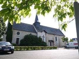
The church in Beaucouzé | ||
| ||
 Beaucouzé | ||
|
Location within Pays de la Loire region  Beaucouzé | ||
| Coordinates: 47°28′34″N 0°37′54″W / 47.4761°N 0.6317°WCoordinates: 47°28′34″N 0°37′54″W / 47.4761°N 0.6317°W | ||
| Country | France | |
| Region | Pays de la Loire | |
| Department | Maine-et-Loire | |
| Arrondissement | Angers | |
| Canton | Angers-Ouest | |
| Intercommunality | Angers Loire Métropole | |
| Government | ||
| • Mayor (2008–2014) | Didier Roisné | |
| Area1 | 19.34 km2 (7.47 sq mi) | |
| Population (2009)2 | 5,020 | |
| • Density | 260/km2 (670/sq mi) | |
| Time zone | CET (UTC+1) | |
| • Summer (DST) | CEST (UTC+2) | |
| INSEE/Postal code | 49020 / 49070 | |
| Elevation |
21–88 m (69–289 ft) (avg. 67 m or 220 ft) | |
|
1 French Land Register data, which excludes lakes, ponds, glaciers > 1 km² (0.386 sq mi or 247 acres) and river estuaries. 2 Population without double counting: residents of multiple communes (e.g., students and military personnel) only counted once. | ||
.svg.png)
Beaucouzé is a commune in the Maine-et-Loire department in western France.
Climate
| Climate data for Beaucouzé (1981–2010 averages) | |||||||||||||
|---|---|---|---|---|---|---|---|---|---|---|---|---|---|
| Month | Jan | Feb | Mar | Apr | May | Jun | Jul | Aug | Sep | Oct | Nov | Dec | Year |
| Record high °C (°F) | 17.1 (62.8) |
21.2 (70.2) |
24.8 (76.6) |
29.7 (85.5) |
32.8 (91) |
37.5 (99.5) |
39.8 (103.6) |
38.4 (101.1) |
34.5 (94.1) |
29.8 (85.6) |
22.2 (72) |
19.0 (66.2) |
39.8 (103.6) |
| Average high °C (°F) | 8.3 (46.9) |
9.4 (48.9) |
12.8 (55) |
15.6 (60.1) |
19.4 (66.9) |
23.1 (73.6) |
25.3 (77.5) |
25.4 (77.7) |
22.1 (71.8) |
17.3 (63.1) |
11.7 (53.1) |
8.6 (47.5) |
16.6 (61.9) |
| Average low °C (°F) | 2.8 (37) |
2.5 (36.5) |
4.4 (39.9) |
6.0 (42.8) |
9.5 (49.1) |
12.3 (54.1) |
14.2 (57.6) |
14.1 (57.4) |
11.5 (52.7) |
9.1 (48.4) |
5.3 (41.5) |
3.0 (37.4) |
7.9 (46.2) |
| Record low °C (°F) | −15.4 (4.3) |
−12.8 (9) |
−10.6 (12.9) |
−3.4 (25.9) |
−1.6 (29.1) |
2.3 (36.1) |
4.5 (40.1) |
5.1 (41.2) |
2.5 (36.5) |
−3.2 (26.2) |
−8.0 (17.6) |
−13.4 (7.9) |
−15.4 (4.3) |
| Average precipitation mm (inches) | 69.2 (2.724) |
54.8 (2.157) |
51.6 (2.031) |
56.6 (2.228) |
57.9 (2.28) |
43.2 (1.701) |
52.1 (2.051) |
41.3 (1.626) |
55.0 (2.165) |
71.8 (2.827) |
67.8 (2.669) |
72.0 (2.835) |
693.3 (27.295) |
| Average precipitation days | 11.6 | 9.0 | 9.8 | 10.1 | 10.1 | 6.7 | 6.3 | 6.3 | 7.8 | 10.7 | 11.2 | 11.5 | 111.1 |
| Average snowy days | 1.7 | 1.9 | 1.4 | 0.2 | 0.1 | 0.0 | 0.0 | 0.0 | 0.0 | 0.0 | 0.4 | 1.3 | 7.0 |
| Average relative humidity (%) | 88 | 84 | 80 | 77 | 77 | 75 | 74 | 76 | 80 | 86 | 89 | 89 | 81.3 |
| Mean monthly sunshine hours | 68.9 | 92.8 | 136.5 | 171.5 | 194.5 | 227.4 | 227.8 | 223.7 | 185.9 | 120.2 | 80.7 | 68.8 | 1,798.5 |
| Source #1: Meteo France[1][2] | |||||||||||||
| Source #2: Infoclimat.fr (humidity, snowy days 1961–1990)[3] | |||||||||||||
Population
| Historical population | ||
|---|---|---|
| Year | Pop. | ±% |
| 1793 | 810 | — |
| 1800 | 409 | −49.5% |
| 1806 | 608 | +48.7% |
| 1821 | 677 | +11.3% |
| 1831 | 650 | −4.0% |
| 1836 | 696 | +7.1% |
| 1841 | 761 | +9.3% |
| 1846 | 820 | +7.8% |
| 1851 | 850 | +3.7% |
| 1856 | 796 | −6.4% |
| 1861 | 798 | +0.3% |
| 1866 | 764 | −4.3% |
| 1872 | 753 | −1.4% |
| 1876 | 737 | −2.1% |
| 1881 | 705 | −4.3% |
| 1886 | 719 | +2.0% |
| 1891 | 760 | +5.7% |
| 1896 | 714 | −6.1% |
| 1901 | 703 | −1.5% |
| 1906 | 701 | −0.3% |
| 1911 | 691 | −1.4% |
| 1921 | 595 | −13.9% |
| 1926 | 631 | +6.1% |
| 1931 | 643 | +1.9% |
| 1936 | 636 | −1.1% |
| 1946 | 675 | +6.1% |
| 1954 | 679 | +0.6% |
| 1962 | 656 | −3.4% |
| 1968 | 821 | +25.2% |
| 1975 | 1,395 | +69.9% |
| 1982 | 2,266 | +62.4% |
| 1990 | 3,867 | +70.7% |
| 1999 | 4,869 | +25.9% |
| 2006 | 4,677 | −3.9% |
| 2009 | 5,020 | +7.3% |
See also
References
- ↑ "Données climatiques de la station de Beaucouzé" (in French). Meteo France. Retrieved January 9, 2016.
- ↑ "Climat Pays de la Loire" (in French). Meteo France. Retrieved January 9, 2016.
- ↑ "Normes et records 1961-1990: Angers-Beaucouzé (49) - altitude 50m" (in French). Infoclimat. Retrieved January 9, 2016.
External links
| Wikimedia Commons has media related to Beaucouzé. |
This article is issued from Wikipedia - version of the 11/9/2016. The text is available under the Creative Commons Attribution/Share Alike but additional terms may apply for the media files.