Brownstown, Indiana
| Brownstown, Indiana | |
|---|---|
| Town | |
|
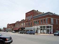
Historic Downtown Main Street | |
| Nickname(s): B-Town | |
 Location in the state of Indiana | |
| Coordinates: 38°52′47″N 86°2′46″W / 38.87972°N 86.04611°WCoordinates: 38°52′47″N 86°2′46″W / 38.87972°N 86.04611°W | |
| Country | United States |
| State | Indiana |
| County | Jackson |
| Township | Brownstown |
| Area[1] | |
| • Total | 1.60 sq mi (4.14 km2) |
| • Land | 1.59 sq mi (4.12 km2) |
| • Water | 0.01 sq mi (0.03 km2) |
| Elevation | 623 ft (190 m) |
| Population (2010)[2] | |
| • Total | 2,947 |
| • Estimate (2012[3]) | 2,989 |
| • Density | 1,853.5/sq mi (715.6/km2) |
| Time zone | EST (UTC-5) |
| • Summer (DST) | EST (UTC-5) |
| ZIP code | 47220 |
| Area code(s) | 812 |
| FIPS code | 18-08470[4] |
| GNIS feature ID | 0431647[5] |
Brownstown is a town in Brownstown Township, Jackson County, Indiana, United States. The population was 2,947 at the 2010 census. The city is the county seat of Jackson County.[6] It was named for Jacob Brown, a general of the War of 1812.[7]
History

The town of Brownstown was platted on 8 April 1816, notably prior to the statehood of Indiana itself.[8] Brownstown became the county seat of Jackson County in November 1816, replacing Fort Vallonia, which had only been the county seat since June of that year. The land for the Jackson County Court House, which rests in the heart of Brownstown on the square, was donated by Col. John Ketcham (1782–1865) for this specific function.
The Jackson County Courthouse was listed on the National Register of Historic Places in 2011.[9]
Geography
Brownstown is located at 38°52′47″N 86°2′46″W / 38.87972°N 86.04611°W (38.879823, -86.046163).[10]
According to the 2010 census, Brownstown has a total area of 1.6 square miles (4.14 km2), of which 1.59 square miles (4.12 km2) (or 99.38%) is land and 0.01 square miles (0.03 km2) (or 0.63%) is water.[1]
Brownstown lies on the East Fork of the White River, bordered by the Jackson-Washington State Forest and near the Hoosier National Forest.
Demographics
| Historical population | |||
|---|---|---|---|
| Census | Pop. | %± | |
| 1860 | 504 | — | |
| 1870 | 572 | 13.5% | |
| 1880 | 849 | 48.4% | |
| 1890 | 1,422 | 67.5% | |
| 1900 | 1,685 | 18.5% | |
| 1910 | 1,492 | −11.5% | |
| 1920 | 1,554 | 4.2% | |
| 1930 | 1,758 | 13.1% | |
| 1940 | 1,860 | 5.8% | |
| 1950 | 1,998 | 7.4% | |
| 1960 | 2,158 | 8.0% | |
| 1970 | 2,376 | 10.1% | |
| 1980 | 2,704 | 13.8% | |
| 1990 | 2,872 | 6.2% | |
| 2000 | 2,978 | 3.7% | |
| 2010 | 2,947 | −1.0% | |
| Est. 2015 | 2,952 | [11] | 0.2% |
2010 census
As of the census[2] of 2010, there were 2,947 people, 1,175 households, and 792 families residing in the town. The population density was 1,853.5 inhabitants per square mile (715.6/km2). There were 1,282 housing units at an average density of 806.3 per square mile (311.3/km2). The racial makeup of the town was 98.3% White, 0.1% African American, 0.3% Native American, 0.2% Asian, 0.1% Pacific Islander, 0.3% from other races, and 0.8% from two or more races. Hispanic or Latino of any race were 1.0% of the population.
There were 1,175 households of which 34.7% had children under the age of 18 living with them, 48.3% were married couples living together, 15.0% had a female householder with no husband present, 4.2% had a male householder with no wife present, and 32.6% were non-families. 29.0% of all households were made up of individuals and 14.8% had someone living alone who was 65 years of age or older. The average household size was 2.42 and the average family size was 2.97.
The median age in the town was 38.7 years. 25.7% of residents were under the age of 18; 8% were between the ages of 18 and 24; 24.2% were from 25 to 44; 23.5% were from 45 to 64; and 18.6% were 65 years of age or older. The gender makeup of the town was 48.2% male and 51.8% female.
2000 census
As of the census[4] of 2000, there were 3,000 people, 1,168 households, and 805 families residing in the town. The population density was 2,080.6 people per square mile (804.1/km²). There were 1,242 housing units at an average density of 867.7 per square mile (335.3/km²). The racial makeup of the town was 98.76% White, 0.10% African American, 0.24% Native American, 0.24% Asian, 0.10% Pacific Islander, 0.07% from other races, and 0.50% from two or more races. Hispanic or Latino of any race were 0.60% of the population.
There were 1,168 households out of which 34.6% had children under the age of 18 living with them, 49.7% were married couples living together, 16.4% had a female householder with no husband present, and 31.0% were non-families. 28.0% of all households were made up of individuals and 14.0% had someone living alone who was 65 years of age or older. The average household size was 2.43 and the average family size was 2.96.
In the town the population was spread out with 26.8% under the age of 18, 8.8% from 18 to 24, 27.8% from 25 to 44, 19.4% from 45 to 64, and 17.3% who were 65 years of age or older. The median age was 36 years. For every 100 females there were 85.1 males. For every 100 females age 18 and over, there were 76.7 males.
The median income for a household in the town was $35,000, and the median income for a family was $39,044. Males had a median income of $27,984 versus $21,503 for females. The per capita income for the town was $15,525. About 8.9% of families and 11.7% of the population were below the poverty line, including 18.0% of those under age 18 and 6.2% of those age 65 or over.
References
- 1 2 "G001 - Geographic Identifiers - 2010 Census Summary File 1". United States Census Bureau. Retrieved 2015-07-13.
- 1 2 "American FactFinder". United States Census Bureau. Retrieved 2012-12-11.
- ↑ "Population Estimates". United States Census Bureau. Archived from the original on 2013-06-17. Retrieved 2013-06-25.
- 1 2 "American FactFinder". United States Census Bureau. Archived from the original on 2013-09-11. Retrieved 2008-01-31.
- ↑ "US Board on Geographic Names". United States Geological Survey. 2007-10-25. Retrieved 2008-01-31.
- ↑ "Find a County". National Association of Counties. Archived from the original on 2011-05-31. Retrieved 2011-06-07.
- ↑ History of Jackson County, Indiana: From the Earliest Time to the Present, with Biographical Sketches, Notes, Etc., Together with an Extended History of the Northwest, the Indiana Territory and the State of Indiana. Unigraphic. 1886. p. 362.
- ↑ History of Jackson County, Indiana: From the Earliest Time to the Present, with Biographical Sketches, Notes, Etc., Together with an Extended History of the Northwest, the Indiana Territory and the State of Indiana. Unigraphic. 1886. p. 500.
- ↑ "National Register of Historic Places Listings". Weekly List of Actions Taken on Properties: 12/12/11 through 12/16/112. National Park Service. 2011-11-23.
- ↑ "US Gazetteer files: 2010, 2000, and 1990". United States Census Bureau. 2011-02-12. Retrieved 2011-04-23.
- ↑ "Annual Estimates of the Resident Population for Incorporated Places: April 1, 2010 to July 1, 2015". Retrieved July 2, 2016.
- ↑ "Census of Population and Housing". Census.gov. Archived from the original on May 11, 2015. Retrieved June 4, 2015.
External links
Municipalities and communities of Jackson County, Indiana, United States | ||
|---|---|---|
| City | ||
| Towns | ||
| Townships | ||
| CDPs | ||
| Other unincorporated communities |
| |