Cache Peak (Idaho)
| Cache Peak | |
|---|---|
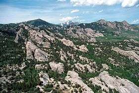 Cache Peak at center in background and the City of Rocks National Reserve | |
| Highest point | |
| Elevation | 10,339 ft (3,151 m) |
| Prominence | 4,459 ft (1,359 m) [1] |
| Coordinates | 42°11′08″N 113°39′40″W / 42.185606°N 113.661156°WCoordinates: 42°11′08″N 113°39′40″W / 42.185606°N 113.661156°W |
| Geography | |
 Cache Peak | |
| Parent range | Albion Mountains |
| Topo map | USGS Cache Peak |
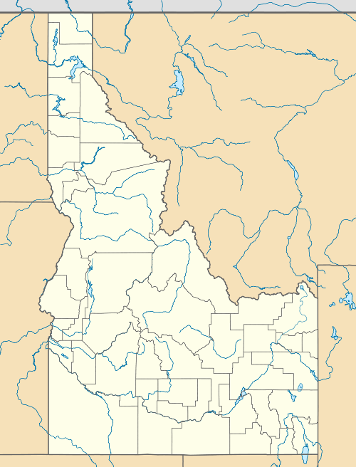
Cache Peak, at 10,339 feet (3,151 m) above sea level is the highest peak in the Albion Mountains of Cassia County in Southern Idaho. Cache Peak is located in the central part of the range southeast of Oakley and north of Almo in the Albion Division of the Minidoka Ranger District of Sawtooth National Forest.[2][3][4][5]
Cache Peak is in the watershed of tributaries of the Snake River, which itself is a tributary of the Columbia River. The peak is a part of the Great Basin Divide and the Basin and Range Province. It is the highest peak in Idaho south of the Snake River Plain, the highest in Cassia County, and north of City of Rocks National Reserve. The Independence Lakes are located in the basin north of the peak, and Mount Independence is about 1 mi (1.6 km) northwest of the peak.[4] The peak can be reached via a non-technical hike, and there are several alpine lakes on the east side of the peak.[6]
Cache Peak supports one of the three populations of Cymopterus davisii, a plant that is endemic to the Albion Mountains. The Cache Peak population is considered a single population with Mount Independence.[7]
See also
References
- ↑ "Cache Peak, Idaho". Peakbagger.com. Retrieved 2012-05-10.
- ↑ "Cache Peak". Geographic Names Information System. United States Geological Survey.
- ↑ U.S. Forest Service, U.S. Department of Agriculture. "Sawtooth National Forest". Retrieved 2012-05-10.
- 1 2 "Cache Peak (ID)". SummitPost.org. Retrieved 2012-05-10.
- ↑ "Albion Range". PeakBagger. Retrieved 2012-05-10.
- ↑ "Albion Range". SummitPost.org. Retrieved 2012-05-10.
- ↑ Moseley, R. K. (October 1993), The status and distribution of Christ’s Indian paintbrush (Castilleja christii) and Davis’ wavewing (Cymopterus davisii) in the Albion Mountains, Sawtooth National Forest and City of Rocks National Reserve (PDF), Idaho Department of Fish and Game, archived from the original (PDF) on July 28, 2015, retrieved July 28, 2015