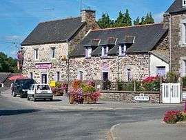
La Harmoye
| La Harmoye Lanhervoed | ||
|---|---|---|
 | ||
| ||
 La Harmoye | ||
|
Location within Brittany region  La Harmoye | ||
| Coordinates: 48°20′10″N 2°57′36″W / 48.3361°N 2.96°WCoordinates: 48°20′10″N 2°57′36″W / 48.3361°N 2.96°W | ||
| Country | France | |
| Region | Brittany | |
| Department | Côtes-d'Armor | |
| Arrondissement | Saint-Brieuc | |
| Canton | Plélo | |
| Intercommunality | Pays de Quintin | |
| Government | ||
| • Mayor (2014–2020) | Michel Le Duault | |
| Area1 | 17.67 km2 (6.82 sq mi) | |
| Population (2008)2 | 423 | |
| • Density | 24/km2 (62/sq mi) | |
| Time zone | CET (UTC+1) | |
| • Summer (DST) | CEST (UTC+2) | |
| INSEE/Postal code | 22073 / 22320 | |
| Elevation | 175–317 m (574–1,040 ft) | |
|
1 French Land Register data, which excludes lakes, ponds, glaciers > 1 km² (0.386 sq mi or 247 acres) and river estuaries. 2 Population without double counting: residents of multiple communes (e.g., students and military personnel) only counted once. | ||
.svg.png)
La Harmoye (Breton: Lanhervoed, Gallo: Laharmoét) is a commune in the Côtes-d'Armor department of Brittany in northwestern France.
Population
| Historical population | ||
|---|---|---|
| Year | Pop. | ±% |
| 1962 | 525 | — |
| 1968 | 555 | +5.7% |
| 1975 | 464 | −16.4% |
| 1982 | 424 | −8.6% |
| 1990 | 374 | −11.8% |
| 1999 | 383 | +2.4% |
| 2008 | 423 | +10.4% |
Inhabitants of La Harmoye are called harmoyens in French.
See also
References
External links
| Wikimedia Commons has media related to La Harmoye. |
This article is issued from Wikipedia - version of the 9/27/2016. The text is available under the Creative Commons Attribution/Share Alike but additional terms may apply for the media files.