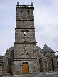
Rostrenen
| Rostrenen Rostrenenn | ||
|---|---|---|
 | ||
| ||
 Rostrenen | ||
|
Location within Brittany region  Rostrenen | ||
| Coordinates: 48°14′14″N 3°18′56″W / 48.2372°N 3.3155°WCoordinates: 48°14′14″N 3°18′56″W / 48.2372°N 3.3155°W | ||
| Country | France | |
| Region | Brittany | |
| Department | Côtes-d'Armor | |
| Arrondissement | Guingamp | |
| Canton | Rostrenen | |
| Intercommunality | Kreiz-Breizh | |
| Government | ||
| • Mayor (2014–2020) | Jean-Paul Le Boëdec | |
| Area1 | 32.17 km2 (12.42 sq mi) | |
| Population (2008)2 | 3,390 | |
| • Density | 110/km2 (270/sq mi) | |
| Time zone | CET (UTC+1) | |
| • Summer (DST) | CEST (UTC+2) | |
| INSEE/Postal code | 22266 / 22110 | |
| Elevation | 152–262 m (499–860 ft) | |
|
1 French Land Register data, which excludes lakes, ponds, glaciers > 1 km² (0.386 sq mi or 247 acres) and river estuaries. 2 Population without double counting: residents of multiple communes (e.g., students and military personnel) only counted once. | ||

Rostrenen (Breton: Rostrenenn pronounced [(h)ʀosˈtʀen] or pronounced [ˈ(h)ʀostʀen]) is a commune in the Côtes-d'Armor department of Brittany in northwestern France.
Population
Inhabitants of Rostrenen are called rostrenois in French.
Breton language
The municipality launched a linguistic plan through Ya d'ar brezhoneg on September 13, 2004. In 2008, 34.5% of primary children attended bilingual schools.[1]
 The train station |
See also
References
- ↑ (French) Ofis ar Brezhoneg: Enseignement bilingue
External links
| Wikimedia Commons has media related to Rostrenen. |
- Official website (French)
- French Ministry of Culture list for Rostrenen (French)
This article is issued from Wikipedia - version of the 6/21/2016. The text is available under the Creative Commons Attribution/Share Alike but additional terms may apply for the media files.