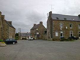
Tréglamus
| Tréglamus Treglañviz | |
|---|---|
 | |
 Tréglamus | |
|
Location within Brittany region  Tréglamus | |
| Coordinates: 48°33′28″N 3°16′24″W / 48.5578°N 3.2733°WCoordinates: 48°33′28″N 3°16′24″W / 48.5578°N 3.2733°W | |
| Country | France |
| Region | Brittany |
| Department | Côtes-d'Armor |
| Arrondissement | Guingamp |
| Canton | Belle-Isle-en-Terre |
| Intercommunality | Pays de Belle-Isle-en-Terre |
| Government | |
| • Mayor (2014–2020) | Dominique Pariscoat |
| Area1 | 18.79 km2 (7.25 sq mi) |
| Population (2008)2 | 977 |
| • Density | 52/km2 (130/sq mi) |
| Time zone | CET (UTC+1) |
| • Summer (DST) | CEST (UTC+2) |
| INSEE/Postal code | 22354 / 22540 |
| Elevation | 128–295 m (420–968 ft) |
|
1 French Land Register data, which excludes lakes, ponds, glaciers > 1 km² (0.386 sq mi or 247 acres) and river estuaries. 2 Population without double counting: residents of multiple communes (e.g., students and military personnel) only counted once. | |
Tréglamus (Breton: Treglañviz) is a commune in the Côtes-d'Armor department of Brittany in northwestern France.
Population
| Historical population | ||
|---|---|---|
| Year | Pop. | ±% |
| 1793 | 785 | — |
| 1800 | 1,200 | +52.9% |
| 1806 | 1,250 | +4.2% |
| 1821 | 1,316 | +5.3% |
| 1831 | 1,493 | +13.4% |
| 1836 | 1,493 | +0.0% |
| 1841 | 1,487 | −0.4% |
| 1846 | 1,587 | +6.7% |
| 1851 | 1,575 | −0.8% |
| 1856 | 1,509 | −4.2% |
| 1861 | 1,574 | +4.3% |
| 1866 | 1,582 | +0.5% |
| 1872 | 1,535 | −3.0% |
| 1876 | 1,502 | −2.1% |
| 1881 | 1,504 | +0.1% |
| 1886 | 1,511 | +0.5% |
| 1891 | 1,445 | −4.4% |
| 1896 | 1,373 | −5.0% |
| 1901 | 1,337 | −2.6% |
| 1906 | 1,327 | −0.7% |
| 1911 | 1,415 | +6.6% |
| 1921 | 1,245 | −12.0% |
| 1926 | 1,236 | −0.7% |
| 1931 | 1,132 | −8.4% |
| 1936 | 1,058 | −6.5% |
| 1946 | 1,025 | −3.1% |
| 1954 | 947 | −7.6% |
| 1962 | 840 | −11.3% |
| 1968 | 757 | −9.9% |
| 1975 | 715 | −5.5% |
| 1982 | 763 | +6.7% |
| 1990 | 795 | +4.2% |
| 1999 | 836 | +5.2% |
| 2008 | 977 | +16.9% |
Inhabitants of Tréglamus are called Cocagnards and Cocagnardes in French.
See also
References
External links
| Wikimedia Commons has media related to Tréglamus. |
This article is issued from Wikipedia - version of the 12/26/2014. The text is available under the Creative Commons Attribution/Share Alike but additional terms may apply for the media files.