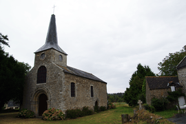
Saint-Lormel
| Saint-Lormel Sant-Loheñvel | |
|---|---|
 | |
 Saint-Lormel | |
|
Location within Brittany region  Saint-Lormel | |
| Coordinates: 48°32′48″N 2°13′42″W / 48.5467°N 2.2283°WCoordinates: 48°32′48″N 2°13′42″W / 48.5467°N 2.2283°W | |
| Country | France |
| Region | Brittany |
| Department | Côtes-d'Armor |
| Arrondissement | Dinan |
| Canton | Plancoët |
| Intercommunality | Plancoët Val d'Arguenon |
| Government | |
| • Mayor (2014–2020) | Claude Rigolé |
| Area1 | 9.77 km2 (3.77 sq mi) |
| Population (2008)2 | 887 |
| • Density | 91/km2 (240/sq mi) |
| Time zone | CET (UTC+1) |
| • Summer (DST) | CEST (UTC+2) |
| INSEE/Postal code | 22311 / 22130 |
| Elevation | 0–61 m (0–200 ft) |
|
1 French Land Register data, which excludes lakes, ponds, glaciers > 1 km² (0.386 sq mi or 247 acres) and river estuaries. 2 Population without double counting: residents of multiple communes (e.g., students and military personnel) only counted once. | |
Saint-Lormel (Breton: Sant-Loheñvel) is a commune in the Côtes-d'Armor department of Brittany in northwestern France.
Population
| Historical population | ||
|---|---|---|
| Year | Pop. | ±% |
| 1962 | 729 | — |
| 1968 | 716 | −1.8% |
| 1975 | 736 | +2.8% |
| 1982 | 780 | +6.0% |
| 1990 | 787 | +0.9% |
| 1999 | 777 | −1.3% |
| 2008 | 887 | +14.2% |
See also
References
External links
| Wikimedia Commons has media related to Saint-Lormel. |
This article is issued from Wikipedia - version of the 11/9/2014. The text is available under the Creative Commons Attribution/Share Alike but additional terms may apply for the media files.