Saint-Michel-en-Grève
| Saint-Michel-en-Grève Lokmikael-an-Traezh | |
|---|---|
 | |
 Saint-Michel-en-Grève | |
|
Location within Brittany region  Saint-Michel-en-Grève | |
| Coordinates: 48°41′02″N 3°33′45″W / 48.6839°N 3.5625°WCoordinates: 48°41′02″N 3°33′45″W / 48.6839°N 3.5625°W | |
| Country | France |
| Region | Brittany |
| Department | Côtes-d'Armor |
| Arrondissement | Lannion |
| Canton | Plestin-les-Grèves |
| Intercommunality | Lannion Trégor |
| Government | |
| • Mayor (2014–2020) | Christophe Ropartz |
| Area1 | 4.69 km2 (1.81 sq mi) |
| Population (2008)2 | 483 |
| • Density | 100/km2 (270/sq mi) |
| Time zone | CET (UTC+1) |
| • Summer (DST) | CEST (UTC+2) |
| INSEE/Postal code | 22319 / 22300 |
| Elevation | 0–107 m (0–351 ft) |
|
1 French Land Register data, which excludes lakes, ponds, glaciers > 1 km² (0.386 sq mi or 247 acres) and river estuaries. 2 Population without double counting: residents of multiple communes (e.g., students and military personnel) only counted once. | |
Saint-Michel-en-Grève (Breton: Lokmikael-an-Traezh) is a commune in the Côtes-d'Armor department of Brittany in northwestern France.
In 2009 huge quantities of Ulva lactuca washed up on the beach at Saint Michel, causing the death of a horse[1] and possibly a factor in the death of a cleanup crew truck driver.[2]
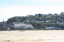
 The bay at Saint-Michel-en-Grève
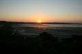 Sunset over the Lieue-de-Grève
Population
| Historical population | ||
|---|---|---|
| Year | Pop. | ±% |
| 1962 | 363 | — |
| 1968 | 372 | +2.5% |
| 1975 | 382 | +2.7% |
| 1982 | 398 | +4.2% |
| 1990 | 376 | −5.5% |
| 1999 | 405 | +7.7% |
| 2008 | 483 | +19.3% |
Inhabitants of Saint-Michel-en-Grève are called michelois in French.
See also
References
External links
| Wikimedia Commons has media related to Saint-Michel-en-Grève. |
This article is issued from Wikipedia - version of the 1/6/2015. The text is available under the Creative Commons Attribution/Share Alike but additional terms may apply for the media files.