Lescure-d'Albigeois
| Lescure-d'Albigeois | |
|---|---|
|
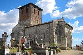
The church in Lescure-d'Albigeois | |
 Lescure-d'Albigeois | |
|
Location within Occitanie region  Lescure-d'Albigeois | |
| Coordinates: 43°57′15″N 2°10′16″E / 43.9542°N 2.1711°ECoordinates: 43°57′15″N 2°10′16″E / 43.9542°N 2.1711°E | |
| Country | France |
| Region | Occitanie |
| Department | Tarn |
| Arrondissement | Albi |
| Canton | Albi-Nord-Est |
| Intercommunality | Albigeois |
| Government | |
| • Mayor (2001–2008) | Claude Julien |
| Area1 | 14.18 km2 (5.47 sq mi) |
| Population (2006)2 | 4,038 |
| • Density | 280/km2 (740/sq mi) |
| Time zone | CET (UTC+1) |
| • Summer (DST) | CEST (UTC+2) |
| INSEE/Postal code | 81144 / 81380 |
| Elevation |
154–302 m (505–991 ft) (avg. 168 m or 551 ft) |
|
1 French Land Register data, which excludes lakes, ponds, glaciers > 1 km² (0.386 sq mi or 247 acres) and river estuaries. 2 Population without double counting: residents of multiple communes (e.g., students and military personnel) only counted once. | |
Lescure-d'Albigeois is a commune in the Tarn department in southern France.
See also
References
| Wikimedia Commons has media related to Lescure-d'Albigeois. |
This article is issued from Wikipedia - version of the 7/20/2016. The text is available under the Creative Commons Attribution/Share Alike but additional terms may apply for the media files.