Lynn County, Texas
| Lynn County, Texas | |
|---|---|
|
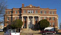
Lynn County Courthouse in Tahoka | |
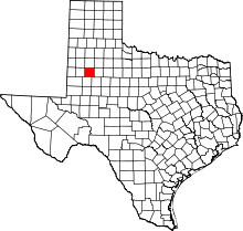 Location in the U.S. state of Texas | |
 Texas's location in the U.S. | |
| Founded | 1903 |
| Seat | Tahoka |
| Largest city | Tahoka |
| Area | |
| • Total | 893 sq mi (2,313 km2) |
| • Land | 892 sq mi (2,310 km2) |
| • Water | 1.6 sq mi (4 km2), 0.2% |
| Population | |
| • (2010) | 5,915 |
| • Density | 6.6/sq mi (3/km²) |
| Congressional district | 19th |
| Time zone | Central: UTC-6/-5 |
| Website |
www |


Lynn County is a county located in the U.S. state of Texas. As of the 2010 census, its population was 5,915.[1] Its county seat is Tahoka.[2] The county was created in 1876 and later organized in 1903.[3]
Lynn County, along with Crosby and Lubbock Counties, is part of the Lubbock Metropolitan Statistical Area (MSA). The Lubbock MSA and Levelland Micropolitan Statistical Area (µSA), encompassing only Hockley County, form the larger Lubbock–Levelland Combined Statistical Area (CSA).
Lynn County is one of thirty prohibition,[4] or entirely dry, counties in the state of Texas.
The county has two historical museums, the O'Donnell Heritage Museum, with a Dan Blocker room, located in O'Donnell, and the Tahoka Pioneer Museum in Tahoka.
History
Native Americans
Apache and Comanche roamed the high plains, until pushed away by various military expeditions of the 19th Century.
The Red River War of 1874 was a military campaign to drive out the Apache, Comanche and Kiowa in Texas.[5] In 1877, the ill-fated Nolan Expedition[6] crossed the county in search of livestock stolen by Comanche renegades.[7] The various Indian tribes had moved on by the time of white settlement, due to the depletion of the buffalo herds by hunters.[8]
Settlers
In the early 1880s sheep and cattle ranchers began to set up operations in the county. The situation changed as large-scale ranching spread into the county.
W C. Young of Fort Worth and Illinois Irishman Ben Galbraith established the beginnings of the Curry Comb Ranch in the northwest part of Garza County. By 1880, it spilled over into Lynn County.[9] The Square Compass Ranch of Garza County also protruded into Lynn County.
The county remained sparsely settled ranching territory for two decades after 1880. It had no towns; the population was nine in 1880, twenty-four in 1890, and seventeen in 1900. Farmers began to move into the county and invest in corn, grains and cotton.
County established
Lynn County was formed in 1876 from Bexar.[10] The county was organized in 1903, with Takoha becoming the county seat.
Numerous new towns were founded during the early years of the twentieth century. O'Donnell,[11] named for railroad man Tom J. O'Donnell, was established in 1910 as a speculative venture based on the opening up of new farmlands in southern Lynn and northern Dawson Counties. Wilson, thirteen miles (19 km) northeast of Tahoka, was established in 1912 to attract farmers to the newly opened lands of the Dixie Ranch. A large number of Central Texas Germans purchased county lands, thus beginning a small-scale migration of Germans into the county that lasted into the 1950s.
Cotton farming prospered in the early part of the 20th century. Farmers later expanded to wheat and sorghum, plus cattle, sheep, hogs, and poultry, chiefly chickens and turkeys.
Oil was discovered in the county in 1950. By 1983 the total production was 10,612,550 barrels (1,687,261 m3).
Geography
According to the U.S. Census Bureau, the county has a total area of 893 square miles (2,310 km2), of which 892 square miles (2,310 km2) is land and 1.6 square miles (4.1 km2) (0.2%) is water.[12]
Geographic features
- Caprock escarpment, eastern edge of Lynn County
- Double Mountain Fork Brazos River, begins as a small depression between Draw, Redwine, and Grassland, Texas.
- Double Lakes, northwest of Tahoka
- Guthrie Lake, southwest of Tahoka
- Tahoka Lake, northeast of Tahoka
Major highways
Adjacent counties
- Lubbock County (north)
- Garza County (east)
- Borden County (southeast)
- Dawson County (south)
- Terry County (west)
- Hockley County (northwest)
Demographics
| Historical population | |||
|---|---|---|---|
| Census | Pop. | %± | |
| 1880 | 9 | — | |
| 1890 | 24 | 166.7% | |
| 1900 | 17 | −29.2% | |
| 1910 | 1,713 | 9,976.5% | |
| 1920 | 4,751 | 177.3% | |
| 1930 | 12,372 | 160.4% | |
| 1940 | 11,931 | −3.6% | |
| 1950 | 11,030 | −7.6% | |
| 1960 | 10,914 | −1.1% | |
| 1970 | 9,107 | −16.6% | |
| 1980 | 8,605 | −5.5% | |
| 1990 | 6,758 | −21.5% | |
| 2000 | 6,550 | −3.1% | |
| 2010 | 5,915 | −9.7% | |
| Est. 2015 | 5,724 | [13] | −3.2% |
| U.S. Decennial Census[14] 1850–2010[15] 2010–2014[1] | |||
As of the census[16] of 2000, there were 6,550 people, 2,354 households, and 1,777 families residing in the county. The population density was 7 people per square mile (3/km²). There were 2,671 housing units at an average density of 3 per square mile (1/km²). The racial makeup of the county was 75.53% White, 2.84% Black or African American, 1.02% Native American, 0.15% Asian, 18.24% from other races, and 2.21% from two or more races. 44.63% of the population were Hispanic or Latino of any race.
There were 2,354 households out of which 38.90% had children under the age of 18 living with them, 61.00% were married couples living together, 11.10% had a female householder with no husband present, and 24.50% were non-families. 23.10% of all households were made up of individuals and 12.10% had someone living alone who was 65 years of age or older. The average household size was 2.76 and the average family size was 3.25.
In the county, the population was spread out with 31.20% under the age of 18, 7.80% from 18 to 24, 26.00% from 25 to 44, 21.00% from 45 to 64, and 14.00% who were 65 years of age or older. The median age was 35 years. For every 100 females there were 99.60 males. For every 100 females age 18 and over, there were 93.80 males.
The median income for a household in the county was $26,694, and the median income for a family was $33,146. Males had a median income of $27,972 versus $19,531 for females. The per capita income for the county was $14,090. About 19.30% of families and 22.60% of the population were below the poverty line, including 28.00% of those under age 18 and 24.40% of those age 65 or over.
The county is served by a weekly newspaper, nearby stations KBXJ (FM) and KPET (AM), and the various Lubbock radio and TV stations. KAMZ (FM) and KMMX (FM) are licensed to Tahoka, but have offices and studios in Lubbock and originate few if any programs from Lynn County.
Communities
- Grassland
- New Home
- O'Donnell (small part in Dawson County)
- Tahoka (county seat)
- Wayside
- Wilson
- New Lynn
Notable residents
- Dan Blocker, actor
- Jerry "Bo" Coleman, radio disc jockey
- Phil Hardberger, politician
- E L Short, former member of both houses of the Texas State Legislature
See also
References
- 1 2 "State & County QuickFacts". United States Census Bureau. Retrieved December 19, 2013.
- ↑ "Find a County". National Association of Counties. Retrieved 2011-06-07.
- ↑ "Texas: Individual County Chronologies". Texas Atlas of Historical County Boundaries. The Newberry Library. 2008. Retrieved May 25, 2015.
- ↑ http://www.tabc.state.tx.us/local_option_elections/index.asp
- ↑ Red River Historian
- ↑ Find A Grave, Major Nicholas Nolan
- ↑ Handbook of Texas, Nolan Expedition
- ↑ A Beginner’s Guide to Freedom, Buffalo Hunted to Near Extinction
- ↑ Curry Comb Ranch
- ↑ Handbook of Texas, Lynn County
- ↑ Texas Escapes, O’Donnell
- ↑ "2010 Census Gazetteer Files". United States Census Bureau. August 22, 2012. Retrieved May 3, 2015.
- ↑ "County Totals Dataset: Population, Population Change and Estimated Components of Population Change: April 1, 2010 to July 1, 2015". Retrieved July 2, 2016.
- ↑ "U.S. Decennial Census". United States Census Bureau. Retrieved May 3, 2015.
- ↑ "Texas Almanac: Population History of Counties from 1850–2010" (PDF). Texas Almanac. Retrieved May 3, 2015.
- ↑ "American FactFinder". United States Census Bureau. Retrieved 2011-05-14.
External links
- Lynn County government’s website
- Lynn County from the Handbook of Texas Online
- Lynn County Profile from the Texas Association of Counties
- Roadside America, Dan Blocker Memorial
 |
Lubbock County | | ||
| Terry County | |
Garza County | ||
| ||||
| | ||||
| Dawson County | Borden County |
Municipalities and communities of Lynn County, Texas, United States | ||
|---|---|---|
| Cities | | |
| Unincorporated communities | ||
| Footnotes | ‡This populated place also has portions in an adjacent county or counties | |
Coordinates: 33°11′N 101°49′W / 33.18°N 101.82°W