Polk County, Texas
| Polk County, Texas | |
|---|---|
| County | |
| County of Polk | |
|
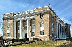
Polk County Court House | |
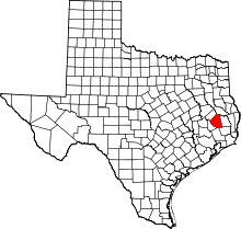 Location in the U.S. state of Texas | |
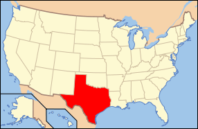 Texas's location in the U.S. | |
| Founded | March 30, 1846 |
| Named for | James K. Polk |
| Seat | Livingston |
| Largest town | Livingston |
| Area | |
| • Total | 1,110 sq mi (2,875 km2) |
| • Land | 1,057 sq mi (2,738 km2) |
| • Water | 53 sq mi (137 km2), 4.74% |
| Population | |
| • (2010) | 45,413 |
| • Density | 43/sq mi (17/km²) |
| ZIP code(s) | 75934, 75936, 75939, 75960, 77326, 77335, 77350, 77351, 77360, 77364 |
| Area code(s) | 936 |
| Congressional district | 36th |
| Time zone | Central: UTC-6/-5 |
| Website |
www |
Polk County is a county located in the U.S. state of Texas. As of the 2010 census, the population was 45,413.[1] Its county seat is Livingston.[2]
The Alabama-Coushatta Indian Reservation of the federally recognized tribe is in Polk County, where the people have been since the early 19th century, after migrating from the Southeast.[3] The 2000 census reported a resident population of 480 persons within the reservation. The tribe reports 1100 enrolled members.
History

Polk County, named for His Excellency James Knox Polk of Tennessee, President of the United States, was by act of the First Legislature of the State of Texas, approved on March 30, 1846, created out of Liberty County and embraced that portion thereof known and designated as the "Northern Division" of said Liberty County. It was one of the first of a series of 23 counties, formulated, constituted and established by the State of Texas, after annexation with the United States.[4]
Infrastructure

The Texas Department of Criminal Justice Allan B. Polunsky Unit is located in West Livingston.[5][6] This has been the location of the State of Texas death row since 1999.[7]
Demographics
| Historical population | |||
|---|---|---|---|
| Census | Pop. | %± | |
| 1850 | 2,348 | — | |
| 1860 | 8,300 | 253.5% | |
| 1870 | 8,707 | 4.9% | |
| 1880 | 7,189 | −17.4% | |
| 1890 | 10,332 | 43.7% | |
| 1900 | 14,447 | 39.8% | |
| 1910 | 17,459 | 20.8% | |
| 1920 | 16,784 | −3.9% | |
| 1930 | 17,555 | 4.6% | |
| 1940 | 20,635 | 17.5% | |
| 1950 | 16,194 | −21.5% | |
| 1960 | 13,861 | −14.4% | |
| 1970 | 14,457 | 4.3% | |
| 1980 | 24,407 | 68.8% | |
| 1990 | 30,687 | 25.7% | |
| 2000 | 41,133 | 34.0% | |
| 2010 | 45,413 | 10.4% | |
| Est. 2015 | 46,972 | [8] | 3.4% |
| U.S. Decennial Census[9] 1850–2010[10] 2010–2014[1] | |||
As of the census[11] of 2000, there were 41,133 people, 15,119 households, and 10,915 families residing in the county. The population density was 39 inhabitants per square mile (15/km2). There were 21,177 housing units at an average density of 20 per square mile (8/km²). The racial makeup of the county was 79.64% White, 13.17% Black or African American, 1.74% Native American, 0.38% Asian, 0.01% Pacific Islander, 3.74% from other races, and 1.32% from two or more races. 9.39% of the population were Hispanic or Latino of any race.
There were 15,119 households out of which 28.80% had children under the age of 18 living with them, 57.90% were married couples living together, 10.80% had a female householder with no husband present, and 27.80% were non-families. 24.60% of all households were made up of individuals and 12.50% had someone living alone who was 65 years of age or older. The average household size was 2.50 and the average family size was 2.95.
In the county, the population was spread out with 22.90% under the age of 18, 8.10% from 18 to 24, 26.80% from 25 to 44, 24.20% from 45 to 64, and 18.00% who were 65 years of age or older. The median age was 39 years. For every 100 females there were 108.70 males. For every 100 females age 18 and over, there were 109.50 males.
The median income for a household in the county was $30,495, and the median income for a family was $35,957. Males had a median income of $30,823 versus $21,065 for females. The per capita income for the county was $15,834. About 13.30% of families and 17.40% of the population were below the poverty line, including 23.10% of those under age 18 and 12.30% of those age 65 or over.
Geography
According to the U.S. Census Bureau, the county has a total area of 1,110 square miles (2,900 km2), of which 1,057 square miles (2,740 km2) is land and 53 square miles (140 km2) (4.7%) is water.[12]
Adjacent counties
- Angelina County (north)
- Tyler County (east)
- Hardin County (southeast)
- Liberty County (south)
- San Jacinto County (southwest)
- Trinity County (northwest)
National protected area
Education
Polk County College / Commerce Center was completed in 2013 and is located on the U.S. Highway 59 Bypass. Angelina College offers advanced curriculum study and technical training at this location. The facility provides public auditorium space and may be used as a mass shelter in a disaster event .[13]
Transportation
Major highways
 U.S. Highway 59
 The future route of Interstate 69 is planned to follow the current route of U.S. 59 in most places.
 U.S. Highway 190
 U.S. Highway 287
 State Highway 146
 Farm to Market Road 350
 Farm to Market Road 356
 Farm to Market Road 357
 Farm to Market Road 942
 Farm to Market Road 943
 Farm to Market Road 1745
Mass transportation
Greyhound Lines operates the Livingston Station at the Super Stop Food Mart in Livingston.[14]
Airport
West Livingston has the Livingston Municipal Airport, operated by the City of Livingston.[5][15]
Communities
Cities
Towns
- Corrigan
- Livingston (county seat)
Census-designated place
Unincorporated communities
Ghost town
Notable people
- Percy Foreman: notable criminal defense attorney
- John Wesley Hardin: Old West gunslinger
- William P. Hobby: Governor of Texas, publisher of Houston Post
- Sam Houston: general of the revolution to achieve independence and President of the Republic of Texas, spent much time in Polk County, including making peace treaties with the Alabama-Coushata Indians.[16]
- Margo Jones: stage director who launched the careers of Tennessee Williams and Ray Walston and directed Williams' The Glass Menagerie on Broadway[17]
- René-Robert Cavelier, Sieur de La Salle: noted French explorer of the 17th century; was likely killed in Polk County [18]
- Sally Mayes: Broadway actress and singer. Livingston named a street in her honor.
- Mark Moseley: professional football player; won Super Bowl XVII and was awarded 1982 MVP as a placekicker
- Moon Mullican: musician, "King of the Hillbilly Piano Players".
- Captain (Ike) Isaac Newton Moreland Turner: Confederate captain who joined the Civil War from Polk County, with units called the "Texas Brigade"; his remains were returned here from Georgia and were reinterred in his family cemetery on April 15, 1995[19]
- Annette Gordon-Reed (born November 19, 1958 in Livingston, Texas) is an American historian, Pulitzer Prize winning author, and law professor noted for changing scholarship on Thomas Jefferson regarding his relationship with Sally Hemings and her children.
See also
References
- 1 2 "State & County QuickFacts". United States Census Bureau. Retrieved December 22, 2013.
- ↑ "Find a County". National Association of Counties. Retrieved 2011-06-07.
- ↑ Howard N. Martin, "ALABAMA-COUSHATTA INDIANS", Handbook of Texas Online, uploaded 9 June 2010, accessed 18 November 2014
- ↑ Ike Turner Camp, U. C. V. (1901). Historical Polk County, Texas: Companies and Soldiers Organized in and Enrolled From Said County in Confederate States Army and Navy—1861–1865, Organization Ike Turner Camp, U. C. V., Unveiling, Etc. Livingston, Texas: Polk County Enterprise, Printers. pp. 3–4.
 This article incorporates text from this source, which is in the public domain.
 - 1 2 "West Livingston CDP, Texas." U.S. Census Bureau. Retrieved on May 9, 2010.
- ↑ "Polunsky Unit." Texas Department of Criminal Justice. Retrieved on May 7, 2010.
- ↑ "Death Row Facts", Texas Department of Criminal Justice. Retrieved on May 7, 2010.
- ↑ "County Totals Dataset: Population, Population Change and Estimated Components of Population Change: April 1, 2010 to July 1, 2015". Retrieved July 2, 2016.
- ↑ "U.S. Decennial Census". United States Census Bureau. Retrieved May 6, 2015.
- ↑ "Texas Almanac: Population History of Counties from 1850–2010" (PDF). Texas Almanac. Retrieved May 6, 2015.
- ↑ "American FactFinder". United States Census Bureau. Retrieved 2011-05-14.
- ↑ "2010 Census Gazetteer Files". United States Census Bureau. August 22, 2012. Retrieved May 6, 2015.
- ↑ , Polk County College Archived February 2, 2015, at the Wayback Machine.
- ↑ "." Greyhound Lines. Retrieved on July 29, 2012. NOTE: The information for Livingston appears as a pop-up window.
- ↑ "Municipal Airport." City of Livingston. Retrieved on May 9, 2010.
- ↑ "Tribal History", Alabama-Coushatta website
- ↑ "Margaret Virginia Margo Jones", Texas Escapes website
- ↑ "René-Robert Cavelier, Sieur de La Salle", Handbook of Texas Online, accessed 18 November 2014
- ↑ Randy Hill, "A Southern Homecoming", n.d., USA Deep South website
External links
- Official website
- Polk County (TXGenWeb)
- Polk County from the Handbook of Texas Online
 |
Trinity County | Angelina County | | |
| |
Tyler County | |||
| ||||
| | ||||
| San Jacinto County | Liberty County | Hardin County |
Coordinates: 30°48′N 94°50′W / 30.80°N 94.83°W