Limestone County, Texas
| Limestone County, Texas | |
|---|---|
|
The Limestone County Courthouse in Groesbeck | |
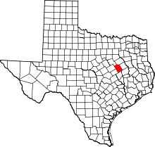 Location in the U.S. state of Texas | |
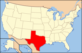 Texas's location in the U.S. | |
| Founded | 1846 |
| Seat | Groesbeck |
| Largest city | Mexia |
| Area | |
| • Total | 933 sq mi (2,416 km2) |
| • Land | 905 sq mi (2,344 km2) |
| • Water | 28 sq mi (73 km2), 3.0% |
| Population | |
| • (2010) | 23,384 |
| • Density | 26/sq mi (10/km²) |
| Congressional district | 17th |
| Time zone | Central: UTC-6/-5 |
| Website |
www |

Limestone County is a county located in the U.S. state of Texas. As of the 2010 census, the population was 23,384.[1] Its county seat is Groesbeck.[2] The county was created in 1846.[3]
History
Native Americans
Indians friendly to the settlers resided in east Texas[4] before the Kiowa, Apache and Comanche intruded upon their territory.[5] These tribes hunted, farmed the land, and were adept traders. The Tawakoni[6] branch of Wichita Indians originated north of Texas, but migrated south into east Texas. From 1843 onward, the Tawakoni were part of treaties made by both the Republic of Texas and the United States. Tawakoni were also sometimes known as Tehuacana. The Limestone County town of Tehuacana[7][8] was settled on the former site of a Tehuacana village. The Waco people[9] were also a branch of the Wichita Indians.
Fort Parker Massacre
Arguably the most infamous Indian depredation in Texas happened in Limestone County on May 19, 1836 when an odd alliance of Comanche, Kiowa, Caddo and Wichita approached Fort Parker surreptitiously under a flag of peace. The Indians subsequently attacked the fort, killing or kidnapping all but about 18 settlers who managed to escape to Fort Houston.[10][11] Captured[12] in the Fort Parker massacre were Elizabeth Kellogg,[13] Rachel Plummer[14] and her son James Pratt Plummer,[15] John Richard Parker[16] and his sister Cynthia Ann Parker, who later became mother of Comanche Chief Quanah Parker.[17]
Settlers
Limestone County was part of the Haden Harrison Edwards (800 families) and Robertson's Colony (800 families) empresario grants[18] made by the Coahuila y Texas (Texas is the old Spanish name (X had the sound of H, i.e., Mexia, Bexar, Mexico.) Tejas, though seldom used, is the modern spelling in Spanish.) legislature in 1825. By contracting how many families each grantee could settle, the government sought to have some control over colonization.
Baptist spiritual leader Daniel Parker[19] and eight other men organized the Pilgrim Predestinarian Regular Baptist Church in Lamotte, Illinois. The fellowship in its entirety migrated in 1833 to the new frontier of Texas. Among this group of settlers were Silas M. Parker, Moses Herrin, Elisha Anglin, Luther T. M. Plummer, David Faulkenberry, Joshua Hadley, and Samuel Frost. Fort Parker, near the Navasota River in what is now central Limestone County, was the earliest actual settlement in the vicinity. Following on the heels of the original settlers, other communities were established.
County established
On April 11, 1846, Limestone County was formed from Robertson County. On August 18, 1846, the county was organized. Springfield became the county seat. The county seat was moved to Groesbeck in 1873 after boundary changes, and the Springfield courthouse being burned down.[20]
Homesteaders became self-sustaining farmers and ranchers who supplemented the dinner table with wild game. Support businesses were connected to the repair and maintenance of farm equipment and livestock. The population of 1860 was 4,537. Of these, 3,464 were white, 1,072 were slaves, and one was a free black female.[21]
Civil War and Reconstruction
Limestone County voted 525 -9 in favor of secession from the Union, and sent its men to fight for the Confederate States of America. Lochlin Johnson Farrar[22] raised the first Confederate company from the county. Reconstruction in the county was so contentious, with racial violence and threats against the government, that on 9 Oct 1871, Texas Governor Edmund J. Davis[23][24] declared the county under martial law.
Post Civil War development
The Houston and Texas Central Railway[25] laid tracks in 1869, terminating near Kosse[26] which was named after the railway's chief engineer Theodore Kosse. The Trinity and Brazos Valley Railway,[27] laid track in 1903 from Cleburne to Mexia. Several towns were established on these routes.
The Thornton Institute was founded in 1877 by Edward Coke Chambers, and was chartered in 1881 as the Thornton Male and Female Institute. The school provided a type of dormitory for the students, and sent many graduates out to teach in rural Texas. Henry P. Davis acquired the school in 1889,[28] and in 1891 the school was given to the Thornton[29] Independent School District.
Oil Gas were discovered[30] in Mexia[31] between 1913 and 1920, creating jobs and a population boom - from just 3,482 people to 35,000 in 1922. Martial law had to be briefly declared in Mexia. The population began to decline during the Great Depression. Camp Mexia, a German prisoner of war camp[32][33] was built during World War II.
The Work Projects Administration and the Civilian Conservation Corps helped ease the county economy during the Great Depression. The Civilian Conservation Corps built Fort Parker State Recreation Area.[34] The WPA erected a number of buildings in the county.
Geography
According to the U.S. Census Bureau, the county has a total area of 933 square miles (2,420 km2), of which 905 square miles (2,340 km2) is land and 28 square miles (73 km2) (3.0%) is water.[35]
Major highways
Adjacent counties
- Navarro County (north)
- Freestone County (northeast)
- Leon County (southeast)
- Robertson County (south)
- Falls County (southwest)
- McLennan County (west)
- Hill County (northwest)
Demographics
| Historical population | |||
|---|---|---|---|
| Census | Pop. | %± | |
| 1850 | 2,608 | — | |
| 1860 | 4,537 | 74.0% | |
| 1870 | 8,591 | 89.4% | |
| 1880 | 16,246 | 89.1% | |
| 1890 | 21,678 | 33.4% | |
| 1900 | 32,573 | 50.3% | |
| 1910 | 34,621 | 6.3% | |
| 1920 | 33,283 | −3.9% | |
| 1930 | 39,497 | 18.7% | |
| 1940 | 33,781 | −14.5% | |
| 1950 | 25,251 | −25.3% | |
| 1960 | 20,413 | −19.2% | |
| 1970 | 18,100 | −11.3% | |
| 1980 | 20,224 | 11.7% | |
| 1990 | 20,946 | 3.6% | |
| 2000 | 22,051 | 5.3% | |
| 2010 | 23,384 | 6.0% | |
| Est. 2015 | 23,320 | [36] | −0.3% |
| U.S. Decennial Census[37] 1850–2010[38] 2010–2014[1] | |||
As of the census[39] of 2000, there were 22,051 people, 7,906 households, and 5,652 families residing in the county. The population density was 24 people per square mile (9/km²). There were 9,725 housing units at an average density of 11 per square mile (4/km²). The racial makeup of the county was 70.75% White, 19.07% Black or African American, 0.45% Native American, 0.12% Asian, 0.01% Pacific Islander, 8.10% from other races, and 1.49% from two or more races. 12.97% of the population were Hispanic or Latino of any race.
There were 7,906 households out of which 32.00% had children under the age of 18 living with them, 54.00% were married couples living together, 13.50% had a female householder with no husband present, and 28.50% were non-families. 25.60% of all households were made up of individuals and 13.80% had someone living alone who was 65 years of age or older. The average household size was 2.55 and the average family size was 3.04.
In the county, the population was spread out with 25.40% under the age of 18, 9.10% from 18 to 24, 26.40% from 25 to 44, 22.70% from 45 to 64, and 16.40% who were 65 years of age or older. The median age was 37 years. For every 100 females there were 103.20 males. For every 100 females age 18 and over, there were 100.80 males.
The median income for a household in the county was $29,366, and the median income for a family was $36,924. Males had a median income of $28,069 versus $18,893 for females. The per capita income for the county was $14,352. About 14.40% of families and 17.80% of the population were below the poverty line, including 22.90% of those under age 18 and 15.00% of those age 65 or over.
Communities
Cities
Towns
Unincorporated communities
Notable residents
- Alfonso Steele (1817–1911) born in 1817 in Hardin County, Kentucky, and is buried in Mexia.[40]
- Anna Nicole Smith (1967–2007) lived briefly in Mexia.
- Don the Beachcomber (1907–1989) born Ernest Raymond Beaumont Gantt in Limestone County.
- Bob Wills (1905-1975) Born on a farm in Kosse, in the southern portion of Limestone County. [41]
See also
References
- 1 2 "State & County QuickFacts". United States Census Bureau. Retrieved December 19, 2013.
- ↑ "Find a County". National Association of Counties. Retrieved 2011-06-07.
- ↑ "Texas: Individual County Chronologies". Texas Atlas of Historical County Boundaries. The Newberry Library. 2008. Retrieved May 25, 2015.
- ↑ Moore, R Edward. "East Texas Indian Lands". Texas Indians. Retrieved 1 May 2010. R E. Moore and Texarch Associates
- ↑ "The Passing of the Indian Era". Texas Beyond History. Retrieved 1 May 2010. Texas Beyond History
- ↑ Krieger, Margery H: Tawakoni Indians from the Handbook of Texas Online. Retrieved 01 May 2010. Texas State Historical Association
- ↑ "Tehuacana, Texas". Texas Escapes - Blueprints For Travel, LLC. Retrieved 1 May 2010. Texas Escapes - Blueprints For Travel, LLC.
- ↑ Smyrl, Vivian Elizabeth: Tehuacana, Texas from the Handbook of Texas Online. Retrieved 01 May 2010. Texas State Historical Association
- ↑ Moore, R Edward. "The Waco Indians". Texas Indians. Retrieved 1 May 2010. R E. Moore and Texarch Associates
- ↑ "Fort Houston, Texas". Texas Escapes - Blueprints For Travel, LLC. Retrieved 1 May 2010. Texas Escapes - Blueprints For Travel, LLC.
- ↑ Watts, Mrs. Harmon: Fort Houston from the Handbook of Texas Online. Retrieved 01 May 2010. Texas State Historical Association
- ↑ "Fort Parker Massacre". Texas Historical Markers. Retrieved 1 May 2010.
- ↑ Heard, J Norman: Kellogg, Elizabeth from the Handbook of Texas Online. Retrieved 01 May 2010. Texas State Historical Association
- ↑ Exley, Jo Ella Powell: Plummer, Rachel from the Handbook of Texas Online. Retrieved 01 May 2010. Texas State Historical Association
- ↑ "Plummer, James Pratt". Ancestry.com. Retrieved 1 May 2010.
- ↑ Friend, Llerena B: Parker, John Richard from the Handbook of Texas Online. Retrieved 01 May 2010. Texas State Historical Association
- ↑ Hacker, Margaret Schmidt: Parker, Cynthia Ann from the Handbook of Texas Online. Retrieved 01 May 2010. Texas State Historical Association
- ↑ "Empresario Contracts in the Colonization of Texas 1825-1834". Texas A & M UNiversity. Retrieved 1 May 2010. Wallace L. McKeehan,
- ↑ Bob Bowman. "The Parker Family". Texas Escapes - Blueprints For Travel, LLC. Retrieved 1 May 2010. Texas Escapes - Blueprints For Travel, LLC.
- ↑ "Limestone County Courthouse". Texas Historical Markers. Retrieved 1 May 2010.
- ↑ Maschino, Ellen: Limestone County from the Handbook of Texas Online. Retrieved 1 May 2010. Texas State Historical Association
- ↑ "Field Officers Serving in Texas Confederate Regiments". Texas in the Civil War. Retrieved 1 May 2010.
- ↑ "Governors of Texas". Texas State Library and Archives Commission. Retrieved 1 May 2010. State of Texas
- ↑ "Limestone County". Texas Association of Counties. Retrieved 1 May 2010.Texas Association of Counties
- ↑ Werner, George C: Houston Texas and Central Railway from the Handbook of Texas Online. Retrieved 01 May 2010. Texas State Historical Association
- ↑ "Kosse, Texas". Texas Escapes - Blueprints For Travel, LLC. Retrieved 1 May 2010. Texas Escapes - Blueprints For Travel, LLC.
- ↑ "Trinity and Brazos Valley Railway". Don's Depot. Retrieved 1 May 2010.
- ↑ Walter, Ray A: Thornton Institute from the Handbook of Texas Online. Retrieved 01 May 2010. Texas State Historical Association
- ↑ "Thornton, Texas". Texas Escapes - Blueprints For Travel, LLC. Retrieved 1 May 2010. Texas Escapes - Blueprints For Travel, LLC.
- ↑ "Oil and Texas: A Cultural History". Texas Almanac. Retrieved 1 May 2010. Texas State Historical Association
- ↑ "Mexia, Texas". Texas Escapes - Blueprints For Travel, LLC. Retrieved 1 May 2010. Texas Escapes - Blueprints For Travel, LLC.
- ↑ "Camp Mexia". Guðmundur Helgason. Retrieved 1 May 2010. Guðmundur Helgason
- ↑ "Mexia School Campus Houses Little-Known Remnants of WW II POW Camp". Texas Health and Human Services. Retrieved 1 May 2010. Texas Health and Human Services
- ↑ "Old Fort Parker". Texas Parks and Wildlife Department. Retrieved 1 May 2010. Texas Health and Human Services
- ↑ "2010 Census Gazetteer Files". United States Census Bureau. August 22, 2012. Retrieved May 3, 2015.
- ↑ "County Totals Dataset: Population, Population Change and Estimated Components of Population Change: April 1, 2010 to July 1, 2015". Retrieved July 2, 2016.
- ↑ "U.S. Decennial Census". United States Census Bureau. Retrieved May 3, 2015.
- ↑ "Texas Almanac: Population History of Counties from 1850–2010" (PDF). Texas Almanac. Retrieved May 3, 2015.
- ↑ "American FactFinder". United States Census Bureau. Retrieved 2011-05-14.
- ↑ http://www.kirkwatson.com/watson-wire/you-looking-at-me/
- ↑ San Antonio Rose: The Life And Music Of Bob Wills. Charles R. Townsend. 1976. University of Illinois. p. 1. ISBN 0-252-00470-1.
External links
- Limestone County government's website
- Limestone County from the Handbook of Texas Online
 |
Hill County | Navarro County | Freestone County | |
| McLennan County | |
|||
| ||||
| | ||||
| Falls County | Robertson County | Leon County |
Municipalities and communities of Limestone County, Texas, United States | ||
|---|---|---|
| Cities | | |
| Towns | ||
| Unincorporated communities | ||
| Footnotes | ‡This populated place also has portions in an adjacent county or counties | |
Coordinates: 31°32′N 96°35′W / 31.54°N 96.58°W