Orange County, Texas
| Orange County, Texas | ||
|---|---|---|
|
The Orange County Courthouse in Orange | ||
| ||
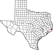 Location in the U.S. state of Texas | ||
 Texas's location in the U.S. | ||
| Founded | January 5, 1852 | |
| Named for | Orange fruit | |
| Seat | Orange | |
| Largest city | Orange | |
| Area | ||
| • Total | 380 sq mi (984 km2) | |
| • Land | 334 sq mi (865 km2) | |
| • Water | 46 sq mi (119 km2), 12% | |
| Population | ||
| • (2010) | 81,837 | |
| • Density | 245/sq mi (95/km²) | |
| Congressional district | 36th | |
| Time zone | Central: UTC-6/-5 | |
| Website |
www | |


Orange County is a county in the U.S. state of Texas. As of the 2010 census, its population was 81,837.[1] The county seat is Orange.[2]
Orange County is included in the Beaumont-Port Arthur, TX Metropolitan Statistical Area. It is located in the very southeastern corner of Texas, with a boundary with Louisiana, within the Golden Triangle of Texas.
History
Orange County was formed in 1852 from portions of Jefferson County.[3] It was named after the orange fruit, the common citrus fruit grown by the early settlers of this County near the mouth of the Sabine River.[4] Due to periodic spells of quite cold winter weather (frosts) in Orange County, it is no longer the home of orange trees and citrus orchards. The production of those fruits in Texas long ago was moved a long way southwest into the Rio Grande Valley, where the weather is almost always warm all winter long. Citrus trees produce their fruit in the wintertime, which makes them especially vulnerable to frost and icy weather.
A similar thing has happened in Florida, where orchards of citrus trees no longer exist in either Citrus County or Orange County because of bad winter freezes in some years. In both Florida and Texas, the citrus agriculture has been moved farther south in search of milder winters, and away from the periodic frosts.
During World War II, Orange County was the home of a large amount of shipbuilding for the navies the United States and allied countries. The major shipbuilder, the Consolidated Steel Corporation was located in the town of Orange, and among the warships that it built were the USS Aulick (DD-569) (1942), the first warship built there, the USS Pope (DE-134) (1943), and the USS Carpenter (DD-825) (1945–46), the last warship built there. During the war, the Consolidate Steel Corporation employed as many as 20,000 people at its shipyard in Orange, Texas.
Geography
According to the U.S. Census Bureau, the county has a total area of 380 square miles (980 km2), of which 334 square miles (870 km2) is land and 46 square miles (120 km2) (12%) is water.[5]
Orange County is bordered on its east by the Sabine River, on its southeast by Sabine Lake, and on the northwest by the Neches River.
The geography of Orange County varies relatively little, with an elevation that reaches 33 feet (10 meters) above sea level at very few points within the county. Orange County is very flat, and its soil is quite sandy, as could be expected in a county along the Gulf of Mexico. (Sandy soil is also common in southern Louisiana, Mississippi, and Alabama, and in western and southern Florida.) There are saltwater marshes in much of the southeastern part of Orange County that borders the Sabine River. There are piney woods (sometimes capitalized) in the northern part of the county.
Adjacent counties and parishes
- Jasper County (north)
- Newton County (north)
- Hardin County (northwest)
- Jefferson County (west)
- Calcasieu Parish, Louisiana (east)
- Cameron Parish, Louisiana (southeast)
National protected area
Demographics
| Historical population | |||
|---|---|---|---|
| Census | Pop. | %± | |
| 1860 | 1,916 | — | |
| 1870 | 1,255 | −34.5% | |
| 1880 | 2,938 | 134.1% | |
| 1890 | 4,770 | 62.4% | |
| 1900 | 5,905 | 23.8% | |
| 1910 | 9,528 | 61.4% | |
| 1920 | 15,379 | 61.4% | |
| 1930 | 15,149 | −1.5% | |
| 1940 | 17,382 | 14.7% | |
| 1950 | 40,567 | 133.4% | |
| 1960 | 60,357 | 48.8% | |
| 1970 | 71,170 | 17.9% | |
| 1980 | 83,838 | 17.8% | |
| 1990 | 80,509 | −4.0% | |
| 2000 | 84,966 | 5.5% | |
| 2010 | 81,837 | −3.7% | |
| Est. 2015 | 84,260 | [6] | 3.0% |
| U.S. Decennial Census[7] 1850–2010[8] 2010–2014[1] | |||
As of the census[9] of 2000, there were 84,966 people, 31,642 households, and 23,794 families residing in the county. The population density was 238 people per square mile (92/km²). There were 34,781 housing units at an average density of 98 per square mile (38/km²). The racial makeup of the county was 87.98% White, 8.38% Black or African American, 0.56% Native American, 0.78% Asian, 0.03% Pacific Islander, 1.12% from other races, and 1.15% from two or more races. 3.62% of the population were Hispanic or Latino of any race.
There were 31,642 households out of which 35.30% had children under the age of 18 living with them, 58.80% were married couples living together, 12.10% had a female householder with no husband present, and 24.80% were non-families. 21.70% of all households were made up of individuals and 9.30% had someone living alone who was 65 years of age or older. The average household size was 2.65 and the average family size was 3.08.
In the county, the population was spread out with 27.30% under the age of 18, 8.70% from 18 to 24, 28.10% from 25 to 44, 23.20% from 45 to 64, and 12.70% who were 65 years of age or older. The median age was 36 years. For every 100 females there were 96.40 males. For every 100 females age 18 and over, there were 92.60 males.
The median income for a household in the county was $37,586, and the median income for a family was $44,152. Males had a median income of $40,185 versus $21,859 for females. The per capita income for the county was $17,554. About 11.40% of families and 13.80% of the population were below the poverty line, including 18.50% of those under age 18 and 12.40% of those age 65 or over.
Government
The Orange County Courthouse serves as the court for the region. Republican County Judge Stephen Brint Carlton presides over the five-member Orange County Commissioners' Court.
Orange County lies in Texas House District 21, represented beginning in 2015 by the Republican Dade Phelan of Beaumont.
Economy
Primary economic activities in Orange County are the petroleum refining industry, paper milling, rice farming, and shrimping.
Orange County was formerly a center for the building of warships, and there is still a large U.S. Navy ghost fleet (reserve fleet) in Jefferson County - from which currently, many old warships are being cleaned of water pollution sources and then scrapped for their metals. Thus, there is still employment for residents of Orange County in shipbreaking.
Transportation
Airports
Orange County Airport operates general aviation flights.
Nearby Southeast Texas Regional Airport (Port Arthur) operates commercial flights.
Major highways
Education
The county is served by 5 school districts:[10]
- Bridge City ISD
- Little Cypress-Mauriceville Consolidated ISD
- Orangefield ISD
- Vidor ISD
- West Orange-Cove Consolidated ISD
West Orange-Cove Consolidated Independent School District
The district's Superintendent of Schools is James Colbert Jr.
- M B North Early Learning Center/Head Start (seeking, Principal)
- West Orange-Stark Elementary (Bennie Smith, Principal)
- West Orange-Stark Middle (seeking, Principal)
- West Orange-Stark High School (Hutcherson Hill, Principal)
- West Orange-Cove Academic Alternative Center (Rodney Anderson, Director)
Bridge City ISD
The Superintendent is Jamey Harrison.[11] It includes:[12]
- Hatton Elementary School (Principal:Norman Gaspard[13])
- Sims Elementary School (Principal:Kent Broussard[14])
- Bridge City Intermediate School (Principal:Tara Fountain[15])
- Bridge City Middle School (Principal:Kevin Jones[16])
- Bridge City High School (Principal:Richard Briggs[17]).
Little Cypress-Mauriceville Consolidated ISD
The Superintendent is Dr. Pauline Hargrove.[18] It includes:[18]
- Mauriceville Elementary School
- Little Cypress Elementary School
- Mauriceville Middle School
- Little Cypress Intermediate School
- Mauriceville Middle School
- Little Cypress Junior High School
- Little Cypress-Mauriceville High School
Communities
Cities
- Bridge City
- Orange (county seat)
- Pine Forest
- Pinehurst
- Port Arthur (mostly in Jefferson County)
- Rose City
- Vidor
- West Orange
Census-designated place
Unincorporated communities
Ghost towns
See also
References
- 1 2 "State & County QuickFacts". United States Census Bureau. Retrieved December 22, 2013.
- ↑ "Find a County". National Association of Counties. Archived from the original on May 10, 2015. Retrieved 2011-06-07.
- ↑ Handbook of Texas Online - ORANGE COUNTY
- ↑ History of Orange, TX
- ↑ "2010 Census Gazetteer Files". United States Census Bureau. August 22, 2012. Retrieved May 5, 2015.
- ↑ "County Totals Dataset: Population, Population Change and Estimated Components of Population Change: April 1, 2010 to July 1, 2015". Retrieved July 2, 2016.
- ↑ "U.S. Decennial Census". United States Census Bureau. Archived from the original on May 11, 2015. Retrieved May 5, 2015.
- ↑ "Texas Almanac: Population History of Counties from 1850–2010" (PDF). Texas Almanac. Retrieved May 5, 2015.
- ↑ "American FactFinder". United States Census Bureau. Retrieved 2011-05-14.
- ↑ Agency, Texas Education (2009-02-12). "School District Locator: Accessible Version". Retrieved 2009-05-30.
- ↑ ISD, Bridge City. "Central Office". Archived from the original on March 3, 2009. Retrieved 2009-05-30.
- ↑ ISD, Bridge City. "Welcome to Bridge City ISD!". Archived from the original on May 8, 2009. Retrieved 2009-05-30.
- ↑ School, Hatton Elementary. "Hatton Elementary". Archived from the original on March 3, 2009. Retrieved 2009-05-30.
- ↑ School, Sims Elementary. "Sims Elementary". Archived from the original on March 3, 2009. Retrieved 2009-05-30.
- ↑ School, Bridge City Intermediate. "Bridge City Intermediate". Archived from the original on March 3, 2009. Retrieved 2009-05-30.
- ↑ School, Bridge City Middle. "Bridge City Middle School". Archived from the original on March 3, 2009. Retrieved 2009-05-30.
- ↑ School, Bridge City High. "Bridge City High School". Archived from the original on March 3, 2009. Retrieved 2009-05-30.
- 1 2 ISD, Little Cypress-Mauriceville Consolidated (2008). "Little Cypress Mauriceville CISD Orange, TX". Retrieved 2009-05-30.
External links
- Orange County government's website
- Orange County in Handbook of Texas Online at the University of Texas
- Historic materials from the Heritage House Museum in Orange, hosted by the UNT's Portal to Texas History
 |
Hardin County | Jasper County and Newton County | | |
| Jefferson County | |
Calcasieu Parish, Louisiana | ||
| ||||
| | ||||
| Jefferson County | Cameron Parish, Louisiana |
Municipalities and communities of Orange County, Texas, United States | ||
|---|---|---|
| Cities | | |
| CDP | ||
| Unincorporated communities | ||
| Ghost towns | ||
| Footnotes | ‡This populated place also has portions in an adjacent county or counties | |

Coordinates: 30°08′N 93°53′W / 30.13°N 93.89°W