Manganese, Minnesota
Manganese was a small village in Minnesota, United States. Located in Wolford Township in Crow Wing County, Manganese lies roughly 2 miles (3.2 km) north of Trommald, Minnesota. Just off County Road 30, it is perhaps best identified by its location between Coles Lake and Flynn Lake. First appearing in the 1920 census, the village was abandoned by 1960.
History
Named after the mining of its namesake,[1] the village first appeared as "Manganese Village" in the 1920 Census with a population of 183.[2] A post office called Manganese was in operation from 1912 until 1924.[3]
Over time, like most other minerals in the Cuyuna Range, all of the ore had been extracted. As a result, no employment remained in the city, and the residents needed to relocate to find new jobs. Unlike other towns in the Cuyuna Range, rather than having its population decline by thirty or forty percent, Manganese lost its entire population.[4] During the 1960s the city was abandoned; it became a ghost town.[5] Nothing remained except for sidewalks, rubble, many building foundations, and various abandoned items. In the 1970s, the city amounted to nothing more than sidewalks and rubble. As time progressed into the 1980s, trees, roots, and shrubs began to uproot and crack through the concrete sidewalks. In the 1990s, a majority of the land was purchased. It is now privately owned and has a "no trespassing" sign posted on the gate of the southeastern part of the city. Presently, the area is consumed entirely by the growth of natural vegetation.
Although the grid pattern of roads remains, the roads have either disintegrated or have been completely overtaken by grass, trees, and shrubs. The sheer height of the trees expose what has become of land once occupied by numerous buildings. Manganese is a classic example of a "ghost town."
References
- ↑ Warren Upham (1920). Minnesota Geographic Names: Their Origin and Historic Significance. Minnesota Historical Society. p. 158.
- ↑ Fourteenth Census of the United States: Population (PDF). III. U.S. Census Bureau. 1920.
- ↑ "Crow Wing County". Jim Forte Postal History. Retrieved 10 May 2015.
- ↑ Kubas. Crow Wing County. Publication forthcoming. pp. 1–51.
- ↑ Census of Population: 1960 Minnesota (PDF). I (pt. 25). U.S. Census Bureau. 1960.
Municipalities and communities of Crow Wing County, Minnesota, United States | ||
|---|---|---|
| Cities | 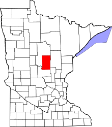 | |
| Townships | ||
| Unorganized territories | ||
| CDP | ||
| Unincorporated communities | ||
| Indian reservation | ||
| Ghost towns | ||
| Footnotes | ‡This populated place also has portions in an adjacent county or counties | |
Coordinates: 46°31′39″N 94°00′35″W / 46.52750°N 94.00972°W