Wolford, Minnesota
| Wolford, Minnesota | |
|---|---|
| Unincorporated community | |
 Wolford, Minnesota  Wolford, Minnesota Location of the community of Wolford | |
| Coordinates: 46°32′44″N 93°58′45″W / 46.54556°N 93.97917°WCoordinates: 46°32′44″N 93°58′45″W / 46.54556°N 93.97917°W | |
| Country | United States |
| State | Minnesota |
| County | Crow Wing |
| Township | Wolford Township |
| Elevation | 1,214 ft (370 m) |
| Time zone | Central (CST) (UTC-6) |
| • Summer (DST) | CDT (UTC-5) |
| ZIP code | 56441 |
| Area code(s) | 218 |
| GNIS feature ID | 654326[1] |
Wolford is an unincorporated community in Wolford Township, Crow Wing County, Minnesota, United States, near Crosby. It is along Crow Wing County Road 30 near River Road. State Highway 6 (MN 6) and County Road 11 are both nearby. Perry Lake Township is also in the immediate area.
Wolford was platted in 1913.[2]
References
- ↑ "Wolford, Minnesota". Geographic Names Information System. United States Geological Survey.
- ↑ Upham, Warren (2001). Minnesota Place Names: A Geographical Encyclopedia. Minnesota Historical Society Press. p. 163. ISBN 978-0-87351-396-8.
Municipalities and communities of Crow Wing County, Minnesota, United States | ||
|---|---|---|
| Cities | 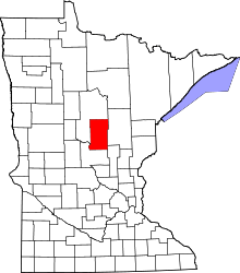 | |
| Townships | ||
| Unorganized territories | ||
| CDP | ||
| Unincorporated communities | ||
| Indian reservation | ||
| Ghost towns | ||
| Footnotes | ‡This populated place also has portions in an adjacent county or counties | |
This article is issued from Wikipedia - version of the 11/4/2016. The text is available under the Creative Commons Attribution/Share Alike but additional terms may apply for the media files.