Jenkins, Minnesota
| Jenkins, Minnesota | |
|---|---|
| City | |
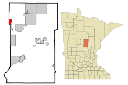 Location of Jenkins within Crow Wing County, Minnesota | |
| Coordinates: 46°38′53″N 94°19′57″W / 46.64806°N 94.33250°W | |
| Country | United States |
| State | Minnesota |
| County | Crow Wing |
| Area[1] | |
| • Total | 4.51 sq mi (11.68 km2) |
| • Land | 4.48 sq mi (11.60 km2) |
| • Water | 0.03 sq mi (0.08 km2) |
| Elevation | 1,263 ft (385 m) |
| Population (2010)[2] | |
| • Total | 430 |
| • Estimate (2012[3]) | 437 |
| • Density | 96.0/sq mi (37.1/km2) |
| Time zone | Central (CST) (UTC-6) |
| • Summer (DST) | CDT (UTC-5) |
| ZIP codes | 56456, 56472 |
| Area code(s) | 218 |
| FIPS code | 27-31832[4] |
| GNIS feature ID | 0645619[5] |
Jenkins is a city in Crow Wing County, Minnesota, United States. The population was 430 at the 2010 census.[6] It is part of the Brainerd Micropolitan Statistical Area.
History
A post office called Jenkins has been in operation since 1895.[7] The city was named for George W. Jenkins, a local lumberman. Jenkins was incorporated in 1969.[8]
Geography
According to the United States Census Bureau, the city has a total area of 4.51 square miles (11.68 km2), of which 4.48 square miles (11.60 km2) is land and 0.03 square miles (0.08 km2) is water.[1] Jenkins is located in the northwest part of Crow Wing County. Jenkins is a gateway to the nearby Whitefish Chain of Lakes.
Minnesota State Highway 371 serves as a main route in the community. Other routes include County Roads 15, 16, and 145.
Jenkins is part of the Brainerd Lakes Area.
Demographics
| Historical population | |||
|---|---|---|---|
| Census | Pop. | %± | |
| 1910 | 130 | — | |
| 1920 | 125 | −3.8% | |
| 1930 | 148 | 18.4% | |
| 1940 | 206 | 39.2% | |
| 1950 | 170 | −17.5% | |
| 1960 | 144 | −15.3% | |
| 1970 | 148 | 2.8% | |
| 1980 | 219 | 48.0% | |
| 1990 | 262 | 19.6% | |
| 2000 | 287 | 9.5% | |
| 2010 | 430 | 49.8% | |
| Est. 2015 | 443 | [9] | 3.0% |
| U.S. Decennial Census | |||
2010 census
As of the census[2] of 2010, there were 430 people, 168 households, and 101 families residing in the city. The population density was 96.0 inhabitants per square mile (37.1/km2). There were 193 housing units at an average density of 43.1 per square mile (16.6/km2). The racial makeup of the city was 99.3% White, 0.5% Native American, and 0.2% from other races. Hispanic or Latino of any race were 3.0% of the population.
There were 168 households of which 34.5% had children under the age of 18 living with them, 43.5% were married couples living together, 9.5% had a female householder with no husband present, 7.1% had a male householder with no wife present, and 39.9% were non-families. 33.3% of all households were made up of individuals and 9% had someone living alone who was 65 years of age or older. The average household size was 2.56 and the average family size was 3.26.
The median age in the city was 31.8 years. 29.3% of residents were under the age of 18; 7.4% were between the ages of 18 and 24; 30.2% were from 25 to 44; 23.3% were from 45 to 64; and 9.8% were 65 years of age or older. The gender makeup of the city was 53.7% male and 46.3% female.
2000 census
As of the census[4] of 2000, there were 287 people, 113 households, and 72 families residing in the city. The population density was 67.5 people per square mile (26.1/km²). There were 123 housing units at an average density of 28.9 per square mile (11.2/km²). The racial makeup of the city was 97.91% White, 0.70% Native American, 0.35% Asian, and 1.05% from two or more races.
There were 113 households out of which 32.7% had children under the age of 18 living with them, 47.8% were married couples living together, 10.6% had a female householder with no husband present, and 35.4% were non-families. 31.0% of all households were made up of individuals and 8.8% had someone living alone who was 65 years of age or older. The average household size was 2.54 and the average family size was 3.15.
In the city the population was spread out with 27.2% under the age of 18, 6.6% from 18 to 24, 32.8% from 25 to 44, 22.0% from 45 to 64, and 11.5% who were 65 years of age or older. The median age was 37 years. For every 100 females there were 103.5 males. For every 100 females age 18 and over, there were 93.5 males.
The median income for a household in the city was $34,167, and the median income for a family was $41,250. Males had a median income of $25,938 versus $17,232 for females. The per capita income for the city was $14,198. About 6.1% of families and 10.1% of the population were below the poverty line, including 13.4% of those under the age of eighteen and 21.7% of those sixty five or over.
References
- 1 2 "US Gazetteer files 2010". United States Census Bureau. Retrieved 2012-11-13.
- 1 2 "American FactFinder". United States Census Bureau. Retrieved 2012-11-13.
- ↑ "Population Estimates". United States Census Bureau. Retrieved 2013-05-28.
- 1 2 "American FactFinder". United States Census Bureau. Retrieved 2008-01-31.
- ↑ "US Board on Geographic Names". United States Geological Survey. 2007-10-25. Retrieved 2008-01-31.
- ↑ "2010 Census Redistricting Data (Public Law 94-171) Summary File". American FactFinder. U.S. Census Bureau, 2010 Census. Retrieved 23 April 2011.
- ↑ "Crow Wing County". Jim Forte Postal History. Retrieved 10 May 2015.
- ↑ Upham, Warren (2001). Minnesota Place Names: A Geographical Encyclopedia. Minnesota Historical Society Press. p. 159. ISBN 978-0-87351-396-8.
- ↑ "Annual Estimates of the Resident Population for Incorporated Places: April 1, 2010 to July 1, 2015". Retrieved July 2, 2016.
External links
Municipalities and communities of Crow Wing County, Minnesota, United States | ||
|---|---|---|
| Cities | 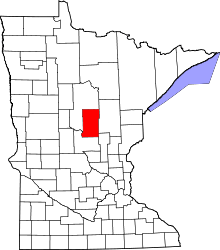 | |
| Townships | ||
| Unorganized territories | ||
| CDP | ||
| Unincorporated communities | ||
| Indian reservation | ||
| Ghost towns | ||
| Footnotes | ‡This populated place also has portions in an adjacent county or counties | |
Cities in the Brainerd Lakes area, Minnesota | |||||||
|---|---|---|---|---|---|---|---|
| Core City | 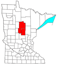 | ||||||
| Surrounding communities |
| ||||||
| Counties | |||||||
† indicates a county seat. ‡ indicates that it is partially in the micropolitan area. § indicates a CDP. | |||||||
Coordinates: 46°38′46″N 94°20′05″W / 46.64611°N 94.33472°W