Montferrier
- For the town in Hérault, see Montferrier-sur-Lez.
| Montferrier | ||
|---|---|---|
|
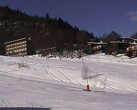
Monts d'Olmes ski resort | ||
| ||
 Montferrier | ||
|
Location within Occitanie region  Montferrier | ||
| Coordinates: 42°53′47″N 1°47′43″E / 42.8964°N 1.7953°ECoordinates: 42°53′47″N 1°47′43″E / 42.8964°N 1.7953°E | ||
| Country | France | |
| Region | Occitanie | |
| Department | Ariège | |
| Arrondissement | Foix | |
| Canton | Lavelanet | |
| Intercommunality | Pays d'Olmes | |
| Government | ||
| • Mayor (2008–2014) | Christian Laffont | |
| Area1 | 51.79 km2 (20.00 sq mi) | |
| Population (2008)2 | 647 | |
| • Density | 12/km2 (32/sq mi) | |
| Time zone | CET (UTC+1) | |
| • Summer (DST) | CEST (UTC+2) | |
| INSEE/Postal code | 09206 / 09300 | |
| Elevation |
548–2,343 m (1,798–7,687 ft) (avg. 684 m or 2,244 ft) | |
|
1 French Land Register data, which excludes lakes, ponds, glaciers > 1 km² (0.386 sq mi or 247 acres) and river estuaries. 2 Population without double counting: residents of multiple communes (e.g., students and military personnel) only counted once. | ||
.svg.png)
Montferrier is a commune in the Ariège department in southwestern France.
Population
| Historical population | ||
|---|---|---|
| Year | Pop. | ±% |
| 1962 | 672 | — |
| 1968 | 742 | +10.4% |
| 1975 | 735 | −0.9% |
| 1982 | 733 | −0.3% |
| 1990 | 748 | +2.0% |
| 1999 | 664 | −11.2% |
| 2008 | 647 | −2.6% |
See also
References
| Wikimedia Commons has media related to Montferrier. |
This article is issued from Wikipedia - version of the 12/16/2014. The text is available under the Creative Commons Attribution/Share Alike but additional terms may apply for the media files.