Le Port, Ariège
| Le Port | |
|---|---|
|
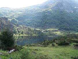
The Étang de Lers, in Le Port | |
 Le Port | |
|
Location within Occitanie region  Le Port | |
| Coordinates: 42°52′12″N 1°22′25″E / 42.87°N 1.3736°ECoordinates: 42°52′12″N 1°22′25″E / 42.87°N 1.3736°E | |
| Country | France |
| Region | Occitanie |
| Department | Ariège |
| Arrondissement | Saint-Girons |
| Canton | Massat |
| Intercommunality | Canton of Massat |
| Government | |
| • Mayor (2008–2014) | Noëlle Moralès |
| Area1 | 49.87 km2 (19.25 sq mi) |
| Population (2008)2 | 204 |
| • Density | 4.1/km2 (11/sq mi) |
| Time zone | CET (UTC+1) |
| • Summer (DST) | CEST (UTC+2) |
| INSEE/Postal code | 09231 / 09320 |
| Elevation |
666–2,196 m (2,185–7,205 ft) (avg. 710 m or 2,330 ft) |
|
1 French Land Register data, which excludes lakes, ponds, glaciers > 1 km² (0.386 sq mi or 247 acres) and river estuaries. 2 Population without double counting: residents of multiple communes (e.g., students and military personnel) only counted once. | |
Le Port is a commune in the Ariège department in southwestern France.
Population
Inhabitants of Le Port are called Portais.
| Historical population | ||
|---|---|---|
| Year | Pop. | ±% |
| 1962 | 132 | — |
| 1968 | 211 | +59.8% |
| 1975 | 188 | −10.9% |
| 1982 | 198 | +5.3% |
| 1990 | 183 | −7.6% |
| 1999 | 190 | +3.8% |
| 2008 | 204 | +7.4% |
See also
References
| Wikimedia Commons has media related to Le Port (Ariège). |
This article is issued from Wikipedia - version of the 3/21/2015. The text is available under the Creative Commons Attribution/Share Alike but additional terms may apply for the media files.