Muchedent
| Muchedent | |
|---|---|
|
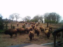
The bison farm | |
 Muchedent | |
|
Location within Normandy region  Muchedent | |
| Coordinates: 49°46′21″N 1°10′59″E / 49.7725°N 1.1831°ECoordinates: 49°46′21″N 1°10′59″E / 49.7725°N 1.1831°E | |
| Country | France |
| Region | Normandy |
| Department | Seine-Maritime |
| Arrondissement | Dieppe |
| Canton | Longueville-sur-Scie |
| Intercommunality | Varenne et Scie |
| Area1 | 7.05 km2 (2.72 sq mi) |
| Population (2008)2 | 124 |
| • Density | 18/km2 (46/sq mi) |
| Time zone | CET (UTC+1) |
| • Summer (DST) | CEST (UTC+2) |
| INSEE/Postal code | 76458 / 76590 |
| Elevation |
43–176 m (141–577 ft) (avg. 60 m or 200 ft) |
|
1 French Land Register data, which excludes lakes, ponds, glaciers > 1 km² (0.386 sq mi or 247 acres) and river estuaries. 2 Population without double counting: residents of multiple communes (e.g., students and military personnel) only counted once. | |
Muchedent is a commune in the Seine-Maritime department in the Haute-Normandie region in north-western France.
Geography
A small farming village situated by the banks of the river Varenne in the Pays de Caux, some 13 miles (21 km) south of Dieppe at the junction of the D77, the D154 and the D476 roads.
Population
| 1962 | 1968 | 1975 | 1982 | 1990 | 1999 | 2006 | 2007 | 2008 |
|---|---|---|---|---|---|---|---|---|
| 100 | 112 | 115 | 96 | 117 | 129 | 113 | 118 | 124 |
| Starting in 1962: Population without duplicates | ||||||||
Places of interest
- The bison farm.
- The church of St. Pierre, dating from the eleventh century.
- A nineteenth century château.
See also
References
External links
| Wikimedia Commons has media related to Muchedent. |
- Website of the bison farm (French)
- Muchedent on the Quid website (French)
This article is issued from Wikipedia - version of the 3/20/2016. The text is available under the Creative Commons Attribution/Share Alike but additional terms may apply for the media files.