Ostopovice
| Ostopovice | |||
|---|---|---|---|
| Municipality | |||
 | |||
| |||
 Ostopovice | |||
| Coordinates: 49°9′37″N 16°32′41″E / 49.16028°N 16.54472°ECoordinates: 49°9′37″N 16°32′41″E / 49.16028°N 16.54472°E | |||
| Country |
| ||
| Region | South Moravian | ||
| District | Brno-Country | ||
| Area | |||
| • Total | 3.83 km2 (1.48 sq mi) | ||
| Elevation | 245 m (804 ft) | ||
| Population (2012) | |||
| • Total | 1,544 | ||
| • Density | 400/km2 (1,000/sq mi) | ||
| Postal code | 664 49 | ||
| Website | http://www.ostopovice.cz | ||

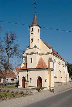
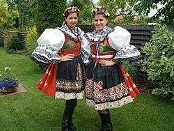
Ostopovice is a village and municipality (obec) in Brno-Country District in the South Moravian Region of the Czech Republic.
The municipality covers an area of 3.83 square kilometres (1.48 sq mi), and has a population of 1,406 (as at 31 December 2007).
Ostopovice lies approximately 7 kilometres (4 mi) south-west of Brno and 185 km (115 mi) south-east of Prague.
References
| Wikimedia Commons has media related to Ostopovice. |
This article is issued from Wikipedia - version of the 4/7/2016. The text is available under the Creative Commons Attribution/Share Alike but additional terms may apply for the media files.