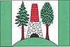
Lažánky (Brno-Country District)
| Lažánky | |||
|---|---|---|---|
| Municipality | |||
 | |||
| |||
 Lažánky | |||
| Coordinates: 49°16′44″N 16°23′17″E / 49.27889°N 16.38806°ECoordinates: 49°16′44″N 16°23′17″E / 49.27889°N 16.38806°E | |||
| Country |
| ||
| Region | South Moravian | ||
| District | Brno-Country | ||
| Area | |||
| • Total | 14.00 km2 (5.41 sq mi) | ||
| Elevation | 442 m (1,450 ft) | ||
| Population (2012) | |||
| • Total | 700 | ||
| • Density | 50/km2 (130/sq mi) | ||
| Postal code | 664 71 | ||
| Website | http://www.lazanky.cz | ||
Lažánky is a village and municipality (obec) in Brno-Country District in the South Moravian Region of the Czech Republic.
The municipality covers an area of 14.00 square kilometres (5.41 sq mi), and has a population of 654 (as at 2005).
Lažánky lies approximately 19 kilometres (12 mi) north-west of Brno and 168 km (104 mi) south-east of Prague.
References
| Wikimedia Commons has media related to Lažánky (Brno-Country District). |
This article is issued from Wikipedia - version of the 4/7/2016. The text is available under the Creative Commons Attribution/Share Alike but additional terms may apply for the media files.