Paducah, Texas
| Paducah, Texas | |
|---|---|
| Town | |
|
Paducah welcome sign | |
| Motto: "Crossroads of America" | |
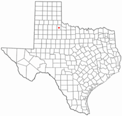 Location of Paducah, Texas | |
 | |
| Coordinates: 34°0′50″N 100°18′14″W / 34.01389°N 100.30389°WCoordinates: 34°0′50″N 100°18′14″W / 34.01389°N 100.30389°W | |
| Country | United States |
| State | Texas |
| County | Cottle |
| Area | |
| • Total | 1.5 sq mi (3.9 km2) |
| • Land | 1.5 sq mi (3.9 km2) |
| • Water | 0.0 sq mi (0.0 km2) |
| Elevation | 1,860 ft (567 m) |
| Population (2010) | |
| • Total | 1,186 |
| • Density | 788/sq mi (304.1/km2) |
| Time zone | Central (CST) (UTC−6) |
| • Summer (DST) | CDT (UTC−5) |
| ZIP code | 79248 |
| Area code | 806 |
| FIPS code | 48-54600[1] |
| GNIS feature ID | 1364686[2] |
| Website |
www |


Paducah is a town in Cottle County, Texas, United States. The population was 1,186 at the 2010 census,[3] down from 1,498 at the 2000 census. It is the county seat of Cottle County.[4] It is just south of the Texas Panhandle and east of the Llano Estacado.
Geography
Paducah is located south of the center of Cottle County at 34°0′50″N 100°18′14″W / 34.01389°N 100.30389°W (34.013957, -100.303780).[5] According to the United States Census Bureau, the town has a total area of 1.5 square miles (3.9 km2), all of it land.[3]
Three U.S. highways intersect in the center of town. U.S. Route 83 leads north 32 miles (51 km) to Childress and south 28 miles (45 km) to Guthrie, while U.S. Route 70 leads east 36 miles (58 km) to Crowell and west 31 miles (50 km) to Matador. U.S. Route 62 follows US 83 north out of town and US 70 to the west.
History
The town was named for Paducah, a city in western Kentucky.[6]
Demographics
| Historical population | |||
|---|---|---|---|
| Census | Pop. | %± | |
| 1910 | 1,350 | — | |
| 1920 | 1,357 | 0.5% | |
| 1930 | 2,802 | 106.5% | |
| 1940 | 2,677 | −4.5% | |
| 1950 | 2,952 | 10.3% | |
| 1960 | 2,392 | −19.0% | |
| 1970 | 2,052 | −14.2% | |
| 1980 | 2,216 | 8.0% | |
| 1990 | 1,788 | −19.3% | |
| 2000 | 1,498 | −16.2% | |
| 2010 | 1,186 | −20.8% | |
| Est. 2015 | 1,122 | [7] | −5.4% |
As of the census[1] of 2000, there were 1,498 people, 650 households, and 421 families residing in the town. The population density was 985.0 people per square mile (380.5/km²). There were 820 housing units at an average density of 539.2 per square mile (208.3/km²). The racial makeup of the town was 79.57% White, 11.21% African American, 7.61% from other races, and 1.60% from two or more races. Hispanic or Latino of any race were 20.29% of the population.
There were 650 households out of which 28.0% had children under the age of 18 living with them, 49.7% were married couples living together, 12.3% had a female householder with no husband present, and 35.1% were non-families. 34.0% of all households were made up of individuals and 23.5% had someone living alone who was 65 years of age or older. The average household size was 2.25 and the average family size was 2.86.
In the town the age distribution of the population shows 24.0% under the age of 18, 6.0% from 18 to 24, 20.3% from 25 to 44, 23.0% from 45 to 64, and 26.6% who were 65 years of age or older. The median age was 45 years. For every 100 females there were 82.2 males. For every 100 females age 18 and over, there were 78.4 males.
The median income for a household in the town was $23,333, and the median income for a family was $30,652. Males had a median income of $26,184 versus $16,131 for females. The per capita income for the town was $15,778. About 15.4% of families and 20.4% of the population were below the poverty line, including 30.0% of those under age 18 and 17.8% of those age 65 or over.
Education
The town is served by the Paducah Independent School District and is home to the Paducah High School Dragons.
Government
Republican Drew Springer, Jr., a businessman from Muenster in Cooke County, has since January 2013 represented Paducah and Cottle County in the Texas House of Representatives.[9]
Notable people
- Tom Abraham, a business and civic figure and philanthropist in Canadian, Texas, first worked in Paducah upon his graduation from Texas Tech University in 1932.
- Maury Bray, NFL player for the Pittsburgh Pirates
- William S. "Bill" Heatly, a Democratic member of the Texas House of Representatives from 1955–1983, known as the "Duke of Paducah". A sculpture of his bust is located on the west side of the Cottle County Courthouse. Heatly's son, William H. "Bill" Heatly, is currently serving as District Judge for the 50th Judicial District with his home base in Paducah.
- Clarence Hailey Long, the original inspiration for the Marlboro Man advertising campaign stemming from a 1949 issue of Life magazine, born in Paducah in 1910
- Donna G. Nelson, former member of the Oregon House of Representatives
Climate
The Köppen climate classification sub-type for this climate is "BSk". (Tropical and Subtropical Steppe Climate).[10]
| Climate data for Paducah, Texas | |||||||||||||
|---|---|---|---|---|---|---|---|---|---|---|---|---|---|
| Month | Jan | Feb | Mar | Apr | May | Jun | Jul | Aug | Sep | Oct | Nov | Dec | Year |
| Average high °F (°C) | 54 (12) |
59 (15) |
67 (19) |
77 (25) |
84 (29) |
92 (33) |
97 (36) |
95 (35) |
87 (31) |
78 (26) |
65 (18) |
56 (13) |
76 (24) |
| Average low °F (°C) | 27 (−3) |
31 (−1) |
38 (3) |
48 (9) |
57 (14) |
66 (19) |
70 (21) |
69 (21) |
61 (16) |
50 (10) |
38 (3) |
30 (−1) |
49 (9) |
| Average precipitation inches (mm) | 0.8 (20) |
0.9 (23) |
1.3 (33) |
1.8 (46) |
3.7 (94) |
3.4 (86) |
2 (50) |
2.2 (56) |
2.7 (69) |
2.2 (56) |
1.1 (28) |
1 (30) |
22.9 (582) |
| Source: Weatherbase [11] | |||||||||||||
References
- 1 2 "American FactFinder". United States Census Bureau. Retrieved 2008-01-31.
- ↑ "US Board on Geographic Names". United States Geological Survey. 2007-10-25. Retrieved 2008-01-31.
- 1 2 "Geographic Identifiers: 2010 Census Summary File 1 (G001): Paducah town, Texas". U.S. Census Bureau, American Factfinder. Retrieved August 6, 2015.
- ↑ "Find a County". National Association of Counties. Retrieved 2011-06-07.
- ↑ "US Gazetteer files: 2010, 2000, and 1990". United States Census Bureau. 2011-02-12. Retrieved 2011-04-23.
- ↑ Texas Handbook Online. "Paducah, Texas".
- ↑ "Annual Estimates of the Resident Population for Incorporated Places: April 1, 2010 to July 1, 2015". Retrieved July 2, 2016.
- ↑ "Census of Population and Housing". Census.gov. Retrieved June 4, 2015.
- ↑ "State Rep. Springer announces district tour July 30". Lubbock Avalanche-Journal, July 16, 2013. Retrieved July 18, 2013.
- ↑ Climate Summary for Paducah
- ↑ "Weatherbase.com". Weatherbase. 2013. Retrieved on July 31, 2013.
External links
- Paducah Chamber of Commerce
- Paducah Independent School District
- Cottle County website
- Cottle County in Handbook of Texas Online at the University of North Texas
- Cottle, George Washington (1811-1836)
- Historical Marker -- Cottle County
- Historical Marker -- Cottle County
- Historical Marker -- Cottle County Courthouse
Municipalities and communities of Cottle County, Texas, United States | ||
|---|---|---|
| Town | 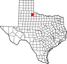 | |
| Unincorporated community | ||
| Ghost town | ||