Del Rio, Texas
| Del Rio, Texas | |
|---|---|
| City | |
| City of Del Rio | |
 Location of Del Rio, Texas | |
| Coordinates: 29°21′50″N 100°54′00″W / 29.364°N 100.900°WCoordinates: 29°21′50″N 100°54′00″W / 29.364°N 100.900°W | |
| Country |
|
| State |
|
| County | Val Verde |
| Government | |
| • Type | Council-Manager |
| • Mayor | Robert Garza |
| • City Manager | Henry Arredondo |
| Area | |
| • Total | 52.3 km2 (20.2 sq mi) |
| • Land | 52.2 km2 (20.2 sq mi) |
| • Water | 0.1 km2 (0.04 sq mi) |
| Population (2015 est) | |
| • Total | 40,549 |
| • Density | 780/km2 (2,000/sq mi) |
| Time zone | CST (UTC−6) |
| • Summer (DST) | CST (UTC−5) |
| ZIP code | 78840-78843, 78847 |
| Area code | 830 |
| Website | CityOfDelRio.com |


Del Rio is a city in and the county seat of Val Verde County, Texas .[1] It is one hundred fifty-two miles west of San Antonio. As of 2015, the city had a population of 40,549.[2] Del Rio is connected with Ciudad Acuña via the Lake Amistad Dam International Crossing and Del Río – Ciudad Acuña International Bridge. Del Rio is also home to Laughlin Air Force Base, the busiest United States Air Force pilot training complex in the world.
History
The Spanish established a small settlement south of the Rio Grande in present-day Mexico, and some Spaniards settled on what became the United States side of the Rio Grande as early as the 18th century. U.S. development on the north shore of the Rio Grande did not begin until after the American Civil War.
The San Felipe Springs, about 8 mi (13 km) east of the Rio Grande on the U.S. side of the border, produces 90×106 US gal (340,000 m3) of water a day. Developers acquired several thousand acres of land adjacent to the springs, and to San Felipe Creek formed by the springs, from the State of Texas in exchange for building a canal system to irrigate the area. The developers sold tracts of land surrounding the canals to recover their investment and show a profit. The initial investors (William C. Adams, John P. Grove, Donald Jackson, John Perry, Joseph Ney, Randolph Pafford, A. O. Strickland, and James H Taylor) formed the San Felipe Agricultural, Manufacturing, and Irrigation Company in 1868. The organization completed construction of a network of irrigation canals in 1871. Residents referred to the slowly developing town as San Felipe Del Rio because local lore said the name came from early Spanish explorers who offered a Mass at the site on St. Philip's Day, 1635.
In 1883, local residents requested a post office be established. The United States Postal Department shortened "San Felipe del Rio" to "Del Rio" to avoid confusion with San Felipe de Austin. In 1885, Val Verde County was organized and Del Rio became the county seat. The City of Del Rio was incorporated on November 15, 1911.
The San Felipe community was started by the Arteaga family. Arteaga Street and Arteaga Park are named after them.
Many history items from Del Rio, particularly from the 19th century, are preserved at the Whitehead Memorial Museum downtown.
Del Rio is known as the American address of legendary Mexican radio stations XERA and XERF just over the U.S.-Mexico border in Ciudad Acuña; their 500,000-watt signals could be heard at night as far away as Canada. Legendary deejay Wolfman Jack operated XERF in the 1960s, using a Del Rio address to sell various products advertised on the station.[3]
Laughlin Air Force Base
In 1942, the Army Air Corps opened Laughlin Field 9 mi (14 km) east of Del Rio as a training base for the Martin B-26, but it was deactivated in 1945. As the Cold War pressures built, along with new border control issues, Laughlin Field was rebuilt and renamed Laughlin Air Force Base. It was again used as a home for flight training. In the mid-1950s, the Strategic Air Command (SAC) noted Laughlin's remoteness that allowed for secret operations, and opened its strategic reconnaissance program there with the RB-57, a bomber modified for high-altitude reconnaissance. SAC soon transitioned to the high-altitude U-2 Dragonlady and based all of them in Laughlin AFB. In 1962, Laughlin-based U-2s took the first photographs of land-based medium-range ballistic missile sites being constructed in Cuba. The presence of these missiles precipitated what became known as "the Cuban Missile Crisis." The U-2s were relocated to Davis–Monthan Air Force Base near Tucson, Arizona, in July 1963, and Laughlin's mission transitioned to the Undergraduate Pilot Training mission in the T-37 and T-38 aircraft. Laughlin AFB currently provides training in the T-1A Jayhawk, the T-6A Texan II, and the T-38 aircraft.
Laughlin plays a large part in the Del Rio community as the area's largest employer. The Border Patrol is the city's second-largest employer (with two large stations along with the sector headquarters). At one time, Del Rio was in the running to become the home of the Federal Law Enforcement Training Center for agents of the U.S. Border Patrol and Federal Air Marshal Service, but lost to the current site in Artesia, New Mexico. The proposed site was located on property belonging to Laughlin AFB. Since the base has unused land, the Air Force is able to lease it to other federal law enforcement agencies for such projects. This benefits Laughlin AFB and the city of Del Rio both financially and economically. Del Rio was one of five cities in the United States selected for an FBI regional headquarters' office; the building is adjacent to the six-story Roswell Hotel in downtown Del Rio.
Geography
Del Rio is located at 29°22′15″N 100°53′45″W / 29.37083°N 100.89583°W (29.370716, −100.895839).[4]
According to the United States Census Bureau, the city has a total area of 20.2 square miles (52.3 km2), of which 52.2 km2 (20.2 sq mi) is land and 0.1 km2 (0.039 sq mi), or 0.24%, is covered by water.[5]
Del Rio lies on the northwestern edges of the Tamaulipan mezquital, also called the South Texas brush country. It is also near the southwestern corner of the Edwards Plateau, which is the western fringe of the famous, oak savanna-covered Texas Hill Country; that area is dotted with numerous small springs; one of these is the San Felipe Springs, which provides a constant flow of water to San Felipe Creek. The creek supplied fresh water for drinking and irrigation to early settlers of Del Rio, and the springs are still the town's water supply.
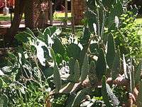
The Del Rio region, west to about the Pecos River, has a mix of desert shrub and steppe vegetation, depending on soil type, with the gray-leafed cenizo (Leucophyllum spp.), several different acacias, cacti, and grama grasses dominant members of local flora. The terrain is mostly level, but some areas are dissected with substantial canyons and drainages, though none of the upland areas are high or large enough to be considered mountains.
Climate
The climate is semiarid in moisture and subtropical in temperature. Humidity is more often high than low, with periodic morning fog due to Gulf of Mexico air masses moving northwest into the area. This gives Del Rio and adjacent areas the effect of being in a coastal dryland area, even though the Gulf of Mexico is over 300 mi (480 km) away. Such humid periods alternate with periods of hot and dry desert air masses in the spring and fall, or cold and dry Great Plains air masses during winter. Moisture rarely lasts long enough for weather systems to react with it to create much precipitation, as happens more frequently to the north and east of the area; some exceptions occur during some autumn (tropical weather systems) and spring (stalled fronts to the north).
Summers are long, hot, and frequently humid; winters vary between sunny, warm, cloudy, and cool weather, depending on the wind direction and jet stream location. Snow or freezing rain is rare, about every seven to 10 years, and such wintry precipitation does not last long enough to be of consequence.
| Climate data for Del Rio International Airport, Texas (1981–2010 normals,[6] extremes 1905–present) | |||||||||||||
|---|---|---|---|---|---|---|---|---|---|---|---|---|---|
| Month | Jan | Feb | Mar | Apr | May | Jun | Jul | Aug | Sep | Oct | Nov | Dec | Year |
| Record high °F (°C) | 92 (33) |
99 (37) |
103 (39) |
106 (41) |
109 (43) |
112 (44) |
111 (44) |
109 (43) |
110 (43) |
106 (41) |
96 (36) |
90 (32) |
112 (44) |
| Mean maximum °F (°C) | 80.3 (26.8) |
85.7 (29.8) |
91.0 (32.8) |
97.0 (36.1) |
100.7 (38.2) |
102.3 (39.1) |
102.9 (39.4) |
103.1 (39.5) |
99.1 (37.3) |
93.9 (34.4) |
85.5 (29.7) |
79.9 (26.6) |
105.8 (41) |
| Average high °F (°C) | 63.8 (17.7) |
68.6 (20.3) |
76.2 (24.6) |
83.6 (28.7) |
89.8 (32.1) |
94.7 (34.8) |
96.6 (35.9) |
97.1 (36.2) |
90.8 (32.7) |
82.4 (28) |
72.0 (22.2) |
64.0 (17.8) |
81.7 (27.6) |
| Average low °F (°C) | 40.6 (4.8) |
45.0 (7.2) |
52.1 (11.2) |
59.6 (15.3) |
67.9 (19.9) |
73.4 (23) |
75.2 (24) |
75.3 (24.1) |
69.8 (21) |
61.0 (16.1) |
49.6 (9.8) |
40.8 (4.9) |
59.2 (15.1) |
| Mean minimum °F (°C) | 26.2 (−3.2) |
29.2 (−1.6) |
34.4 (1.3) |
43.7 (6.5) |
55.8 (13.2) |
65.8 (18.8) |
69.6 (20.9) |
69.8 (21) |
56.7 (13.7) |
44.1 (6.7) |
33.2 (0.7) |
25.9 (−3.4) |
22.5 (−5.3) |
| Record low °F (°C) | 12 (−11) |
11 (−12) |
19 (−7) |
33 (1) |
45 (7) |
49 (9) |
63 (17) |
60 (16) |
43 (6) |
28 (−2) |
17 (−8) |
10 (−12) |
10 (−12) |
| Average precipitation inches (mm) | 0.72 (18.3) |
0.88 (22.4) |
1.14 (29) |
1.65 (41.9) |
2.81 (71.4) |
2.35 (59.7) |
1.78 (45.2) |
2.18 (55.4) |
2.20 (55.9) |
2.23 (56.6) |
0.93 (23.6) |
0.65 (16.5) |
19.52 (495.9) |
| Average snowfall inches (cm) | 1.2 (3) |
trace | 0 (0) |
0 (0) |
0 (0) |
0 (0) |
0 (0) |
0 (0) |
0 (0) |
0 (0) |
0 (0) |
0 (0) |
1.2 (3) |
| Average precipitation days (≥ 0.01 in) | 4.4 | 5.1 | 5.4 | 5.2 | 6.7 | 5.7 | 4.2 | 4.0 | 5.3 | 5.8 | 4.4 | 4.9 | 61.1 |
| Average snowy days (≥ 0.1 in) | 0.5 | 0.1 | 0 | 0 | 0 | 0 | 0 | 0 | 0 | 0 | 0 | 0 | 0.6 |
| Source: NOAA[7][8] | |||||||||||||
Demography
| Historical population | |||
|---|---|---|---|
| Census | Pop. | %± | |
| 1880 | 50 | — | |
| 1890 | 1,980 | 3,860.0% | |
| 1900 | 2,098 | 6.0% | |
| 1910 | 5,688 | 171.1% | |
| 1920 | 10,589 | 86.2% | |
| 1930 | 11,693 | 10.4% | |
| 1940 | 13,343 | 14.1% | |
| 1950 | 14,211 | 6.5% | |
| 1960 | 18,612 | 31.0% | |
| 1970 | 21,330 | 14.6% | |
| 1980 | 30,034 | 40.8% | |
| 1990 | 30,705 | 2.2% | |
| 2000 | 33,867 | 10.3% | |
| 2010 | 35,591 | 5.1% | |
| Est. 2015 | 40,549 | [9] | 13.9% |
| U.S. Decennial Census | |||
As of the census[10] of 2000, 33,867 people, 10,778 households, and 8,514 families resided in the city. The population density was 2,194.0 people per square mile (846.9/km²). The 11,895 housing units averaged a density of 770.6 per square mile (297.5/km²). The racial makeup of the city was 73.05% White, 7.21% African American, 0.70% Native American, 0.49% Asian, 0.06% Pacific Islander, 17.79% from other races, and 2.68% from two or more races. Hispanics or Latinos of any race were 81.04% of the population.
Of the 10,778 households, 42.0% had children under the age of 18 living with them, 59.3% were married couples living together, 15.8% had a female householder with no husband present, and 21.0% were not families. About 18.7% of all households were made up of individuals, and 8.4% had someone living alone who was 65 years of age or older. The average household size was 3.09 and the average family size was 3.56.
In the city, the population was distributed as 31.7% under the age of 18, 8.8% from 18 to 24, 27.6% from 25 to 44, 20.2% from 45 to 64, and 11.7% who were 65 years of age or older. The median age was 32 years. For every 100 females, there were 94.0 males. For every 100 females age 18 and over, there were 89.6 males.
The median income for a household in the city was $27,387, and for a family was $30,788. Males had a median income of $27,255 versus $17,460 for females. The per capita income for the city was $12,199. About 22.9% of families and 27.0% of the population were below the poverty line, including 35.8% of those under age 18 and 26.4% of those age 65 or over.
Micropolitan area
Del Rio is the principal city of the Del Rio Micropolitan Statistical Area, which includes all of Val Verde County;[11] the micropolitan area had an estimated population of over 50,000 in 2007.[12] Located across from Del Rio, in the Mexican state of Coahuila, is the city of Ciudad Acuña with a city population of 181,426.
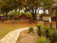
Parks and recreation
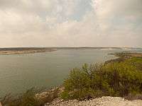
Lake Amistad provides year-round, water-based recreation opportunities, including boating, fishing, swimming, scuba diving and water-skiing, as well as other recreational opportunities for picnicking, camping, and hunting. The area is rich in archeology and rock art, and contains a wide variety of plant and animal life. Del Rio is home to the George Paul Memorial Bullriding, which is the oldest stand-alone bull riding event in the world.[13]
The United League Baseball is looking into placing an expansion franchise in Del Rio for the 2014 season. Home games will be played at Del Rio Bank and Trust Ram Stadium (formerly Roosevelt Park); the stadium is going through a renovation and seating expansion project. A future minor-league baseball stadium is being proposed to be built at the Val Verde Fairground Complex.
Education
K–12
The city is served by the San Felipe Del Rio Consolidated Independent School District. There are around 10,450 students and 637 teachers at 14 campuses. Del Rio is now home to Premier High School of Del Rio, a public charter school.[14]
Higher education
- SWTJC Del Rio (part of Southwest Texas Junior College)[15]
- Rio Grande College Del Rio (part of Sul Ross State University)[16]
- Park University – Laughlin AFB Campus[17]
Media
The Del Rio News-Herald is a daily newspaper published in Del Rio, covering Val Verde County. It is owned by Southern Newspapers Inc.[18]
The newspaper has a daily circulation of 10,400 and a Sunday circulation of 13,500 newspapers.[19]

Infrastructure
Transportation
Del Rio International Airport serves the city. United Express operating regional jet aircraft on behalf of United Airlines had provided daily nonstop service between Del Rio (DRT) and Houston Intercontinental Airport (IAH); however, the airline ceased serving the DRT-IAH route in April 2013. The airport currently has no scheduled passenger air service. The nearest airport with scheduled air service is the San Antonio International Airport. Texas Sky Airlines will provide air service to Del Rio/Cd. Acuna and the Middle Rio Grande region in 2016.
Bus service to Del Rio is provided by Greyhound Bus Lines.
Amtrak provides passenger rail service at the Del Rio station on the Sunset Limited route which proceeds eastbound to San Antonio, continuing on to New Orleans, and westbound to El Paso and Los Angeles.
Major highways
- U.S. Route 90—Connects with Alpine, Marfa, and El Paso to the west. Connects with San Antonio to the east.
- U.S. Route 277—Connects with San Angelo to the north. Connects with Carrizo Springs and Laredo (by U.S. Route 83) to the southeast.
- U.S. Route 377—Crosses sparsely populated west Texas through several small towns before eventually reaching Fort Worth.
- Texas State Highway Loop 79 in Val Verde County and Del Rio: This four-lane road, known as a Super Two, Loop opened for traffic in mid-May 2012. It connects with U.S. Route 90, U.S. Route 277, and U.S. Route 377; Loop 79 is part of the Ports to Plain Corridor Infrastructure and the future Interstate 27 that extends from Laredo, Texas, to Denver, Colorado. It is expected to create an economic boom that will bring in national-brand hotel, retail, and restaurant outlets.
Government
Federal representation

The United States Border Patrol Del Rio sector headquarters is located at 2401 Dodson Ave.
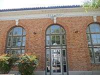
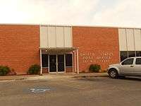
The United States Postal Service operates two post office facilities in the Del Rio area: the Downtown Post Office (Broadway Street) and Northside Post Office (Bedell Avenue); the Laughlin Post Office (Laughlin AFB) closed because of budget cuts.[20][21]
A federal court building operates across from the downtown post office.
Val Verde Correctional Facility
The GEO Group, a private correctional facility corporation based in Boca Raton, Florida, manages the Val Verde Correctional Facility in Del Rio. It has a contract to house offenders for the county, for the U.S. Marshals Service (USMS) (male/female) prisoners, and U.S. Customs & Border Protection (CBP) detainees. The facility opened in 2001 with 688 beds. In 2007, the facility was expanded to its current capacity of 1,400 beds. It is one of the major employers in the Del Rio area and is in accordance with standards required by the State of Texas and federal guidelines.
State agencies
The Texas Department of Criminal Justice operates the Del Rio Parole Office in Del Rio.[22]
Notable people
- Jessica Alba, actress, was a resident when her father was stationed at Laughlin Air Force Base
- Judge Roy Bean, an eccentric justice of the peace associated primarily with nearby Langtry, Texas, is interred, along with a son, at Del Rio's Whitehead Memorial Museum
- Lance Blanks, retired NBA player, was drafted in the first round of the 1990 NBA draft by the Detroit Pistons, and is currently the General Manager of the NBA's Phoenix Suns
- Larvell Blanks, MLB infielder for the Atlanta Braves, Cleveland Indians and Texas Rangers
- Sid Blanks, halfback for the Houston Oilers and Boston Patriots of the American Football League
- John R. Brinkley, controversial medical doctor who experimented with goat glands as a means of curing male impotence
- Radney Foster, country music singer/songwriter
- Bob Gruber, retired offensive tackle in the NFL and USFL
- Todd Hays, bobsledder who won the silver medal in the four-man event at the 2002 Winter Olympics in Salt Lake City, Utah
- Jay Kerr, actor who has appeared in various movies and television series, including his role as Con Madigan in the Australian series Five Mile Creek
- Tyrell McCrea, football player for the New Orleans VooDoo[23]
- Shawn Michaels, professional wrestler, was a resident when his father was stationed at Laughlin Air Force Base
- Evelyn Peirce, actress
- Jerry Edwin Smith, judge of the United States Court of Appeals for the Fifth Circuit
- Byron Velvick, Bassmasters pro fisherman and reality show contestant on The Bachelor
- Hoke Hayden "Hooks" Warner, MLB player for the Chicago Cubs and Pittsburgh Pirates in the early 20th century
- Cory James, NFL football player for the Oakland Raiders and played for Colorado State University
Del Rio in film and television
In the episode "The Young Gun" (February 7, 1958) of the CBS western television series Trackdown, starring Robert Culp as the Texas Ranger Hoby Gilman, the Ranger travels to Del Rio to investigate a bank robbery and goes undercover to gain inside information to solve the case. He tricks one of the robbers to lead him to the other gang members.[24]
The 1994 motion picture Texas, based on the James A. Michener novel Texas,[25] was partly filmed in Del Rio. The movie, which took place in the beginning of the 19th century as many Anglo Americans were settling in the Mexican province of Texas, featured Randy Travis and Anthony Michael Hall.
Del Rio features prominently (even though scenes were shot elsewhere) in No Country for Old Men, the 2007 neo-Western thriller film directed, written, and edited by Joel and Ethan Coen, based on the Cormac McCarthy novel of the same name.
Other presentations with a Del Rio setting include:
- 1951 Arrowhead – Charlton Heston
- 1955 The Last Command – Ernest Borgnine
- 1958 Five Bold Women – Irish McCalla
- 1960 John Wayne's The Alamo
- 1960 The Spirit of the Alamo (TV) – NBC
- 1960 The Roy Rogers Show (TV)
- 1961 John Ford's – Two Rode Together – Jimmy Stewart
- 1966 Top Hand (TV)
- 1967 Aye, That Pancho Villa (TV)
- 1967 Bandolero – Dean Martin
- 1968 Children's West (Lon Chaney, Jr.) (TV)
- 1973 A Death in Tombstone
- 1974 The Sugarland Express – Goldie Hawn
- 1974 The Texas Ballad (KLRN-TV)
- 1978 Adventures of Jody Shanan
- 1983 Call to Glory – Craig T. Nelson, Elisabeth Shue (TV)
- 1986 Houston: The Legend of Texas (TV) – Sam Elliott
- 1986 The Alamo – Thirteen Days To Glory (TV) – Alec Baldwin
- 1986 No Safe Haven – Wings Hauser
- 1987 Alamo: Price of Freedom – Caser Biggs
- 1988 Lonesome Dove (TV) – Robert Duvall
- 1989 Gunsmoke – The Last Apache (TV) – James Arness
- 1991 JCV Japanese Quiz Show (TV)
- 1991 American Movie Classics (TV) – Bob Dorian
- 1992 Rio Diablo (TV) – Travis Tritt
- 1992 Travis Smith (direct to video)
- 1993 Bad Girls – Madeleine Stowe
- 1993 Like Water for Chocolate
- 1993 El Mariachi, Robert Rodriguez
- 1994 8 Seconds – Luke Perry
- 1994 Gambler V: Playing for Keeps (TV) – Kenny Rogers
- 1994 James A. Michener's Texas (TV) – John Schneider as Davy Crockett
- 1995 Good Old Boys (TV) – Sam Shepard
- 1995 Streets of Laredo (TV) – James Garner
- 1995 A&E History Channel's The Alamo (TV)
- 1995 Discovery Channel's – The Battes of the Alamo (TV)
- 1995 PBS – Ken Burns The West (TV)
- 1995 A&E Biography – Davy Crockett: American Frontier Legend (TV)
- 1995 The Learning Channel's – Famous Battles – Alamo Segment (TV)
- 1995 Discovery Channel's – Buffalo Soldiers (TV)
- 1995 Desperado, Robert Rodriguez, Antonio Banderas, Salma Hayek
- 1996 From Dusk till Dawn is a 1996 action/horror film directed by Robert Rodriguez and written by Quentin Tarantino. The movie stars George Clooney, Harvey Keitel, Quentin Tarantino, Juliette Lewis, and Cheech Marin.
- 1996 Once Upon a Time In China and America – Sammo Hung
- 1996 Lone Star – by director John Sayles
- 1999 Alamo... The New Defenders (direct to video)
- 1999 The Bullfighter – Domenica Scorsese
- 1999 The History Channel's – Haunted San Antonio (TV)
- 2000 Jericho Mark Valley – Leon Coffee – Buck Taylor
- 2001 The History Channel's History vs Hollywood (TV)
- 2002 Westown Sturghill Productions
- 2004 Bandido, Carlos Gallardo, Scott Duncan
- 2006 Blue Eyes – Walker Cable Productions
- 2006 Mexican Gold – Walker Cable Productions
- 2007 The Man Who Came Back – Walker Cable Productions – Eric Braden – Billy Zane
- 2007 Friend of The Devil (TV Pilot)
- 2007 No Country for Old Men
- 2009 Not Forgotten
Music videos
- 1969 Willie Canseco – Fredrick
- 1995 Brooks & Dunn – You're Gonna Miss Me When I'm Gone
- 1995 Tim McGraw- Refried Dreams
- 1996 Gary Hobbs – Corazon de la Ardiente
- 1996 La Tropa F – The Sheriff
- 1996 Los Palominos
- 1999 Shade of Red – Revolution
Neighborhoods
Rincon del Diablo – the section where Barron St. meets Magnolia Street.
Barrio Chihuahua: In the southern part of the city, this neighborhood, named after the Chihuahua Soccer Field, is located between West Gibbs to the north, Texas State Spur 29 to the west, Garfield Ave., West Garfield to the southeast, and S. Ave F to the far east.
Buena Vista is located near Buena Vista Park. Lake Amistad and North Del Rio are located past the Buena Vista area.
Cienegas Terraces: Outside the city limits, it is home to the "Duck Pond" and various ranches, on the west side of the city.
Eastside: Named by locals after the school on the corner of Bedell & 7th Street, the neighborhood is also home to Star Park. Surrounded by Veterans Boulevard to the west and E. Gibbs to the south, the neighborhood is home to the Val Verde Regional Medical Center.
San Felipe: The original neighborhood in Del Rio, the city originally got its name from it as in "San Felipe del rio", south of Barrio Chihuahua and the Northside. Anywhere south of Chihuahua but not past San Felipe Creek is known as The Winery, due to its close proximity to Val Verde Winery, the oldest privately owned winery still operating in the United States.
Westside: Home to Del Rio International Airport, the neighborhood is surrounded to the north by W. 15th, 18th, and 17th Streets, to the east by Veterans Blvd., and to the south by W. Gibbs bordering Chihuahua.
Comalia: A neighborhood isolated by the Woodlawn cemetery and a bridge that leads to the U.S.-Mexico border crossing, it can be found by traveling down W. 2nd Street.
References
- ↑ "Find a County". National Association of Counties. Archived from the original on 2011-05-31. Retrieved 2011-06-07.
- ↑ "Profile of General Population and Housing Characteristics: 2010 Demographic Profile Data (DP-1): Del Rio city, Texas". U.S. Census Bureau, American Factfinder. Archived from the original on September 11, 2013. Retrieved February 1, 2012.
- ↑ Have Mercy, by Wolfman Jack; Warner Books, 1995.
- ↑ "US Gazetteer files: 2010, 2000, and 1990". United States Census Bureau. 2011-02-12. Retrieved 2011-04-23.
- ↑ "Geographic Identifiers: 2010 Demographic Profile Data (G001): Del Rio city, Texas". U.S. Census Bureau, American Factfinder. Archived from the original on September 11, 2013. Retrieved February 1, 2012.
- ↑ Mean monthly maxima and minima (i.e. the highest and lowest temperature readings during an entire month or year) calculated based on data at said location from 1981 to 2010.
- ↑ "NowData – NOAA Online Weather Data". National Oceanic and Atmospheric Administration. Retrieved 2016-06-20.
- ↑ "Station Name: TX DEL RIO INTL AP". National Oceanic & Atmospheric Administration. Retrieved 2016-06-20.
- ↑ "Annual Estimates of the Resident Population for Incorporated Places: April 1, 2010 to July 1, 2015". Retrieved July 2, 2016.
- ↑ "American FactFinder". United States Census Bureau. Archived from the original on 2013-09-11. Retrieved 2008-01-31.
- ↑ Update of Statistical Area Definitions and Guidance on Their Uses, Office of Management and Budget, 2007-11-20. Accessed 2008-12-10.
- ↑ "Annual Estimates of the Population of Metropolitan and Micropolitan Statistical Areas: April 1, 2000 to July 1, 2006 (CBSA-EST2006-01)". 2006 Population Estimates. United States Census Bureau, Population Division. 2007-04-05. Archived from the original (CSV) on July 10, 2007. Retrieved 2007-04-09.
- ↑ George Paul Memorial Bullriding. Retrieved: May 13, 2011.
- ↑ Education – Del Rio Chamber of Commerce
- ↑ Del Rio campus Archived May 9, 2008, at the Wayback Machine. – Southwest Texas Junior College
- ↑ Rio Grande College – Sul Ross State University
- ↑ Park University, Laughlin Campus Center
- ↑ "Del Rio News-Herald". Del Rio News-Herald. Retrieved August 14, 2012.
- ↑ "Southern Newspapers". Southern Newspapers. Retrieved August 14, 2012.
- ↑ "Post Office Location – PECAN." United States Postal Service. Retrieved on May 21, 2010.
- ↑ "Post Office Location – DEL RIO." United States Postal Service. Retrieved on May 21, 2010.
- ↑ "Parole Division Region IV." Texas Department of Criminal Justice. Retrieved on May 21, 2010.
- ↑ New Orleans VooDoo: #52 Tyrell McCrea, FB/LB. Retrieved on May 13, 2011.
- ↑ Billy Hathorn, "Roy Bean, Temple Houston, Bill Longley, Ranald Mackenzie, Buffalo Bill, Jr., and the Texas Rangers: Depictions of West Texans in Series Television, 1955 to 1967", West Texas Historical Review, Vol. 89 (2013), p. 106
- ↑ Texas. – Internet Movie Database.
External links
| Wikivoyage has a travel guide for Del Rio. |
| Wikimedia Commons has media related to Del Rio, Texas. |
- City of Del Rio official website
- Del Rio Chamber of Commerce
- San Felipe Springs information
- Del Rio Area Parks (WildTexas.com)
Municipalities and communities of Val Verde County, Texas, United States | ||
|---|---|---|
| City | 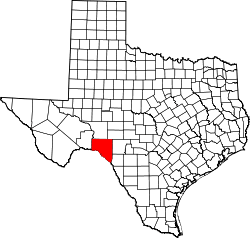 | |
| CDPs | ||
| Unincorporated communities | ||